Cultis Lake Hike
Length of hike: 7.7
Difficulty: Easy
Description of Hike:
Start at trail head Little Cultus lake and head West
along the North edge of the lake. The trail turns to the north west and travels
on level ground through a thick pine forest. The ground is covered with dead trees,
this would be very hard going if not for the trail. About a mile and a quarter in
you cross a very small creek that was still running at the first of August. The
creek is not on the map. Another half mile and a small lake called Deer lake is
on the west side of the trail. There is a camp ground here with about three camp
sites. One has a picnic table. At first glance I was amazed to see a picnic table
this far down the trail, but on further investigation of the area, I found that
there was a road just a few hundred feet away to the northeast. The road was not
on the forest service map so I was surprised to see it. It did explain the existence
of a picnic table this far into the woods.
Another three quarters of a mile and the trail crosses
the feed stream to the lake. According to the map, this comes from Cultus lake.
A few feet further and there is a trail intersection with a trail that goes to Phantom
Lakes. Continuing to the North the trail travels through an area that looks like
it burned a decade or so ago. Amid the standing burnt pine trees are small pines
ranging in height to about eight feet. It was very hot and dry through the next
half mile.
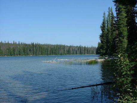
At three miles the trail comes to the West end of
Cultus lake. Here there is a large camping area that is only accessible by boat
or foot. There are pit toilets. The area was occupied by a dozen or so people. I
saw a few tents, and three boats. The trail travels North and East through small
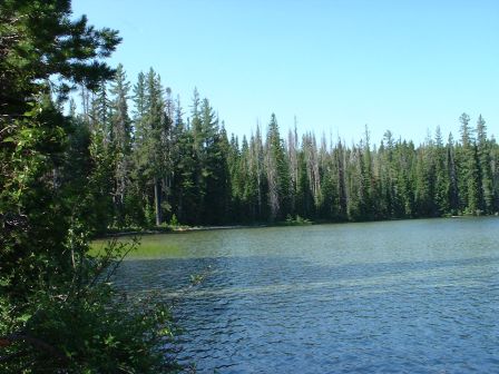
pine and more burnt area for another half mile or so and swings back around to the
edge of the lake. There was another camp here. The trail leaves the lake again and
moves through a small section of old growth pine. There is a good sized stream,
not big enough for fish, but large enough to require a bridge to cross. One more
view of the lake and back into the small pine for another mile. Through this section,
after about four miles on the trail, there are two trail heads, one going to Teddy
Lakes and the other about a quarter mile away going to Corral Lake this one is restricted
to foot traffic only, and there are logs strewn across the path, I am assuming,
to discourage bike riders.
The trail comes back to the lake, and there is another
camp area. I can see from the trail that there are a number of docks for boats.
The trail moves East from here on for about two and a half mile to the East end
of the lake the vehicle camping area.