
Coldwater Trail 230A
Difficulty: Moderate to Dangerous
Suggested Skill Level: Intermediate to Advanced
Trailhead longitude and latitude: 46 17 08N, 122 15 10W
Google Trail Head Location
 Google Directions From Portland
Description of Ride:
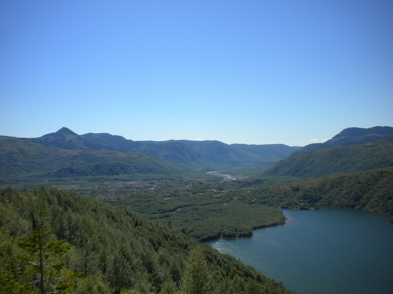
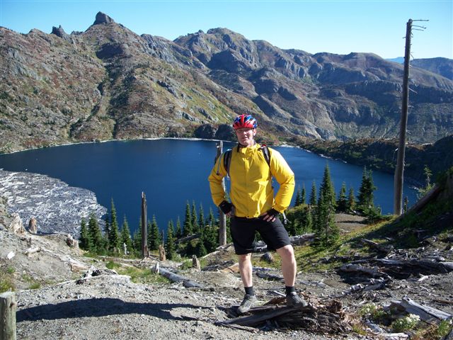
The South Coldwater Trail #230AThis trail is the only single-track open to mountain bikers on the north side of Mount St. Helens. The ride features great views of Coldwater Lake as you ascend. If you can hang on for the entire out to St. Helens Lake you will be treated to panoramas of Mount St. Helens and the Mount Margaret backcountry.
The technical demands aren't too tough in the first 3.5 miles to Tractor Junction at the east end of Coldwater Lake. However, the climb is a challenge. The ante goes up - both in terms of climbing and technical difficulties - on the section between Tractor Junction and St. Helens Lake. This is raw, beautiful country that very few mountain bikers have seen.
This trail was opened and has been maintained by Brian Mahon and Growlers Gulch Racing. In order to keep it open, we must continue to do the maintenance.
A Northwest Forest Pass is NOT required at this trailhead.
The details
From the parking lot on Washington Highway 204, the Spirit Lake Memorial Highway, the trailhead - located on the left, just after you cross the outlet of Coldwater Lake - heads northeast out of the parking lot, climbing across the lower portion of a ridge that extends between South Coldwater Lake and South Coldwater Creek.
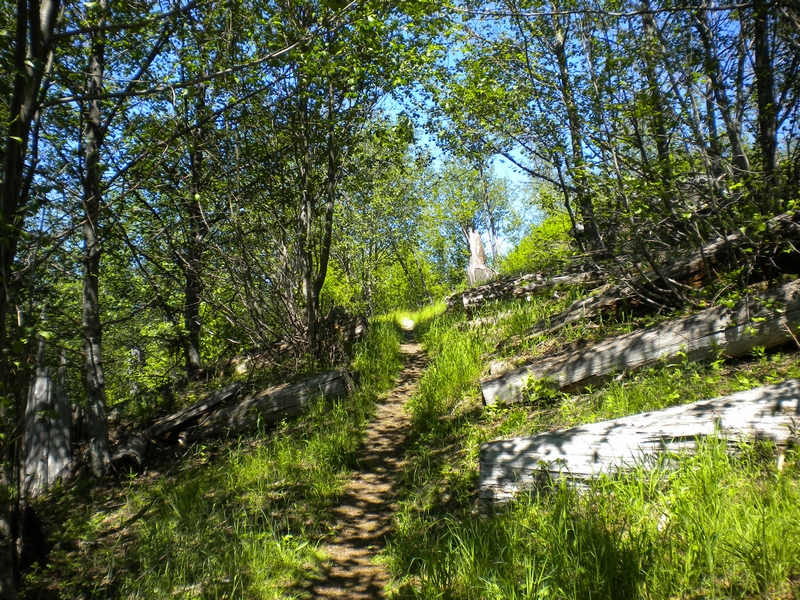
The trail continues around the ridge and starts to climb the north side. The trail here is nice and wide, benched into the hillside for a little under half a mile, but it is fairly steep and will get your attention.
This side of the ridge is an area that collected debris from the blast and has since developed a dense stand of alder, one of the early colonizers of the area since the blast. The conifers on the other hand are slow to recover and there are only a few small trees along the trail.
The trail crosses back over the ridge leaving the dense cover of the alder forest behind and heading up the exposed hillside. It levels out for a short respite before a switchback that doubles back to the top of the ridge.
The trail continues to climb but soon the angle of the climb is almost half that of the previous section. Occasional small fir trees struggling to gain a foothold among the sparse vegetation fringe the top of the ridge. The tread on the trail has developed well.
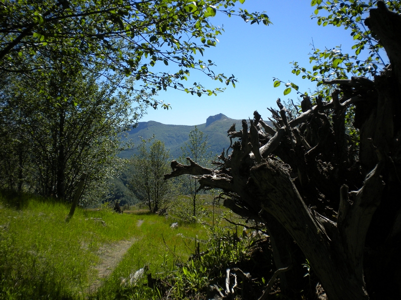
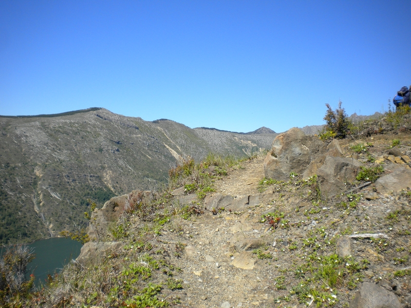
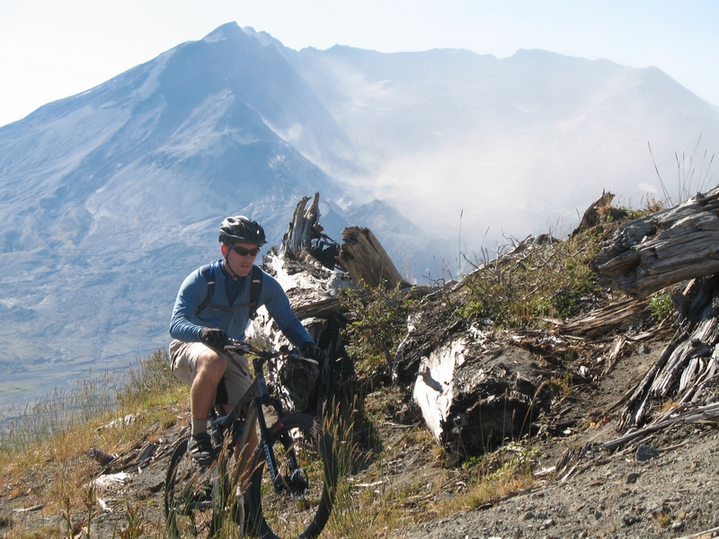
Signs of the devastation from the lateral blast of Mount St. Helens are all around. The bleached-out and rotting remains of uprooted trees are scattered across the ridgetop. There are exceptional views, a panorama of the surrounding hills, thinly veiled in vegetation that barely covers the surfaces exposed by the 1980 eruption.
The trail maintains a fairly consistent climb as it moves from one side of the ridge to the other and back again. The trail runs through dense underbrush on the north side of the ridge and exposes glimpses of the lake from time to time. On the South side of the ridge the trail is exposed and open with the top of Mount Saint Helens peeking over the next ridge to the south.
After little over a mile-and-a-half and 1,000 feet of demanding climbing, the trail emerges from the brush as it approaches the top of a cliff. Coldwater Lake lies below. The trail turns away from this exposure.
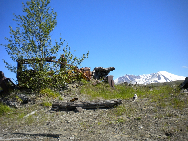
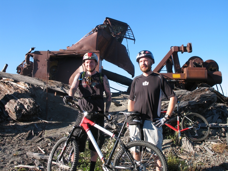
There is a large metal spar pole lying next to the trail, folded in half from the explosive force of the eruption. This was the site of a high-lead logging operation. The tower, the yarder, and a large dozer remain as a testament of that day.
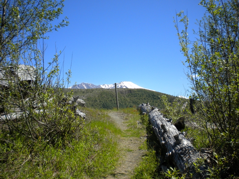
The top of Mount St. Helens is clearly visible above the ridge beyond as the trail turns again to make its way through the wreckage.
The climbing levels a bit at this stage and follows an old logging road east as it parallels the lake below.
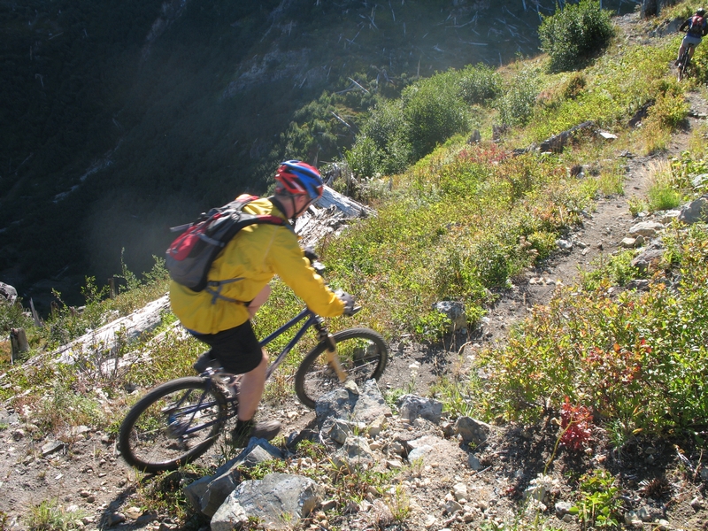
At about the 3.5 mile mark, you will see more equipment destroyed in the '80 eruption. Do not take the left line that heads down toward the back end of the lake. Stay to the right. From this point forward, things are better suited to intermediate and advanced riders.
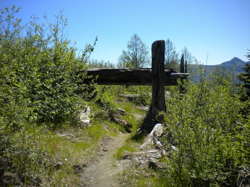
You will climb (or walk) up a sharp hill along a cliffside. Frequently overgrown, this section is referred to as Botany 101. The trail emerges into an open area. The climb continues but at a more gentle grade.
Things change as you get to about the 4 or 4.5 mile mark. The tread is rockier and there are big drops on the left. This canyon at the back end of Coldwater Lake is isolated and spectacular and will make you feel like you are far, far from civilization
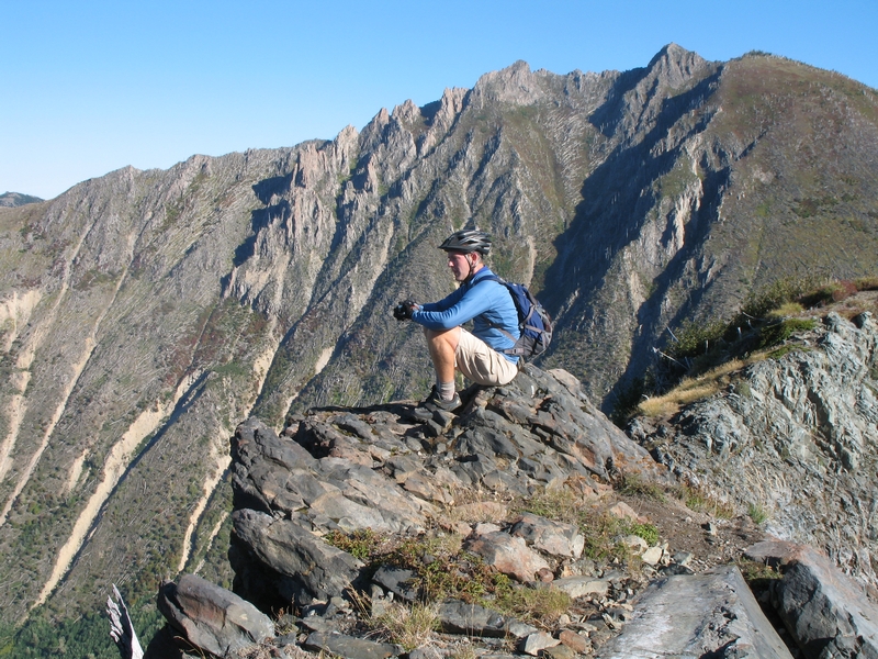
Nothing is easy from here to the top. The tough climbing and hike-a-bike continue. At one point, you break over to the south far enough that you have a great view of the crater of Mount St. Helens. This is a great place to see elk
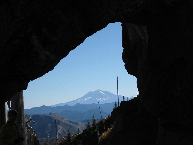
More climbing and hike-a-bike to the arch above St. Helens Lake. If you survived to this point, you deserve to take a break and have lunch. Trees blown down in the 1980 eruption still float in the lake below.
You won't believe you've covered only 6 to 6.5 miles. Just remember that 3,000 feet of climbing in that span can make a dent in any rider's ego.
If it's your first time, you will probably want to turn around and head back at this point. The trail continues into the Mount Margaret backcountry. Friends who have been out there tell me the terrain and tread become even more demanding and more spectacular. Only intermediate to advanced riders should attempt this, and those who do should start early in the morning.
It won't take long to get back to the trailhead. The descent is a rush - technical on the top half and open and fast below Botany 101. The site lines on the lower half are big. At one point, not far after going past the logging equipment at about the 1.5 mile mark, the trail goes south to north and take a left-hand turn with a big drop to the lake below. Be a little cautious here.
Coauthored by Jim LeMonds