George Barnett e-mailed me and asked if I wanted to ride, he was off for the week and wanted to take an afternoon ride.
I headed out a little early so that I could stop and eat a sandwich at the park down on the river, something I have done many times.
When I arrived at the park I noticed there were more cars and people than usual.
I pulled up to my usual parking spot and broke out my lunch. As I sat and ate my sandwich I noticed a couple of guys walking on the trail that passes in front of where I was sitting.
I looked up river and saw a barge being pulled and guided by a couple of tugs, it was moving pretty fast.
The guys walked by and followed the trail over to a picnic table where they stopped and hung out for a while, while I finished half of my sandwich and the barge passed by, causing a small tidal effect along the shore of the Columbia.
A few minutes later the guys had started walking back up the path, one of them separating and heading up across the grass to pass in front of my car.
Weird, were these guys trolling? I always eat my lunch here when going to ride at Stella in the afternoon and rarely see anyone. Now there was these two, a couple of people standing down by a tent, and at least a half dozen cars visited the rest room.
I picked up my cell phone and pretended to answer a call, looking up river as I sat and said, uh huh, ok, year right...
The guy passed by and headed over to stand in front of the rest room, enough! I threw what was left of my lunch back in the bag and left, afraid to eat my banana for fear of what kind of weirdness it might provoke.
I met up with George and we were cranking pedals by noon.
We headed up into the Haru via the first trail, there were a few trees down and the tread was sopping wet, my tires sunk and squished as we rode.
The first hill is a strong climb and the wet soggy fir needles had me slipping and spinning as I kept trying to gain traction, to no avail.
Off my bike we walked a few feet until we had passed the steep part and remounted to ride out the rest of the trail.
Crossing the road we took the short connector trail over to pick up the Lakeside trail. The end of the connector has a very steep but short drop into a skidding muddy descent down to the head of the Lakeside trail.
We rode the Lakeside, splashing through mud puddles and rumbling over rooty sections to finish by taking the last descent back to the road. This is a fun descent that winds through the timber and crosses over a small creek a couple of times, the second time over the creek is on a narrow little arched bridge that someone built and packed in.
We climbed up the Gateway trail, George and I usually take this route over the road climb, for me the challenge of the single track will win out over the grind up gravel every time.
We wandered the maze of trails, staying on the main line most of the time until we reached the ten trails area where we took a short break.
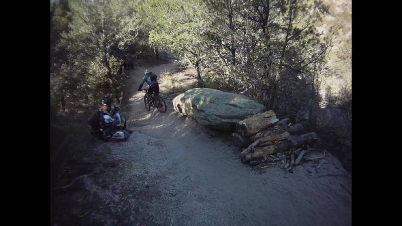
We decided to take the Chicken trail out to the battery and then pick up the loop at the top of Fast and Furious before screaming down Fast and Furious line.
When we hit the Fast and Furious area I noticed that the trails had been cleaned, probably Bob K, since he built the trail and he continues to maintain it (thanks Bob). The tread here was firm with very little sign of anyone riding so there was not a lot of soft gushy stuff.
In my opinion this is one of the best trails on the Stella ridge. It has a fast line, hence the Fast in the name, it is not steep but cranks with a nice flow. There are a couple of quick climbs then it blasts again down a moderate descent with very little twisting and turning but plenty of rolling features.
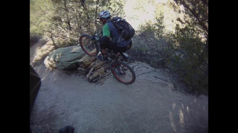
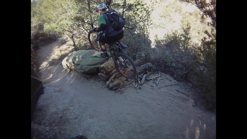
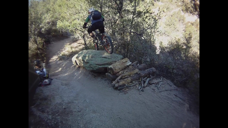
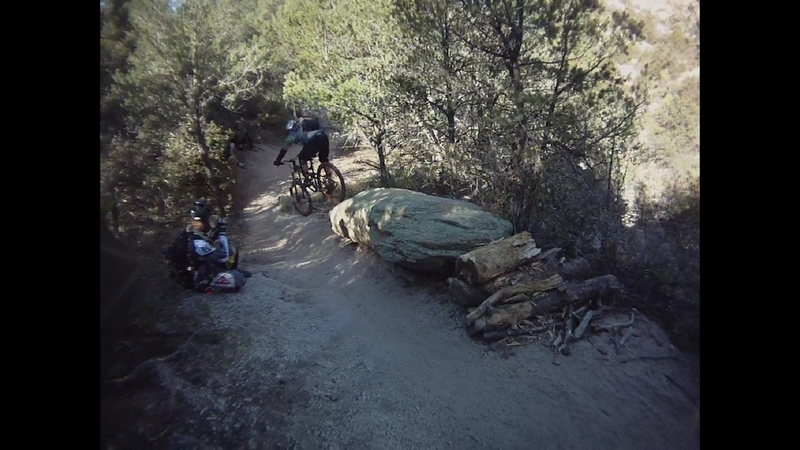
There are a couple of challenges that have always stumped me. Toward the end of the trail there is a quick turn into a couple of logs that makes a ten to twelve inch step up. The approach has always foiled my attempt to clear the logs but today, I just lifted the front end and cranked on through.
The second challenge is more of just a big root wad with the line making a quick turn up and over as it circles half way around the tree, again I just leaned in and rolled it with no real effort, stoked!
We made our way back to Ten trails and took another short break before George suggested we take a route through the maze of trails, just north of Ten trails.
It is a maze, turning and twisting around every tree, hump, and root wad in the area we were soon turned around and looking for the trail that would lead us out.
Wandering around from trail to trail, hitting intersections and trying to turn in the direction that would keep us headed toward Gateway or the Mainline trail, we soon hit an old skidder road that took us up to Mainline which we followed out to Gateway.
We hit Gateway and rumbled across the roots through the upper section, dropping down the hillside to hit the nicely banked corners and finally to skid down the muddy slope at the bottom that dumped us back on the gravel.
We cruised down the gravel to pick up the road side trail and take one of Ed's Texas trails back up to the top of Haru.
We followed the line that runs about half way up the hill, a nice run that parallels a fire road for a while then we dropped out onto a loop that took us half way down to the road before returning on a climb that skirted a narrow steep valley.
A few more dips and squishy turns had us sitting at the top of our final descent, a nice moderately steep run through large timber to a skid down a steep short slope with a quick turn and back onto the road side trail, which we followed out to the end.
The 50 Year Trail.
While in Tucson for the 8ish Days of Christmas event last December we rode a section of the 50 Year trail. I was disappointed with my ride since I balked at some of the big rock features.
I returned to the Tucson area a couple of months later and was invited to ride the 50 Year again with Brian Vance and Jim Nixon.
We started at the parking area located next to the cattle guard at the end of Golder Ranch Dr.
Now the trail, as far as I can tell, starts in Catalina State Park. The trail head in the equestrian area, starts with a sandy double track climb up to a water tank, where it changes to single track.
The reason everyone starts at the end of Golder Ranch Dr. is because the park charges an entry fee. I did a loop up in the park that ended by picking up the 50 Year trail about three miles out and returned to the park.
The portion that runs through the park, has a couple of good climbs but also has a lot of good single track, all be it rocky, with a little rock and rubble.
From the Golder Ranch Dr trail head there is a connector trail that starts right across the road from the cattle guard, there is not any markers but it is very distinct.
The first part, the connector trail varies between double track and single track, rather wide and a bit sandy.
After a couple of minutes of riding the connector runs into the 50 Year trail, not something you will notice, there are a couple of off shoot trails that are more likely cow trails that people walking and other riders may use but the main trial is obvious.
The trail follows the contours of the low rolling terrain through this area, a very nice ride-able area for newbies and beginning riders. I took my wife, who has very limited single track experience, to ride this portion of the trail and she had a great time.
The trail crosses a dirt road and starts down through an area where the rider needs to have a little more experience and have developed some basic skills.
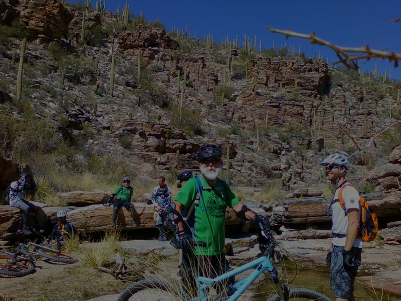
The line heads down through some large boulders, there are lots of options to explore and some big rocks to roll across. The main line is more distinct but Brian and Jim were off on tangent lines, rolling the big rocks.
After we crossed a wash we came to a place where a line split off from the main line to climb up through some rocks and cactus. We climbed up a little ways and Brian pointed out a large boulder that he said was good for hucking, a process where you ride up on the boulder, which had a very good approach from the uphill side and then jump off on the other side instead of rolling it. Which on this boulder, rolling it was not an option.
Back on the main trail the climb intensifies, moderately steep but ride-able in a mid range gear combined with a little huffing and puffing. This is not a sustained climb but more of an interval climb, although some of the intervals are a bit long.
There are lots of large boulders that make the trail weave in and out, or the other option that Brian and Jim would often take; roll up and over.
There are a couple of very large boulders that are right in the path. The key is to get up a little speed, lift on the front end and crank up and over.
One of the big boulder features has a second boulder right behind it that is not visible on the approach. Just as soon as my front wheel hit the rock I could see I was going to have to negotiate the crack between the two. I ended up stalling on top of the rock and un-weighting my front end as I cranked over. You could probably roll it with 29er tires but my first attempt was a little sketchy. There is a spot where a rock is wedged in the crack to make a nice clean transition from one to the other but I missed it.
After the rocky boulder section the trail continues to climb at a very sustained rate for a few minutes, a gritty tread that leads to a section that I think is referred to as the chutes.
I have seen "The Chutes" on maps of the area and it looks like there is a loop trail here but we did not take it.
The line we took was to drop into one of four chutes and scream down through a narrow slot.
Then we turned up the hill, a climb that ran up a gully and across the top of some narrows to finally turn and climb in earnest.
The trail ran up through a narrow gully or rut that ran along the edge of a ridge; a gritty climb that presented challenge after challenge in the form of narrow little gaps, exposed granite in the gullies and sandy sections, and all the while lined with Prickly Pear and Cholla.
There was more than one spot that had me dabbing my way through a narrow rock gap.
Knowledge of the trail can make a huge difference since you know where to torque it out and where to spin.
After about 15 minutes of climbing there is a trail intersection with the Gem Trail, it takes off to the left. The 50 Year Trail goes right.
After a few hundred feet the trail crosses a fence line, bounces down through a short narrows and climbs over a large granite dome to present a very large step. Neither Brian or Jim attempted to make the big step and the last time I was here, there was at least a half dozen riders bite it trying to clear that step. The approach is just to hard of an angle and the step too large for the approach.
There was a little more climbing across more granite faces and through lots of Ocotillo to a spot where the trail splits, giving you the option of climbing a granite face or taking the trail around the rock face, which I have not done.
We started up the granite face and I was off my bike in a couple of pedal strokes, as I lost my balance just as soon as my bike went vertical, so I just leaned into the push and walked up the face.
Brian and Jim made most of the climb.
We stopped at a point about half way through the climb and caught our breath, then as Jim cranked up what looked from my perspective to be a sheer rock wall, Brian started his climb to hear a crack come from his back wheel and found himself with no rear hub. He could crank the pedal, the sprocket would turn but the wheel would not.
Brian said that was the second time that has happened with that hub, but it was still under warranty and he would have to send it in for repair.
We sat on the top of the granite dome for a while talking bikes.
Then Brian decided that he would go back the way we came because there was more climbing to do later in the loop and back would be riding mostly downhill.
We put on our protective gear before we started the next section, mostly downhill over a lot of rocky boulders and granite domes.
Jim and I headed on up and over the top of the dome. Brian warned me to not fall for Jim's trick, asking me to check his backside for cactus spines.
A very exciting bit of riding, on top of a huge rock dome with a huge panoramic views, the line descends down the spine of the rock, ether side dropping away and out of site. The exit from the rock is to cross a large gap that has been filled with rubble, and glide down to a single track that rolls around to meet up with the main line.
The trail starts with a short down and up over a boulder section and follows a gritty line that hits a section where there is a rock drop or an alternate line that rolls around the drop and through a series of boulder rolls.
Last winter there were a bunch of young guys that hit this section two or three times, clearing the jump by five to ten feet.
The trail rolls across a big dome with a good three foot drop on the other side, one of the spots that had me off my bike on the last ride. Jim rolled the drop and cruises on down the trail. I rolled up and shifted my weight back as far as I could as my front tire dropped over the edge, the tire slams the bottom just as the back tire rolls over the edge and I rolled out and down the line.
The trail starts a strong descent; rolling down through gritty little gullies and ruts, dropping over small boulders and skidding around sharp turns.
We reached a spot on the descent where Jim rolled up to a rock where he came to a sudden stop, his back wheel on one side and his front wheel just over the edge on the other, pulling his bike back he walks back and takes another shot at it, again the bike catches and he says, twice is enough, pushing his bike over the rock and riding on down through the jumble of stones.
I didn't even try, I pushed my bike around the rock and remounted to skid down through some embedded grit covered granite stones.
The line rolls along through thick desert flora, lots of Ocotillo, Prickly Pear, and Cholla with fresh green ground cover intermixed with the Agave, bouncing through ruts and over boulders until it drops into a steep descent.
The trail follows a small gully, I tried to ride the line high on the side of a rock, my front wheel sticking but my backe wheel just a little too low and it broke free, causing my bike to slip side ways skidding into the bottom of the ditch.
A quick push off with my foot and a shift of weight back as far as I could sent me down a series of large steps to round another corner and find Jim sitting on top of a huge boulder. He pushed off and glided down the front of the rock. Then up onto another rock and dropped down off the end.
I paid close attention to the line he took because I could not see out over the end of the series of rocks. Climbing up on the top, I looked down the steep face and let my self go. The granite is covered with grit and I could hear a hollow sound from my rear tire every time it skidded on the grit. Transitioning from one rock and over the second, again the hollow sound from my tire skidding as I dropped off of the rock and onto the dirt where I now heard the modulating sound from my back rotor as I continued to descend a steep line in the gritty sand to cross more boulders.
The line descending through a series of dirt steps to round a large boulder where I found Jim sitting on his bike, looking back at me as I approach what looks to me to be at least a four foot drop.
"Really you rolled that?" I asked, and Jim, shook his head as I heard him say "Uh huh".
I backed my bike up about ten feet and took off, a quick bobble and a stop, then I backed up to take one more shot.
I threw my weight back as my front tire dropped off the edge, it was a quick hard bounce as the wheel made contact and my fork compressed, almost throwing me over the front.
The trail winds down through some more sand and grit single track, over a few flat rock areas to approach a huge granite rock. This is the big one, I exclaimed to Jim, to which I got another uh huh.
A huge granite rock that is at least two stories high, the bottom of the rock can not be seen from the top. When I was here last winter I balked and walked down the face, where I realized as I reached the bottom that my shoes stuck to the rock like glue so even though the rock felt like it was near vertical I was able to get good traction.
Jim was down and off the rock before I had even gotten up onto it.
I knew I could not hesitate so I cranked a half pedal stoke to keep me moving. I started shifting my weight back as I rolled forward and started down the front of the rock. My weight moved further back with each foot of the descent until I was so far back that I could feel the tire rubbing against my shorts.
My breaks again modulating with a vibrating sound, a combination of squeaking and rumbling. The rear tube and tire reverberating the skidding noise my tire made as it seemed to stop with each break modulation.
A quick transition from vertical to horizontal through a soft sandy radius at the bottom had me on the line and letting out a hoot.
Rolling a couple of more small boulders the trail followed a line that continued to descend.
There were a few skinny tight spots while passing Saguaro and brushing past more Ocotillo as we descended until we reached a sandy wash at the bottom of a valley and the trail turned to climb again.
I leaned into the climb, the trail crossing the face of the hillside to approach a rocky ridge and take a couple three switchbacks to climb up to the top. It turned again to climb along the top of the ridge where it crossed a few flat rocks but the tread is mostly sand and grit.
The line winds it's way up through a bunch of large boulders, some standing high over my head.
I had to make a couple of more stops to catch my breath but I refused to relent and walk, so I leaned into it and keep grinding the climb out until it broke over the top of the ridge.
I could see Jim standing over on a spur trail that leads to a view.
Jim told me he just saw Brian down below on the trail but by the time I got there Brian was gone.
The trail meanders across the top of the ridge, mostly level with a number of transitions between rock and gritty sandy line.
The area is densely populated with cactus, mostly prickly pear but plenty of other varieties are present.
There are a couple of spots that forced me from my bike because I can not clear the large step up or negotiate a rocky narrow.
Jim turned off the trail at one point to follow a line that is just barely visible as it crosses a grassy section then transitions to some exposed granite.
This line is not one that we rode the first time, back in December.
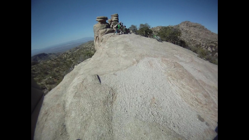
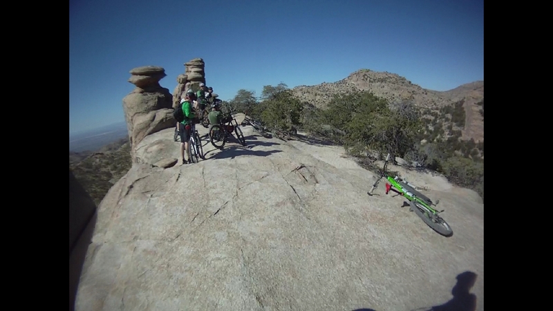
The dome much like the first one we rode, a long solid rock face that drops off sharply to the side but is ride-able over the front. A descent that is both fun and easy but transitions into a very short technical that I find myself off and walking a few steps.
As we crossed a couple of more large granite features, Jim pointed out a couple of launch points for those with the experience and willingness.
We finally ride by a large rock that Jim calls the Lunch Box, a rock that I saw Brian ride up on and down a vertical face on the other side.
This rock is a marker, a spot that people refer to when talking about the 50 Year trail in reference to mountain biking.
After a few rock steps, the trail turns into a well worn grove and I started to pick up speed.
A moderately fast run with a few rocky features to negotiate; a couple of step downs, a few large rocks to roll and lots of fast weaving single track.
The line continues on a fast but not steep descent until it reaches a very short quick climb up some rocks and turns down again, into a narrow rush of quick skidding rock drops.
The trail dropped through more large granite boulders and multiple lines are presented, one of which I took that was both great, a nice ridge of granite to ride down and not so great as I found myself in a narrow that brought me to a stop where I had to lift and push my bike to get through.
The trail presenting more skidding granite steps and fast quick gutters to shoot through and out onto an exposed granite face.
This last part of the trail was fast, quick, and lots of fun.
All too soon the trail hits the bottom of the descent and crosses a very large wash, where we are confronted by a young cow standing on the trail. He waits looking us over as we approach until he finally relents and turns to trot off up the wash.
Then a short rock and rubble climb over the next ridge and down through another wash to be repeated once more over the next ridge where we exited out onto a dirt road.
A few feet down the road and we are back at the 50 Year trail at the point where it crossed the road.
We rode back over the meandering single track to the point where the connector trail split off, then we decided to rocket down the 50 Year to the point where it crossed the road and take the road back. This is a nice fast single track which is a fun swift line.
One of the epic rides in Tucson has to be the Bugs and Millie ride.
The Tucson MTB web site had a posting calling for a ride on the Bug Spring and LaMilagrosa or the Bugs and Millie trails as they are know to the locals.
We met up at a local coffee house "LeBuzz" to plan the shuttle. The ride is a shuttle that starts at 5,860 feet and descends to 2,800 feet over 15.5 miles.
Even though it is a shuttle ride, it is exhausting, this is not a downhill run, it has lots of varied terrain with lots of hike-a-bike climbing throughout the ride.
We drove to the trail head at Bear Canyon picnic area. The trail starts at the west end of the parking area.
I hopped on my bike and rode a hundred feet into the forest when the trail took a turn and headed straight uphill. The line is steep with steps made of railroad ties.
We did a hike-a-bike for the next half mile, covering an almost 500 feet of elevation gain in a half mile.
Now at the highest point on the ride, 6,285 feet, we put on our protective gear (armor). I strapped on my leg and arm guards and we headed down the trail.
The trail descends down across three railroad ties as it turns to run across the top of a ridge and a couple of more ties. Then it follows the top of the ridge, crossing exposed granite rock surfaces on a tread that is made up of the decomposed granite gravel and sand. There are a couple of steep skidding sliding sections that tested my ability to control my breaking and skidding.
The views were broad and sweeping when you could take your eyes off the line long enough to appreciate them. The surrounding hills all covered in low thick brush and small deciduous trees.
The trail moved through a switchback to descend down and across the side of the ridge running in and out of the small draws and descending until it reached the bottom of a valley and a dry creek bed.
The trail follows the dry creek, crossing back and forth, my bike rumbled across the rocky creek bed as if flows down the valley.
The brush in the valley giving way to larger deciduous trees, sycamore trees I think, with pine trees starting to appear. It is interesting to see the mix of vegetation which includes the desert plants like yucca and large timber like pine and fir trees.
The line here is fast and firm single track, with rolling sweeping turns running through the timber to one point where there was a very large pine tree down across the trail. Riders have stacked loose material on either side, turning it into a log over feature.
A very large log over, the log not firm on the ground but suspended a few inches off the ground, the loose logs and sticks piled on either side making the log over tall and narrow, my bike pivoted on the bash guard as I rocked across the log and dropped off the other side.
The trail climbs out of the valley and gains the ridge again, exposed, the timber gone, the tread returns to the gritty crunch material with exposed granite boulders.
The line dropping down across the granite to the bottom of another valley and into a short climb to another feature.
Next to the trail is a large boulder, eight feet long by a good three feet wide and high. There is a pile of loose sticks in front of the boulder and one of my fellow riders, pushes his bike up on the rock. He mounts his bike and with a couple of pedal strokes, launches himself off the other end to land on both wheels and skid a ways down the trail.
Brian Vance walks his bike back up the trail and takes a couple of starts at the feature (video), gauging his speed and approach. Then he hits the pile of sticks and rolls up onto the rock, balanced in a stall for a fraction of a second as he ratchets the crank back half a turn, then Brian cranks down on the pedal while pulling up on the handlebars and launches off the end of the rock, to float to the ground.
The trail wound down a few more feet to round a corner and present a big hike-a-bike up a narrow line over dozens of railroad tie steps to the top of a ridge.
The trail follows the ridge line to take a turn and start a serious descent that had a few of us walking down the first few feet of grit covered boulders.
The slope of the descent slackens a little and the line is a rut filled with granite base rock that provides a mild technical but very ride-able track. The ridge opens up onto a granite dome for a short climb.
At the top of the dome climb is a large step down that a few of the riders tried to launch off of, one of which hammered himself with a body slam (video) that he jumped up from and just shook it off.
The trail continues down the top of the ridge, a ridge that is covered with numerous Hoodoo rock formations, the trail running in and out of these formations.
After a few minutes the trail crosses off the top of the ridge and starts a strong descent. The line not steep but narrow and the track is rocky and gritty.
The vegetation is much sparser and the exposure seemed to be greater, although I know that the exposure was just as or maybe more extreme in some of the upper sections but the brush covers the hillside.
The trail runs down through a couple of switchbacks and down across an open plan to run over another rocky ridge with a couple of places to ride down a low level rock ridge or drop into a rut just a foot below.
There were two spots on the descent where the grit covered slick rock had me off my bike to walk down a ten to twenty foot steep descent, I think if I were following an experienced rider I would have made the descents but the guy I was following was off his bike which put enough doubt in my mind to drag me off mine.
Seven or eight switchbacks and a couple of turns down the front and across the top of the ridge for a bump and rumble downhill run that took almost twenty minutes.
At the bottom of the descent the trail crosses the Catalina Highway. I pulled up to the highway to stop long enough to see a roadie flash by at forty miles an hour, then I crossed to meet up with the rest of the group.
The next section is a run from Prison Camp to Molino Basin, about a two and a half mile long run. The trail from here down through part of the LaMilagrosa trail is part of the Arizona trail. The Arizona trail is a 800 mile trail that runs from Utah to Mexico.
I had ridden this and the LaMilagrosa last December and was looking forward to riding this again, feeling more confident this time down the trail. A little over confident (video) since on the first switchback I dumped it and hit the ground. I was happy I had the armor on.
A little shook up, and seeing the group moving down the hill, I picked my bike up and twisted the handlebars back around forward to mount up and head down the trail.
The run is a good rocky bumpy descent with a few low grade technical sections but for the most part very ride-able, with one sharp hike-a-bike climb for just a few feet.
At about one and three quarter miles the trail diverges to present an exit onto pavement or continue for another three quarter mile on single track, ending with a low grade grind up some single track to the pavement.
By this point, we have been in the saddle for almost two hours. We took a short break before tackling the big hike-a-bike that awaits us.
The Millie trail starts with a five hundred foot climb over rocks and boulders with just a little bit of single track dirt connecting each section of boulder steps. It is a real hike-a-bike, carry-a-bike section.
Once we reached the top of the ridge there was a little chatter about what to expect on the next section.
After crossing the fence, the trail runs along the top of the ridge for a very short distance before descending in earnest.
The descent is a boulder strewn pathway, large rocky steps that have huge penalties for a mistake. The trail runs along the edge of a big drop, I wouldn't call it a cliff but just a few feet of very steep hillside leads to a big drop that will break bones.
The trail becomes ride-able for us mere mortals after a few seconds of hiking. The line winds across the face of the hillside, which is still very steep but I never had time to really look at it because the tread was so busy that I had to pay very close attention.
The line runs out to a rocky outcropping where again I am forced from my bike to pick my way around the precipice and down a few rock drops to remount my bike and bounce down over a few rock steps until I hit the third section that was not ride-able for me.
Another section of steep rock drops and unnerving exposure before I hit the first switchback.
Once around the switchback the line is a little steeper but the exposure in not as extreme and the line not as formidable though I am still so far back on my bike that my ass is hanging out over the back wheel.
The second switchback is not even ride-able for me. It is a short rocky step down to a hard right turn that I walk around.
The side hill has mellowed and the tread is now mostly gritty gravel and a little rock and rubble.
The grit is soft at the next switchback and I washed out, falling on my ass as I danced around trying to get my feet under me.
The rest of the descent is a bumpy gritty track that runs down across exposed rocky flats and rock steps, dodging Prickly Pear and Ocotillo.
The trail winds through the hills, crossing around an outcropping to face another short ascent.
A climb up a rock and rubble track to the top of another ridge.
As I approached the top of the ridge, I mounted my bike and finished the climb to roll over the top and start the next descent. The descent starts with a set of rocky steps that drop across the hillside and turns into rock and rubble.
The line leads to the bottom of another small valley and another climb, hike-a-bike up the hillside to gain the hilltop.
The trail turns into a double track that runs across the side of a hill and then sweeps out through a flat and down to a seasonal creek wash, where it crosses and follows the creek for a short ways to cross again and head off over another low lying hill. The tread on the road is sandy and gritty.
Quickly the trail breaks off the road to the right and heads downhill at an easy grade. There are a few semi-technical sections as the trail approaches and crosses a creek.
A large slick rock section that has the trail exiting off one end over very large boulders, the area referred to as the water fall, not because of any water fall but because the line is down over the boulders like a water fall.
We hung here for a while so that a few of the riders who had the inclination could attempt to ride the water fall. There are two lines down through the rocks, one that runs tight up against a rock wall and the other somewhat more free form.
Brian Vance rode the line up against the rock wall on this ride and on the last ride he had ridden both lines.
Jim, Broody, and Andrew rode it out, a couple had to dab a couple of times to get through.
It was a rocky hike-a-bike out of the valley and up onto the ridge line where we continued to climb. Most of the crew were riding full suspension and in some cases downhill rigs. Vern and I were on hardtails and I was able to crank it out instead of hiking; the line a moderate ascent.
The line levels out and starts a lot of up and down running. The tread a gravel-grit with a little rubble and some buried boulders and an occasional granite slab or slick rock type surface.
The trail followed the ridge line in a mostly downward direction but with a number of uphill challenges, most of which I was able to crank out, a couple being a real challenge but still do-able.
The downhill sections along he ridge line were fun chunky stuff, lots of rock drops and negotiating tight spots and finding a workable line down through a rocky stepped sections. There were a couple of places where I did not see a way through and would have to stop and guide my bike through a tight spot where I could not clear because of pedal striking.
There was no comfort riding on this trail, I was either up and cranking or had my seat post lowered, weight back over the rear tire and balanced on the pedals, focusing on switching my front foot as often as I could.
It was a rare condition of trail surface where I could set my ass on the saddle and relax for a moment. Probably the most relaxed I got was on the climb where my saddle was all the way extended and I could sit and pedal.
We finally reached a point on the descent that started descending at a greater rate and the chunk on the trail increased to all chunky steps and no or very little grit in between. The tread was large angular rocks where I was bouncing down the trail just trying to stay on the bike and me on a line I could handle. I did come to a place where I had to get off and walk for a few feet but got back on because I knew that if I kept walking I would miss all the exciting stuff and end up kicking myself later.
Come to find out, this is the start of the section that is referred to as the rock garden, although I would have been hard pressed to single out any place as a rock garden.
It is a gnarly section, the first part is somewhat ride-able. Then the trail takes a turn around a switchback and not only is it extremely chunky but here is also a bit of exposure. A few feet after the second switchback and the trail again becomes ride-able, although still very chunky.
The line flows from the side of the ridge after the switchbacks to the top of the ridge again to take on another climb and hike-a-bike.
The climb finally relents and the tail takes a line around the edge of a rocky knoll and presents a large slabs of rock, connected by short sections of grit and gravel which soon gives way to a rock and rubble trail.
After a few minutes the line has swung back up to the top of the broad ridge and soon the arrival at the mesquite tree, a location where there is a geo-cache of tequila and a guest log for riders to sign in on the Milagrosa trail.
After a shot of tequila to bolster our nerves, we continue the descent.
The line heads down the ridge top, over lots of lunkers to a drop that has even some of the experienced riders off to walk it, the grit and sand on top of the rocky steps makes it hard to maintain breaking control. A short walk then back in the saddle to the next section of the descent. A rocky gravel-grit section that is broken up with lots of exposed granite; large sections of granite slabs.
The vegetation has been sparse with lots of prickly pear and cholla cactus on ether side of the trail, most of the ground covered with a brown grass and agave plants.
The line winds down over the top of the ridge, crossing from one side to the other, lots of exposed granite sections with a couple of drops that drag me off my bike to walk a couple of steps then resume the descent. This is for me one of my favorite sections. It has lots of rock steps but the amount of granite slabs makes it very challenging yet fun.
The line descends to the creek bed where we took a short break before attacking the final ascent and descent.
There is a short hike-a-bike up some large boulders to gain the top of the ridge above the creek, then a slick rock type of descent for the next quarter mile.
The descent continue down through more rocky steps with a couple of spots that again drag me off my bike to step down a few feet then back on and back to rumbling down the rocky bumpy line until we reached a very sketchy area; a narrow grit and gravel covered rock step grove winding steeply down the hill.
I was riding behind a very experienced rider and when he dismounted to walk through this next section, I followed suite.
We hike-a-bike down to the top of the next ridge and ride along the boulder covered trail, bouncing down through tight sections over large drops until we reach the top of an outcropping where the crew is stopped and waiting.
I guide my bike down through a six foot drop to crank a few feet and stop before the next big drop. Walking down through this I waited and watch two of the experienced riders show me how to ride this on a full suspension bike, with me knowing I would never try that, even if I did have a full suspension bike.
The final descent down a granite face with lots of grit and gravel on ether side, the key was to make the descent by staying high, on the right, of the exposed granite surface.
The bottom of the descent presents a short low level climb up a rock and rubble road to gain the top of the next ridge and blast down the other side on a double track that runs from grit and sand to rock and rubble. Where we finally run out onto a paved surface and crank it out back to the cars and a cold beer.
Sweet Water Trails, for South Western trails, moderately easy riding.
The system starts off with a couple of options, I chose to do the same route we did last December when I was here for the 8ish days of Christmas, a riding event put on by the Sonoran Desert Mountain Bikers.
We rode this trail system on a night ride so I was very excited to ride it during the day.
The trail starts out running through low brush on a sandy gritty track, across a small wash then straight into a low grade climb for about three quarters of a mile. The tread on the climb, was a smooth track interspersed with a rugged rock, not the granite that seems to be so common in the area, but a rough course rock, mostly red in color, but very sharp and jagged like old lava.
It is a smooth hard pack rubble trimmed trail that weaves through large Saguaro cactus up the side of a ridge to gain the top and a narrow pass.
An optional trail loop, the Sun Circle Loop, heads off toward the west. A half mile loop that continues the easy mid gear range riding but with very little climbing.
The Saguaro Cactus gives way to more of the Prickly Pear and Ocotillo and the line heads across a gentle slope with just a few rocky features to negotiate.
A quarter mile out and the trail turns back and descends at an easy grade, a few rocky outcroppings to bounce over but for the most part a fast smooth line that junctions with the original Saguaro Vista Trail.
A left turn and a quick descent down across a wash, followed by a short climb up to the next trail head, the Black Rock Loop.
I have ridden the Black Rock Loop in both directions and I feel the best way is in a clockwise direction, which is the direction presented as you approach the loop from the Saguaro Vista trail. The trail continues the climb from the bottom of the wash and extends out and across a low lying ridge. It crosses another couple of small washes then presents a quick downhill run at a mellow grade.
The line running around and through a number of gullies and washes to finally terminate back where it started.
The trail heads back down through the wash again to climb back up to the top of the ridge and pass over and back down the Saguaro Vista Trail. An option here is to ride the Sun Circle Loop in reverse, which is the way I have been riding it, a little more challenging and some easy rocky riding to prepare for the Lost Arrow Trail.
A few hundred feet down the trail is the junction with the Lost Arrow Trail. A quick turn to the south and the trail runs down to cross a wash, then climbs up and over a small ridge to drop into the wash again, then over another low lying ridge to drop through the wash one last time before climbing a solid single track through a couple of switchbacks.
The single track reaches the top of a low lying ridge and the tread turns to a rocky climb. The ridge is a rocky reach with a thin covering of sandy gravely material. My bike rumbled over rocky outcroppings while I concentrate on picking the easiest line.
I found myself in a mid range for torque, the incline was moderate enough that I could crank slowly over the rough outcropping and still maintain speed.
The climb up the ridge has a couple of breaks where the trail levels off and descends slightly then climbs again.
There are many rock obstacles that are challenging on the ascent, ranging from steps to roughs. There were a number of places that I found it easier to ride across a rocky rough then to twist and turn, trying to negotiate a smother path.
The line runs in and out along the side of the ridge, creating a couple of sharp turns, the second one of which has a boulder in the middle of the track. This spot tossed me off my bike a couple of times because my front tire would miss the bolder but the rear tire would catch it and the saddle would spank me off my bike. I noticed that the spot has been widened out from numerous riders scrambling to maintain their balance and not tumble into the rocks and cactus.
The top of the ridge is another trail junction, "The Spine" runs off to the east and is an easy climb to a pass and the Homestead trail that continues straight on, weaving in and out of the many small gullies.
The Spine trail runs down the east side of the ridge and has some rugged bump and rumble rocky zones until the line widens out to become a double track.
The Spine has three trail junctions on it, Ocotillo Hill Trail which heads down across a wash and back up the other side to climb and junction with Homestead and Red Tail Ridge trail. The Oxbow trail which runs down a wash to junction with the east end of the Red Tail Ridge trail, and the Wildflower Ridge trail which runs back to the parking area through a couple of intermediate technical sections and by way of a simple line called Roller Coaster Trail.
When it comes down to it, there are so many trail junctions and options that many trails can be joined to form loops that can range from easy to intermediate technical trail.
At the top of the climb up Lost Arrow Trail, the Spine, Ocotillo, and Homestead trails create a loop that is a simple technical with some rumbling rocky descent. Where riding the loop in the opposite direction creates a challenging climb up the Spine with an optional route off the Homestead trail, on the Red Canyon trail. The Red Canyon Trail has one very technical spot that took me a couple of tries to clear.
Finally the Red Tail Ridge Trail is a very rocky line that has a couple of good technical spots but very ride-able for intermediate riders.
I found myself riding some of the more fun technical trails in both directions and making my own loops.
The system lends itself to developing your riding style on the rough and rugged rocky terrain.