Ride Report Archive August 2011
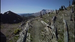
The Sweet Siouxon Trail
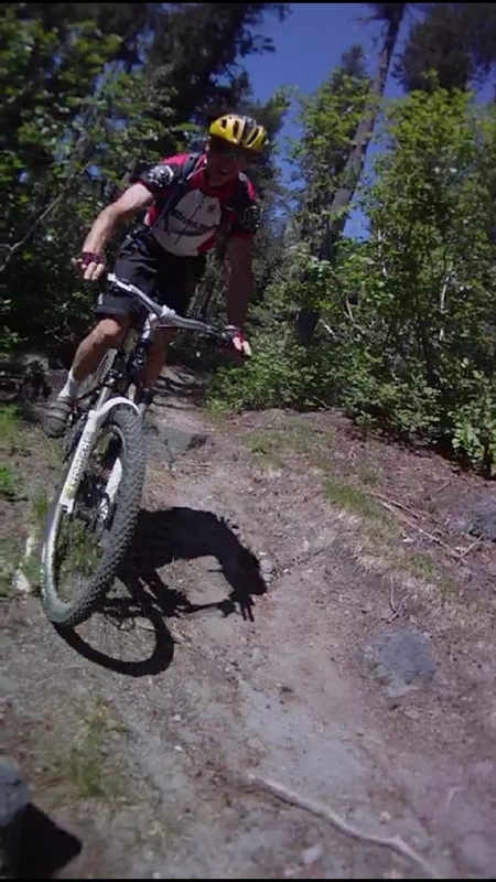
Tuesday 8/23/11
Outstanding day on the Siouxon Trail.
When I made my way to the kitchen this morning and looked out the window, I could see it had rained last night.
The weather man was saying that the worst of it was over and that it would be clearing off around noon.
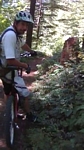
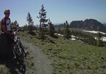
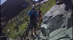
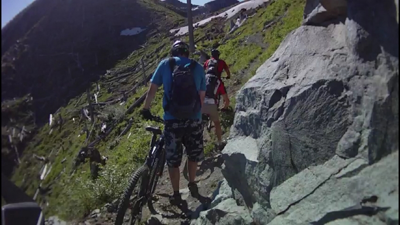
At 7:00 am I met up with Bob Horness, Paul Norris, and Scott Bishop at the Woodland park and ride.
Bob and I took my car, while Scott and the dogs went with Paul.
As we crossed over the pass into the Siouxon Valley, it was veiled in clouds. Green patches of timber visible through the mist.
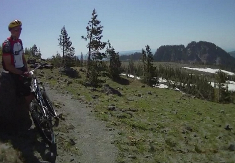
At the upper tail head, we stopped and Scott got his bike and gear out. He was going to take off while we drove down to the lower trail head and returned by the road on our bikes. Scott has only been riding for a few months and he wanted to get a head start on the rest of us.
Just before reaching the trail head, Bob's bike started making a funny noise in the front end; a squeak which Bob thought was in the breaks.
We started down the trail, Paul leading off, with Bob behind him and me sweeping.
Within a half mile, Bob stopped and pulled his front wheel. While we checked the breaks, Paul returned to see what was up. With the wheel back in place, Paul gave it a spin and commented that it sounded like the bearings were in need of some service.
A little over a half mile more and Bob was off his bike again, this time the wheel had a lot of wobble to it. He pulled it off and it looked like the bearings were gone. I handed him my car key and told him it was about a two mile walk.
Paul was gone and I took off in pursuit.
I maintained a steady pace, always expecting to see him somewhere along the trail.
After arriving at the lower parking area, I rode up to the road and looked to see if anyone was at the cars, and then rocketed down the hill to the bridge crossing West Creek.
Cranking up the trail, I passed a forest service employee and a couple of hikers, both said there was another biker just a few minutes ahead of me.
I reached the big pool and waterfall hoping that Scott and Paul would be there, stopping just long enough to take a hit off my electrolyte drink, and then cranking up through the next section.
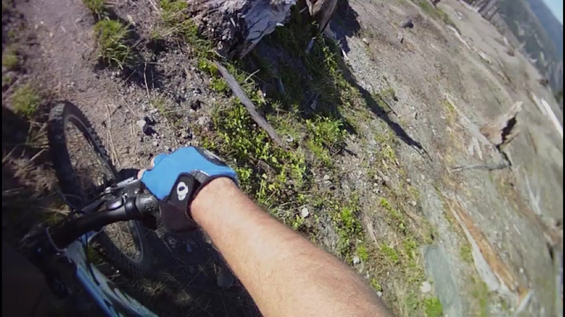
The trail to here was good solid single track with a few rocks and roots but a good ride for almost any level rider. Fast and smooth I had kept my bike in the mid range gears and powered through at a steady pace.
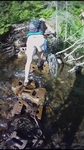
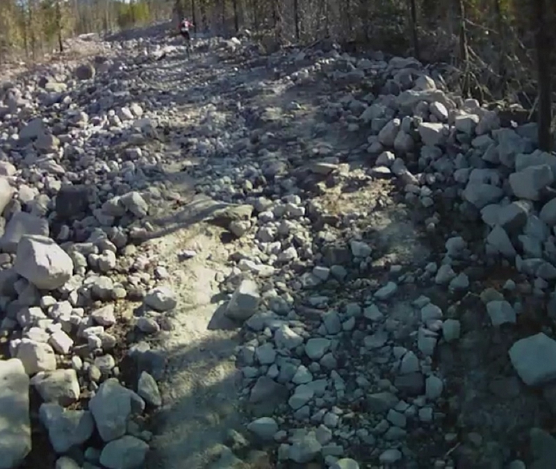
The next couple of miles were tougher; the trail would climb and descend many times as it tracked the Siouxon Creek. The tread was filled with patches of rock. Most of the rock imbedded in the tread along with a few roots. There are more than a dozen places where the rocks becomes the main feature, with heavy rock gardens and steep drop offs next to the trail.
Pressing on, I climbed and descended through the rocks and negotiated the line with only one dismount to finally arrive at the upper bridge that crosses the Siouxon. Paul and Scott were there waiting.
Seems Scott was doing very well and had been there, went up to the falls, taken a nap and was contemplating moving on because he thought we might have passed him while he was up at the falls. Scott had handled the Siouxon much better than he expected.
Looking up the last ridable section of the Siouxon trail, Paul looked at me and asked "do you want to head back or ride on out, I've never ridden that part of the trail". My reply was "I'm not going to say Uncle".
Scott was happy with that decision and told us he was going to head back, taking it a little easier on the return ride.
I had to push my bike up the first twenty feet of trail, then we started a steady climb with a few head down hard, lean in and grind it out sections.
I had ridden this part once before many years ago and all I remembered was that it climbed a lot more and steeper than any other part of this trail.
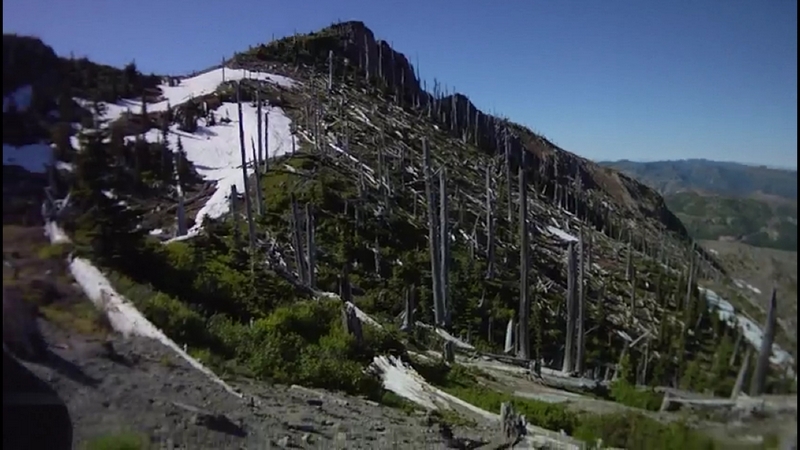
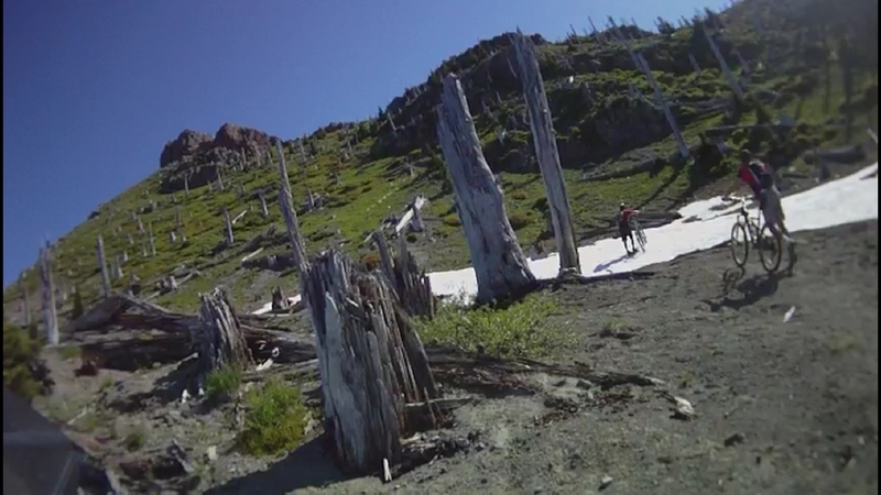
Huffing and puffing up the hill, cranking past rock faces and through a forest that contained quite a few old growth trees, trees that looked like they might have survived the Yacolt burn. Trees that in the upper story, had branches as large as trees.
The track ran across to very steep side hill and in a few places ran out over the Siouxon on high cliffs that put the creek well below us.
A few large trees have fallen across the trail, but because the hillside is so steep, we could ride under them.
I did have to dismount and push my bike at a couple of sketchy locations, like the place where a large tree had fallen and taken part of the trail with it, leaving a gaping hole with a sharp drop off on one side.
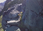
The creek at this time of year displays some very beautiful waterfalls and large crystal clear pools. There are lots of places on along the creek where the water has channeled its way through the bedrock to form a series of linked pools.
Twenty five minutes later and we reach the end of the ride-able trail.
There is trail that extends up on the other side of the creek. The trail we could see looked to be ascending at about a 25% slope, to steep to climb on a bike and very tentative riding on a descent.
After sharing a peanut butter and banana sandwich we start back.
The line is mostly fast downhill on close to perfect single track, very few rocky sections on an old well developed trail. A trail that I don't think sees a lot of mountain bikers and maybe not even that many hikers.
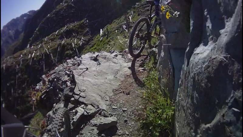
There are a number of places where the exposure is high and the penalty for a mistake could be grave, but they pass quickly and your focus is tuned to the trail.
Returning to the junction of the Siouxon and Chinook Creek trails, we headed back on the track we had powered our way up on.
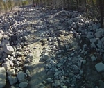
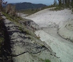
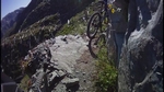
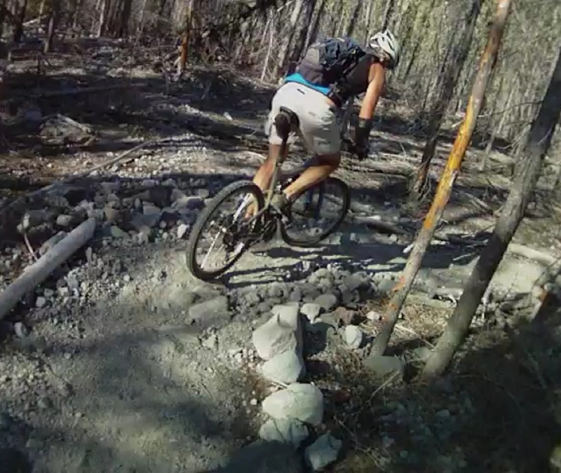
The return has some great rock garden sections that are fun to ride and test your ability to negotiate the right line. I missed the line on probably the roughest rock garden on the trail when I felt and heard a strong clank as I was trying to clear a large rock and root combination. Later at home while cleaning my bike, I noticed that I had broken a spoke and knocked one of the teeth off my small ring gear. It had to have happened there.
Siouxon Rock Garden
Paul cleared the section; he picked a line where he rode over a large rock and kept to the creek side of the trail.
This section of trail has lots of short climb and descents with areas running next to the creek, with steep drop offs but a wide trail.
We stopped for a second at the falls to let the older dog, Muddy, catch up. Then we hit the last section hard.
Riding in mid range gears; we bombed down through a small swale to gain the other side and follow the trail around to the bridge that Jerry de Ruyter had put in over Horseshoe creek.
A fast descent down the most technical section on this part of the trail and hammered hard for the next two miles back to the final climb out and back to the parking lot.
After starting the grind up the last climb, I noticed Bob Horness on the trail, he had borrowed Scott's bike and was riding down to meet us.
The final section has a wide track that is smooth with lots of rocks and roots that are easy to negotiate. This is a good section of trail for beginning riders. An out and back from the lower parking lot is a total of six miles. It does start with a steep downhill but the trail is very wide and easy to ride.
Later when we were back at the car, Bob was showing me video he had made on the trail. It turned out that Bob had decided to not walk his bike but to ride it instead, even though it did not have any bearings. The axel must have just been riding inside the tube, there was probably enough grease in the hub to make it act like a plane bearing. As long as he did not use the front break he was ok.
He had ridden out to the bridge on the Siouxon where Scott had stopped and then back to the parking lot with that front wheel. I am sure Bob must have said to me at some point, where there's a will there's a way.
I tried to spin the wheel on Bob's bike when we got back to the park and ride in Woodland, with a good hard toss, it would turn about a half turn, lots of drag.
Not only did he make the ride, but he videotaped a portion of it while he rode with one hand on the handle bars and one hand holding his camera.
Our efforts racked up eight teen and a half miles with about thirty five hundred feet of climbing, with almost all of the climbing done in short bursts of fifty to a hundred foot elevation gains.
Paul Norris and I discover 3 Corner Rock
Tuesday 8/16/11
Three Corner Rock, switch back boot camp.
Paul Norris picked me up at the park and ride in Woodland, 6:00 am. We were turning cranks by 7:30 am.
The trail starts off climbing 400 feet through five switchbacks to break over the ridge at 1300 feet. The tread was nice forest floor, firm hard packed dirt with a few roots and rocks. Lots of ferns and salmon berry in the under story but a very clean trail with a moderate width. The line weaves back and forth across a very steep hillside.
Then it descends back down 300 feet in just over a mile through two more switchbacks. The track is still firm hard pack with a few stones. The line overall was about a 6% grade that had a few steep sections. The brush was overhanging the trail to a minor extent, slapping me with a few wet spit bug branches as I flew by.
The next climb is a simple 835 feet over one and a third miles, which comes out to about a 12% grade on the average. With just 16 switchbacks, most of which I had to get off and walk around on the way up clearing maybe 3 or 4 of them. The right turn switchback seems to agree with me but the left turns never did. It seemed also that the left turns were almost all covered in loose stone, the approach almost always seemed to get steeper just before and after the switchback.
The line turns down with six more switchbacks and almost a mile of descent. The trail is another 12% grade to the stream crossing. I am still having problems with the switchbacks on the way down and most of the now right hand switchbacks (left hand going up) were giving me the most problems. Most cases found me riding high on the bank before the turn and just dismounting and spinning my bike on the back wheel, then flipping my leg over and start blasting down toward the next switchback.
Finally there is a very short climb to break over the shoulder of a small ridge and drop down to a tributary that feeds Stebbins creek.
This is a good place to turn around and head back for a great ten mile out and back. A spot, where according to the reports I have read on line, is impassable during parts of the year when the water is running high.
The stream on our ride was very low and easily forded. Using the bike as a crutch technique we just stepped from rock to rock and prepared for the next ascent.
We left the steam with a very hard pull up through the first of nine more switchbacks over the next mile.
We were cranking our way up through a section of trail where the tread has turned to loose rock, one or two inch and smaller in size. One short rocky exposed section to cross where the tread turned into a rock garden. I looked the line over as I walked my bike through the rock garden, looking for the best line on the descent and when I hit it on the return run, I had picked a high line, but my back wheel washed out on the loose gravel, turning me sideways and I ended up walking it down.
Finally hitting the top of the ridge, we took a short break with some silly talk about turning around and calling it good, which would make it a twelve mile out and back. Unfortunately the line ahead of us had leveled off in slope which just forced us to proceed.
Now running at about a two to three percent grade the trail rolled along the top of the ridge. There is lots of shifting up and down along the next mile to accommodate the short steep pulls that transition into a fast run out across the side of the ridge; most of the track was a smooth forest floor. Although there were a couple of sections toward the end of the trail where it looked like a stream had jumped a bank and ripped down the trail, exposing very large stones and root drops.
Since leaving the creek, the vegetation along the trail has become more overgrown primarily with salmon berry and huckleberry brush encroaching on the line. My arms have multiple small scratches that display themselves as little red lines.
When we reach the road, the question of continuing to the top goes unspoken. We ride uphill on the gravel looking for the road and after a few hundred feet; check the map to see it is just below the trail exit.
We were on the final push to the top, one and three quarter mile with 18 switchbacks.
The tread on the climb to the top became progressively rockier. Starting with some firm dirt and rock mix and progressing to rock and rubble.
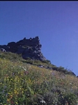
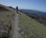
When the trail breaks free of the timber there are some great views of the valleys stretching out and away into a hazy blue horizon. The timber has been replaced with an expanse of wild flowers and brush.
About a half mile from the top the vegetation became so thick that the track was not visible. Pushing our bikes for the next quarter mile to a point where we just gave in and left the bikes to hike the final quarter mile to the top.
Three Corner Rock is not a rock. Like the tip of an ice berg thrust up out of the surrounding sea of timber and brush. The formation is composed of a huge pile of large angular stones that roughly take the shape of a three sided pyramid.
The view from the top is marred by a large relay tower that stands on the hill just a couple thousand feet away from Three Corner Rock. There is a gravel access road that also passes by and access up and onto the geological feature has been developed by or for jeeps and other vehicles.
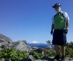
That aside, the view to the north is spectacular, Helens, Rainier, and Adams are all stretched across the horizon.
The descent down to the road looked to be a bit sketchy. On the way up both Paul and I noticed a couple of very exposed areas and I was uncomfortable with all the tight switchbacks on the loose rocky material.
Paul, loosened his seat clamp and dropped his seat as low as it would go, then dropped the gravity seat to the lowest position. I have a dropper seat on my bike, a simple style dropper that is activated by reaching under the seat, pulling the leaver and shifting your weight forward causing the seat to drop about four inches. I rarely use it because of having to take your hand off the bar and reaching under the seat. Once I break into a steep descent, it's not very handy to be steering with one hand.
I lowered my seat with the dropper as low as I could get it before we even started to descend. Sitting back on the saddle, I felt like I was riding a BMX or trials bike; not really made for cranking while sitting.
Starting down through the next quarter mile of thick brush was an exciting challenge. I started by ratcheting the pedal around to take a bite out of my shine as I struggled to get rolling. A trough in the vegetation guided me down to the first switchback, a turn that I made with one foot on the ground as I pivoted around and continued plowing my way through the thick brush.
Pretty soon I started seeing glimpses of dirt as the vegetation started thinning out and the angle of descent started to increase.
Applying pressure to the brakes and sliding back off the seat to stand on the pedals, my weight back and low, I approached the first open switchback. I dropped the outside pedal down and leaned toward the switchback as I turned the bike. With my inside foot off the pedal, I steadied myself as I turned the corner and moved back into a descending stance.
Switchback after switchback I used the same technique. The saddle lowered down made all the difference. It was out of the way and not likely to slap me in the ass if the back tire hit a rock or root in the turn. It made all the difference in making the corners and giving me the confidence to turn a trepid descent into an exciting experience.
Eighteen switchbacks and one front tire washout to plow me into a bank and I was at the road crossing.
Then next mile plus was a run along the back side of the ridge, starting off with a challenging rock garden where I had to step off for one large drop but was able to regain a line and finish rumbling through.
The ridge section had a few small streams where culverts had been put in but they were exposed and created yet another feature to deal with as each crossing seemed to lead into a steep but short climb.
This was a fast section of the trail even though it was not steep. The tread was primarily hard packed dirt and premium single track.
The trail came up on top of the ridge for a short distance then dropped down the front side. The tack cut a swath through the brush, not as heavy as it was above the tree line or in the upper section of trail but still very brushy. The tread varied from dirt imbedded with stone to mostly loose gravel and stones.
Though there was a steep hillside, the brush covering the hill dampened my concern and I kept my focus on the trail.
After the first few switchbacks the line ran at a moderately steep descent, a good half mile. Long enough that I caught myself setting back on the lowered seat and cruising sections of the trail where I felt comfortable with the tread.
The long cruising section ended with four more switchbacks and a short run to make one more switchback and drop down a steep incline to the creek. This is a good spot to take a break and get some electrolytes and nutrition because there is a big climb coming up.
After crossing the creek and climbing a short climb there is a nice little glide through the trees to get you prepared for the next big ascent.
After reaching the top of the climb I rolled up behind Paul and said "I'm feeling it", to which he replied "That wasn't as steep as the other side. It was steep the whole way but there weren't those brutal super sections."
Some more reward for the exhausting climb that lay behind us. The tread along this section is more dirt single track with just a touch of rock garden and some gravel in spots. A couple of gnarly spots where the line runs through a couple of small ravines kick me off my bike but just for a couple of feet. With more energy I might have thought about attempting to clear them.
There are a couple three switchbacks that leave little room for error, one that is loose with a steep angle which for some reason dumped my bike and me into the hillside. One that turns through a rock garden and exits across a rugged rocky grade, then one that on the way up I was thinking this will be fun on the way back down but looking down the steps formed by some big rocks and the roots of an old stump, I stopped, planted both feet and stepped off to pick up the bike.
We had one final climb to reach the ridge that we had first crossed over, both Paul and I distinctly remembered the not so steep descent of around three hundred feet and expected a nice mellow spinning climb back to the ridge. We found out differently. The climb back up was spinning except there were numerous short steeps, where we had to crank like hell before returning to spinning.
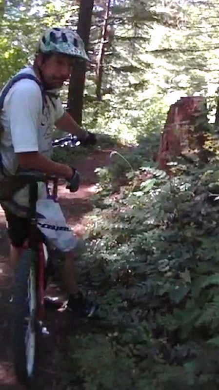
As we climbed up through the timber, Paul spotted a Lobster fungus growing next to the trail. Hypomyces lactifluorum, the lobster mushroom is a parasitic fungus that grows on other mushrooms.
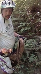
Paul quickly stepped off his bike and dropped it alongside the trail as he gently picked the fungus using both hands then pulled his pack off and stashed it inside. About to leave, he spotted a second lobster mushroom. Paul told me the only issue with the mushroom was that they could grow on and engulf a mushroom that was poisonous but that he was fairly sure it was not an issue around here.
I checked on line and found that indeed there has never been a reported fatality from ingesting the lobster mushroom, although there have been reports of people getting sick and of some just tasting bad.
We finally break across the ridge and start heading down the final descent back to the car. The line traverses the steepest slope we have crossed all day but the hillside is covered in large timber and the tread is very smooth.
Within seconds Paul has disappeared out of sight. A very fast run, I catch up to him just before the first switchback where he has stopped to lower his seat post.
Paul whips around the first switchback and again disappears as he rockets out of sight. I round the switchback and dropping back over the rear wheel let the bike fly. The next switchback has a large tree protruding out into the line just after the turn and the trail has sluffed off just below it, causing me to clamp on my brakes and push my bike a few feet past the tree.
All too soon we are at the bottom where neither of us can believe this last section was so short, because it sure didn't seem that way on the climb.
Download your custom bike to a spread sheet
Build A Bike
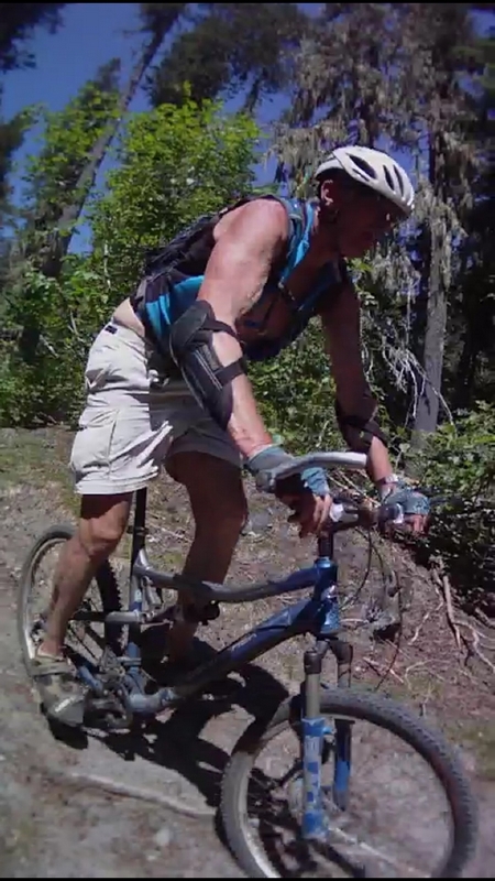
Barry and I ride the Sidewinder Trail thanks to Tom our guide in Post Canyon.
Sunday 8/14/11
I posted to my facebook page that Barry and I would be riding up at Post Canyon on Sunday, leaving early and hoped to be on the trail before 8:00.
I picked up Barry at 6:00 and we were on the trail by 7:30. We were the first riders on the track.
Starting on the first trail at the bottom of the road, it was much different than what I had seen last April when I had rode with Paul, Guy, and Jessie. The tread was dry and dusty. Both the trail and the creek were dry.
I noticed on the little steeps that the consistency of the dust was like small granules which made the track somewhat slippery in places where there was a lot of dust.
We made our way up the trail, catching every feature we felt comfortable with; I didn't ride any of the skinnies.
After hitting the official trail, we headed up the nice wide line that is Trail 100.
Shortly after starting up the trail there is a junction with trail 101, which follows closer to the creek. We had taken this route last time and the line is narrower with lots of roots to negotiate while the main line is wider and more developed. The 101 trail is very short, a couple three small slat bridges and it is back to the main line.
The climb up to Family Man, which can be done for most of the climb in a mid range gear combination, is a good solid climb with one final steep that took all the energy Barry could muster to clear it, I walked it.
We rode around and tried most everything in the Family Man area, spent some time trying to pump the track but the spacing was so much wider than our track. I had to pedal between most of the rollers. We rode it in both directions and in the counter clockwise direction there were three rollers before a banked turn that did launch me into the curve enough so that I could see what it is supposed to feel like on a pump track.
A run through Middle School and then we headed down 100L until we hit 105, which merges with trail 158; all very confusing.
The most important part was that trail 158 is a screamer. The upper part filled with rollers and big banked corners, even a couple of table tops, but the lower part has got a section that is swift with large rolling terrain. The effect feels like riding your bike over waves, the line undulates up and down as it traverses the hillside.
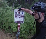
When we got to the bottom there was a sign that told us that the Mitchell Ridge trail was closed due to logging in the area. I suggested we go ahead and ride until we got to the closure.
We headed up Spaghetti Factory (trail 116). The line starts with a vertical ascent that Barry leaned into and pumped it all the way up, I had tried last time I was here and chose to push my bike up.
The Spaghetti Factory is the best uphill trail I have ever ridden. There is just enough downhill on the climb to keep you out of the saddle and pumping through the corners in a mid range gear combination. There was only one short section at the top where I dropped into the small ring gear. Just about the time I felt like I was going to run out of gas, the trail would make a switchback and shoot down hill at a grade that was just fast enough. Up on the pedals and pushing back with a very light touch on the break lever until the line would make you push forward and start cranking up through another short section of switchbacks, never enough grade to really even make me think about shifting down.
We rode the trail out to the junction with the Frankenstein Free Ride down hill trail. We stopped and took a break, walking down the trail to look at the big jumps and features. There was one that just looking at it, I could see the design was such that it would kick you straight up and have an impossible amount of hang time before dropping you back onto a steep ramp.
We headed up the trail looking for the inevitable trail closure.
A few hundred feet up the trail we ran into three guys that had just rode up from trail 100 on a new trail 103. They were all grins about the intensity of the climb. We talked for a bit about the closure and they suggested an alternate route that would take us over to a trail called 8 track.
We rode out to the gravel, Post Canyon Rd and up to the staging area. We found the trail the riders had talked about, but after reviewing a map that I had brought with me, decided to ride back down Spaghetti Factory, thinking it had to be a good downhill run.
We turned around and passed the other riders as they headed to the staging area, we headed down the trail. The first part was pretty good, but the rest of the trail was a disappointment.
Spaghetti Factory was not meant to be ridden down. The multitude of switchbacks and the dozen or so short climbs just never allowed us to get any speed or flow.
We ran into a half dozen riders in a couple of groups on the ride back down and since we were heading back the same way we had come up, it was not looking good we were seeing more and more riders on the trail.
We reached the bottom of the trail and standing at the junction, I started looking over alternate routes to take back. I did not want to go back up 158 because it is such a fantastic downhill; I didn't want to break the flow of anyone screaming down the line.
Just after looking at the options, the three other riders we had talked to up above showed up and said they were going to climb 158. Now the climb would most likely be a good climb but just as they took off, another rider came around the bend and had to pull aside for them to pass.
He was not happy, telling us as he approached, that they need to set up the trails to be directional.
I pointed out the fact that Mitchell Ridge tail was closed and he said, no. There is a temporary cut across below the logging operation. Looking at us he said, "you want the full meal deal don't you".
Well of course we did and he said "ok, follow me I'll guide you through"
After brief interdictions, Tom headed down and across the slat bridge over Flume Creek and cranked right up the steep.
Damn it, with a guide there was no slacking off so I leaned into the climb, putting my weight low and forward. My ass just barely on the saddle as I put everything I had into weight distribution and keeping my tires on the tread.
To my own amazement, I cranked it out and hit the flat on the top, to turn and start shifting up as the line immediately takes a quick flash down a long steep and right back up the other side. Fast enough that taller gears are the best combination when the inertia starts to fail on the climb and there is another fast section just a few feet away.
Tom was a hard rider; like so many mountain bikers, you cannot tell by looking at them just how much strength they have, or what kind of a rider they are.
Tom set a fast pace that had me gasping for air as we climbed. I have to admit I was very thankful for the short downhill sections that gave me a little time to catch my breath before I had to crank into it again.
Once on top, we stopped at the trail where we had met the other guys. Tom told us that he had ridden down trail 103 and it was not very much fun, as he put it "lots of hiking switchbacks not good for a mountain bike" but he didn't know what kind of climb it would be. Though he did seem skeptical about it being a very good climb.
Once we hit Post Canyon Rd, we took a turn down the gravel for a short ways, maybe a quarter mile until we crossed in front of the logging operation that was on the hillside next to the road.
There was a wood slat bridge across the ditch that runs next to the road and this led onto the new stretch of trail. The trail was in good shape and looked for the most part to be well seasoned. I looked at my map later at home and found where they had cut a new line in to merge with an existing trail that leads over to Mitchell Ridge.
We took a short break after hitting the Mitchell Ridge trail. Tom gave us a couple of pointers about the trail, he told us that we would hit a junction and to stay right at the first junction and go left at the second junction.
Tom took off first and we bombed down the top of the ridge line, moving from the top to the back side to bounce over a few roots and skim past a few trees to level off for a second and burst into a fast drop down a hard packed clay surface where you could see a black line from the tires.
Then the first split in the trail, where I started to go left and remembered his instructions and dropped straight down a steep on the right. Lots of root dropping through a steep section to the next split in the trail where I balked and dismounted to step down over some big drops. In hind sight I know I could have ridden it out but...
We headed down the track to rip through a small valley and across through some brush on the other side, then to follow the ridge in more of the steep descent.
Tom pulled up to describe the line to us, he said that around the corner the trail would drop over a small steep section and we would have to make a hard right to regain the ridge line and the track with the best flow.
We screamed down the ridge to end where the power lines crossed over Mitchell Ridge. We stood looking over Mitchell Point, a prominent rocky monolith jutting out from the ridge and standing high above the highway that all lay below us.
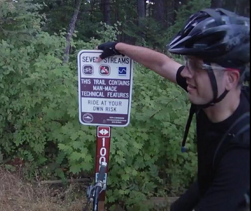
As we turned away from the view, Tom pointed out that most of the riders descend down the access road from here and ride back on the seven streams trail. He was going to show us a trail that would take us right back to the cars.
We headed across the open area to start climbing up the power line road, a dirt road that had a lot of rock and rubble scattered along the tread. Really not as bad a climb as it looked like from a distance.
After a few minutes the line turned into the woods, the double track mostly climbing at a moderate rate, until we reach a wide spot where a single track runs away through the woods to the right.
Tom was waiting for us and tells us that the next section runs down the side of the mountain and makes a turn to the left, where it becomes progressively steeper until it plunges down through a narrow gully and up the other side. Then he tells us, the faster you go the greater the reverse G effect. The gully is clean and free of roots and rocks so the faster you go the better. Then Tom throws his leg over the bike and as he starts to pull away, he looks back over his shoulder and says "Really Fun".
We wait a few second, than Barry takes off. I kick my pedal around to vertical and stomp down, pulling forward and head down through the timber.
Just as Tom had described it, the trail takes off down through the timber and makes a turn to the left, it starts a good solid descent as I start slowing and watch Barry pull away from me. The line turns a little more to the left and I can see Barry starting to bomb down the hill, then rocket up the other side. A few more feet and I start easing up on the breaks, the track is clean but for one root and I fully release the breaks to drop in what feels like a free fall down the side of the hill. A rush flows through me as my bike streaks through the bottom of the narrow gully and I am launched up the other side.
A couple of pedal stokes and its all grins as I exclaim "That is outrageous"!
Looking back at the hill, I tell the others, "If I had seen that before I went down it, I would not have gone down it". The trail on the other side of the gully looks like it is straight up.
We hop back on the bikes and take off around the hill, moving at a good speed the line drops then turns to rail across a long ditch, I had a hard time getting back up on the edge of the ditch and swung a little wide at the exit, throwing me a little off the line for a few feet.
Barry is in the lead as we roll swiftly through the timber, around the hillside and into another drop. The line makes a split around a tree and Barry can't make up his mind. The slope is too steep to stop so he runs into the tree. No damage done to the tree or Barry as Tom and I skid by, dropping over a couple of roots to follow the line down across a small gully and back out across the face of the hill.
A fast swift run as the trail descends, following the contours of the hillside until we turn straight down and drop onto the road, just about twenty feet from where our car is parked.
A big thanks to Tom, as I reiterate that I have a web page and my e-mail is on there. I tell him I would be very happy to show him around Growlers or Stella, just drop me a line because I am available most any time for a mountain bike ride.
Post Canyon and Sidewinder Trail
Video.
Growlers afternoon COB ride.
Thursday 8/11/11
I met Vaughn and George at the parking area on the end of the Growlers Gulch road and we were riding up gravel by 1:00.
We hit Mr. T to start the single track, riding it in the reverse direction does present a couple of sharp bank climbs to clear, one of which none of us made.
Hitting the road trails we cruised until we were forced onto the grave and headed up to climb Hyde.
Hyde was in excellent shape for climbing, the tread firm and sticky even though it has dried out pretty well over the last couple of weeks. I could not help comparing the climb to the wet weather ascent and still have a tendency to un-weight the front end when crossing roots.
We continued climbing up Vortex, the entrance into the second section was blind because of the radical change from bright sun light to the dark forest which takes a few seconds to adapt to. Since I know the line by heart, I was able to crank through but it caught both George and Vaughn.
The tread again superb, the banked corners and rollers are now in such good condition that it was premium on both the ascent and descent.
We made it to Legacy and after a bit of discussion, we decided to ride it in the reverse direction to the normal flow. I had not ridden Legacy for quite a while now and the feedback I had heard in the last few weeks was that the track was getting very overgrown. We decided that the short climb and longer descent might be the better way to go.
It turns out that there is not a good way to ride it when it is so over grown. The ascent was all doable except for the fifty foot section of vertical trail.
After making the top and seeing a pile of dark blue poop on the trail, I had to comment on all the bear scat I had seen on the climb, at least five sightings. Our trail must be the best place to relieve oneself or there is a lot of fertilizer out there in that clear cut.
The ride down around the back side of the hill was so overgrown with brush and grass that my wheels were singing from the spokes rattling through the growth. The rear wheel was ghost shifting from pieces of grass or dry twigs getting caught in the sprocket and pushing the chain up until it would hit the shifting ramp.
The sight line was constantly blocked with brush so that I could only see a few feet down the track, stuff that I would normally ratchet the pedals or make a slight line adjustment for was causing pedal strikes or bringing me to an abrupt halt.
By the time we hit the tree line, all three of us had our legs covered with scratches and bleeding. The trail is in need of a gas weed eater, badly in need.
On the WTF line, the trail was very clear; a superb descent through the small fir trees.
Entering Vortex again took a moment to adjust my eyes. The entrance is under some low hanging fir trees, like going into a cave. Ducking low, I started off very slow, almost off the saddle as I pushed my weight back. My breaks making a very slow thumping sound as the brake pads slid slowly across each of the blank sections on the rotor until I could make out the line in front of me. Releasing the pressure on the breaks turned the sound into a buzz as I broke into a fast descent.
Vortex has quickly matured into a great downhill run. Thanks to the efforts of Ryane, Miles and others who have put a lot of work into developing the track.
We hit the gravel at the bottom of Vortex and talked about our options, Vaughn suggested we do the new Little Sister trail since George had never seen it.
Little Sister has still got a ways to go before she matures. The track is getting better but it is such a busy line. The top of the trail is the best part of the descent, partly because it is the smoothest but mostly because it is the steepest part of the trail.
We crossed gravel and picked up Jekyll.
Jekyll paid out, the track hard and well worn in. I looked for the damage from the horse that was here just a few weeks ago but only saw a few places where the trail was sluffed off.
Down across the two creek crossing, the first with a short piece of canoe log is still a bit sketchy on the approach.
There was one more short intense climb up to the KMA middle section and a real blast down through the woods to finish on a couple of big banked corners.
George and I waited on the gravel for Vaughn. Finally dropping through the dip as he exited the forest, I immediately noticed he was bleeding from a couple of scrapes on his thigh. I asked if that was from the Legacy trail and he told me that he had been going a little too fast. His front wheel must have missed the line and he washed out. From the looks of his injuries he is going to have a couple of good bruises there in the morning.
Vaughn said he thought that his dog Tess was getting a little tired so we headed back to the cars; it had been a good solid three and a half hours of ridding.
Al Hansen's ride without Al Hansen.
Thursday 8/4/11
Al Hansen, a friend of the Growlers Gulch Racing, moved to Florida this past winter. He was returning to the area for a wedding and wanted to do a ride on Mt Saint Helens while he was here. I was invited to join the ride, even though I have only met Al a couple of times.
Al's plane was late so the ride fell apart except for a few of the older under employed riders such as myself.
I met up with
Vaughn Martin and
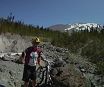
Bob Horness at the Woodland park and ride to car pool up to the Blue Lake trail head on Mt St Helens.
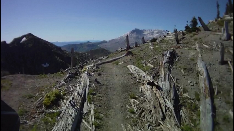
The plan for Al's ride had been to do a loop ride starting at Red Rock Pass. The loop would include the Toutle Trail #238 up to the Sheep Canyon Trail #240. Then to take that up to the Loowit Trail #216 and cross over to the Butte Camp Trail #238 and drop back down to the Toutle Trail. The total mileage would be around 15 miles.
We started at the Blue Lake trail head instead of the Red Rock Pass trail head. The loop would be the same except we would eliminate the mile and a half up and back from Red Rock Pass. Our ride would be 12 miles in length.
The Blue Lake trail head is located on the edge of a big wash area. The trail starts by running through the wash for the first quarter mile or so. Lots of rock and sand; imagine a trail that runs up a dry creek bed and you would have a pretty clear picture of what the trail starts out like.

The trail crosses Coldspring creek, the crossing is done on some large concrete blocks that have been strategically placed in the creek. We used our bikes for balance and quickly negotiated the crossing.
The trail climbs for about 800 feet over the next couple of miles. A couple of spots are a little steep but overall a very doable climb in mid and low range gears.
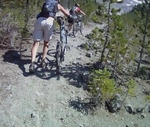
The trail has not had any maintenance and there is a lot of forest debris on the track, we encountered a few logs across our path on every section of trail on the ride.
At about 3800 feet we started hitting snow patches along the trail. Bob took a shot at riding over the first of these patches and did a body slam when his front wheel slid out and he dropped like a rock. But he bounced back up as fast as he went down to my amazement and said he was ok.
The next quarter mile or so had us hiking across snow patches as we made our way through the forest following the trail by spotting sections where it was not covered in snow.
We hit a short steep downhill run that dropped us almost 400 feet in a half mile, to a trail junction with Sheep Canyon Trail #240.
The trail sign indicated the Sheep Canyon Trail was another 1/8 mile and had an arrow pointing down the trail, but this junction was confusing because there was another trail heading up a creek and away from the main line. Bob rode up the trail just a short ways and found another sign that indicated that it was trail #240, it was a new sign so we went with it.
The Sheep Canyon trail starts with a creek crossing on a wide bridge and a very steep climb for a few hundred feet that was interrupted with a big tree down across the trail.
The line meanders back and forth across the ridge, moving out to the edge of a large canyon a couple of time and offering a glimpse of the mountain while it climbs.
Near the top of the trail, the track becomes very challenging with steep climbing through the rock and rubble as it twists and turns up the hillside.
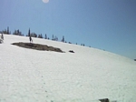
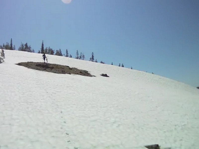
Again as we approach the 4000 foot level we start running into patches of snow that had us dismounted and pushing and dragging our bikes over the mounds of snow.
We finally hit the Loowit Trail #216 at about 4600 feet. A climb of 1000 feet in a mile and a half, the second time I have done that this week, I think I need to start looking for easier trails.
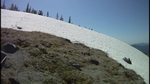
We started our way along the Loowit Trail and immediately ran into snow, we probably should have started thinking about turning around here but the thought never crossed our minds.
We slogged our way across the snow bank, the snow now becoming rather soft and the bike was hard to keep upright as I tried to walk it.
After a short break and some grand views of the mountain and surrounding valleys, we took off down the trail again.
Both Vaughn and I had been on this trail before and we discussed the fact that there was a very large ravine that we had to cross very soon.
As we took off, I told Bob to keep an eye out for the reroute because the main line goes right off a cliff into the ravine.
After about three minutes of riding, a couple of down trees and a half dozen snow banks, we found the reroute.
The line turns straight downhill. There are lots of good solid root drops a fun line to ride except that in the back of my mind I knew we were going to have to go back up.
The last visit to this trail back in 2007, the reroute was gnarly but it did not take you far off the main line. A few hundred yards then a scrabble down the rocky side wall. This time, we rode down to where we had turned and headed over to the ravine but the track took another turn and we continued further down along the edge of the ravine.
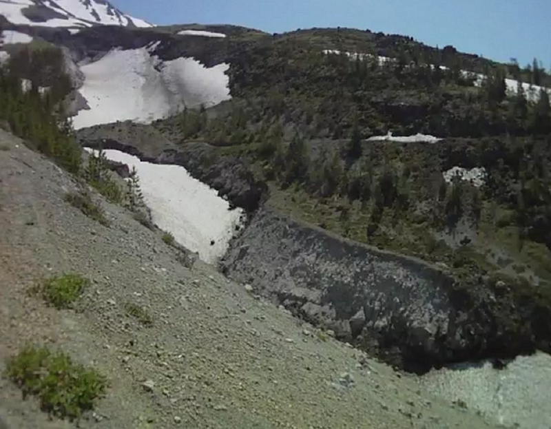
After half a mile of a 16% slope we finally reached a location that was somewhat safe to cross.
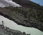
We scrambled down a small gully that was filled with loose stone and boulders into the main ravine. The bottom had a river of snow, a large drift that had to be ten feet high stretched down the middle of the ravine. The height of the side walls at this level looked to be between thirty and forty feet high and the upper ravine where we had turned onto the reroute had to have been close to twice that.
The small gully that leads back out was another hundred feet further down. A rugged gash in the wall of the ravine that was full of loose rock and boulders, steeper and narrower then the descent, the fear of a large boulder breaking loose and rolling over you was all to real.
Out of the ravine, we started the hike a bike back up to the main line. There were a few places where I was able to get on and crank away for a while but they were very few.
As I hiked back up to the main line I was thinking how happy I was that there was only one of these ravines to cross, but I was concerned about the snow. My last experience had me crossing a couple of large snow fields that were very steep, where a misstep could have you glissading a few hundred feet out of control.
Back on the Loowit I didn't get but a couple of hundred feet up the trail before I was off and dragging my bike across a few of the snow drifts.
Then just a few more feet around a bend and another very large ravine comes into sight, damn I don't remember that. The trail heads up to cross high on the snow filled ravine and cross the face of a very steep hillside.

Up across the face of the hillside the line runs, over the top of the ridge and another snow field waits. A large round mountain of snow that breaks away into a steep side hill just at the point we are able to cross.
Around a couple of more sharp alpine ridge lines, the views are spectacular and the track is good. The line runs back into a small valley that is full of snow. Bob takes a charge at it, skidding back and forth he manages to keep his bike under him until he reaches the other side. Me, I get off and walk.
Over the next ridge more snow, this patch too big to be called a drift and too small to be a field, so it is a snow patch.
The next ridge crossing brings the Butte Camp Butte into view, straight ahead I know that we have to pass it before we will reach trail #238A and be able to descend. Other than the snow field crossings my main concern now is that we will be able to cross the exposed area on the other side of the Butte.
The trail rounds the ridge to head back to yet another snow field, this one very large with a good exposed side hill.
We actually got about three minutes of solid single track before we hit the wall, a very steep snow field. Looking up and down the hill did not seem to show much for circumventing the climb. There was one set of Elk tracks that came across and up the face of the snow field. A patch of dirt was exposed up toward the top where the incline was at its steepest.
The snow was soft enough that a couple of kicks and you could make a fair toe hold, Bob took off up the steep before Vaughn and I could protest. I followed Bob and dragging my bike along I kicked into the toe holds he had started.
I leaned into the climb, heading for the dirt patch and thinking it was a place I could take a break, but I was wrong. The dirt patch was just as steep but there was no way to get a toe hold. I had to just lay into the hillside as I made my way to the next, even steeper section and start stomping my way up over the top edge.
Once on top, it was clear the trail was not here, it cut around the ridge we had just climbed and was down below us. We crossed over the ridge and headed down the back side, Bob in the lead; he jumped on his bike and bounced straight down the front of the ridge on to the trail. I walked my bike.
As unbelievable as it may sound, there was another snow field to cross, with a steep climb up a loose rocky hill on the other side.
About a minute and a half of single track, then we made our way down the hillside to cross another snow field at a location that looked a little safer then where the trail crossed.
Thirty seconds of single track and another snow field.
So it went from snow field to snow field, with one more small ravine to cross where we were able to hand our bikes up and carefully make our way up through some very large rocks onto the trail.
To finally reach the junction with the Butte Camp Trail #238A and what I was hoping would be a fast shot down the edge of the ridge and through the small fir trees to the exposed crossing.
I have ridden the track down from here twice, once on the loop ride like the one I am doing now and once on an out and back from Red Rock Pass.
The line from the Loowit Trail down to the exposed rock slide is fast and exciting. Starting by riding a ridge line formed of lava, to cross the face of the ridge and shoot off through the small fir trees. The disappointing part was that as soon as the line left the ridge, the rest of the trail was covered in a foot to three of snow. It was a hike a bike down what was as I remember a great little run.
The only thing to be concerned about when riding down this line, when you can ride it, is that it ends at a cliff, a large rock cliff where the trail takes a ninety degree turn to guide you over and across a very large rock slide.
The line crossing the rock slide is fairly wide; it bothers me though because of the spatial effect it has on me. I have to look down at the trail and keep my focus there as I cross the open area. Bob just rode across, and after getting about half way across, Vaughn hopped on his bike and rode the rest of the way across.
Once across and into the timber I was able to remount and cruise down the steep incline. The side hill here is just as steep as it is crossing the slide but other than the fact it's a steep damn side hill I am fine.
Three switchbacks and some steep fast downhill to the Butte Camp camping area.
From Butte Camp the next mile and a half to the Toutle Trail is a blast. I have never ridden it without having a couple two or three trees down and this time was no different. The track is filled with features like root drops and lava rock steps, a few small rock gardens and even a couple of smooth swift banks. The only caution is there are a couple of sand pits where I almost lost it in one.
From the Toutle trail junction it is just over two miles back to the Blue Lake trail head. The trail climbs a bit around a number of lava ridges and the technical aspect makes it a good challenging ride. Most of it can be done in a mid range gear combination, which gives you the opportunity to apply enough torque to clear almost every feature.
The line changes to a deep forest setting with large old growth timber then turns to climb up a small valley, the only place I had to drop my gearing to make this short 12% grade.
The top of the climb turns to cross a rock flow; the timber disappears and is replaced by very small, stunted trees. The track is rocky and rubble, a challenge.
There is one more small ravine to cross, small in comparison to the others we had seen that day but still a good thirty feed deep. Last time I rode this trail the ravine was just a wash about ten feet deep. Now the trail turns and runs parallel to the ravine for a few hundred feet. When the trail that crosses it looks like it is ride-able going down but it was a hard scramble to get up the other side carrying my bike.
The last leg of the ride is rock garden after rock garden with a few rocks thrown in to make it exciting. All of it is doable as long as you keep your speed up, your weight back and focus on the line.
Five and a half hours of riding, drag-a-bike, hike-a-bike, carry-a-bike, and hammering through the final reward over 12 miles. I went through 64 oz of water, 20 oz of electrolyte drink and still started cramping in my forearms near the end.
Loowit Loop
Video.
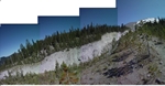
Cold Water Trail #230A
Monday 8/1/11
Jim LeMonds posted a notice for an under employed ride on the Cold Water Trail.
Sunday at the bike park work party, he was trying to backpedal his way out of it but Paul Norris wouldn't let him.
Paul, Jim, Bob Horness and I met at the Castle Rock park and ride and after a little discussion, headed for the trail head.
Bob was the first to hit the trail, followed in just a few seconds by me. I was up on my pedals in a mid range gear and knew this would not last long.
A few minutes later as I entered the alder and the trail turned to present some serious climbing I was panting and shifting gears to hunker down and start grinding out the ascent.
It was cool at the parking lot with a beautiful clear blue sky overhead. I had put on sun block and decided to forgo a second layer even though I was feeling the cool dampness.
By the time I reached the first switchback I was wondering how long that sun block was going to last with all the sweating I had ahead of me.
I could feel the chill of the dampness on the toes of my canvas shoes as I huffed my way up through the tall grass and flowers that lined the trail. The blooms were intense along the path; thick patches of tall blue lupine flowers with a sprinkling of a red plant that may be paint brush. The open areas on the south side of the ridge seemed to be predominantly covered with white and yellow daises.
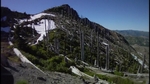
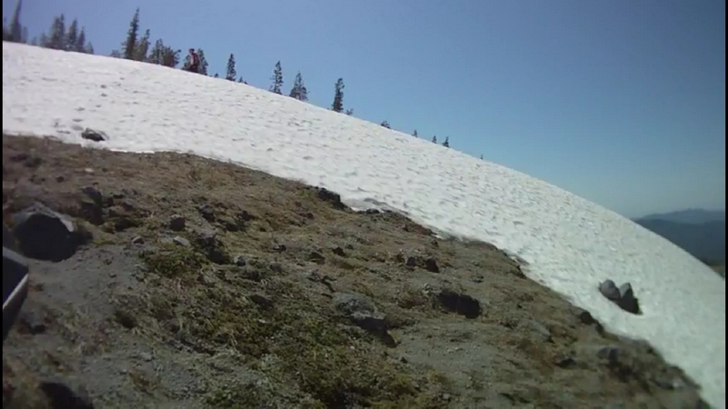
The trail presents a continuous change in scenery. The climb has views of the Cold Water Creek then crossing over the ridge to break out into views of Cold Water Lake and the adjacent hillside, stark and still barren from the volcanic blast of thirty years ago.
At the wreckage, logging equipment that had been destroyed in the Mt Saint Helens blast, we had done a climb of 1000 feet in 1.6 miles that had me well warmed up. The slope had been in the neighborhood of a 12% grade. From here the trail continues to climb over the next mile but at about half the grade.
Then there is a short stretch, a little under half a mile, of downhill running along the edge of the ridge before turning to re-engage the steep climb.
As we rode west toward the end of the lake, the hillside along the west end slowly rose above the horizon. A much more rugged looking landscape with a craggy peaked ridge line and the face of the exposed hillside scarred with vertical crevices. The largest peak, Minnie Peak is about 5500 feet or about 3000 feet above the lake.
We turn back to the climb up through some thick brush that looks like salmon berry with large, kind of fuzzy looking leaves, the trail hidden in a few spots. The track for a short distance runs at the base of a large rock slab that forms a cliff above our heads.
On through more brush until the trail crosses onto a large plateau, a sign located in front of a broad clearing along the trail reads camping.
The climb is starting to get into a hike a bike along here, sections of the trail too steep and over extended lengths that require me to dismount and push my bike. Sometimes I stand my bike on the back wheel and push because the trail is narrow and walking next to it is hard.
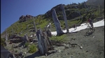
The scene is familiar in the blast zone, bleached white stumps from large timber that was harvested just before the eruption in a field of grass, shrubs and wild flowers. The trail is a sandy gritty ash that makes a crushing sound under the bikes tires.
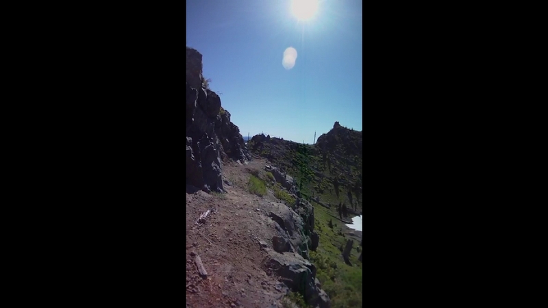
The trail comes to a very large rock outcropping that leads to a very exposed crossing around the end of a ridge, large angular flat stones form an access to a short ledge that leads around to where the trail continues on the other side.
The line is becoming very steep. I seem to be pushing my bike more then riding it. The track is loose, soft and narrow. Even if I do get to moving in a slow grind, my progress is halted at the bleached out remains of a tree lying across the trail.
I continued to push my bike up past another rock face at the edge of the trail that stands a good twenty feet high. Trudging just a little further through the brush to gain the top of a very large rock outcropping. We were standing on the top of the outcropping that is the end of a long ridge that we were now going to traverse.
The views are spectacular.
Now we are at the spot where Jeep (Jim LeMonds) turns to us and says something like "This is a good place to turn around because from here on it gets a lot tougher". No one is willing to say uncle as my gaze moves from Bob, who looks like a kid just about to unwrap a present, to Paul who has that look on his face like "There is no way I'm turning around, even though my knee is killing me" and I just look at Jeep and smile.
Jeep and Bob each head down the next fifty feet, coasting along on their bikes, the side hill about a 70% slope where one mistake has a big penalty, most likely broken something.
I take another approach and walk my bike down the rock studded track to the rock outcropping which has a shear drop below it and holding my bike with one hand, ease my way around to a rock covered track on the other side.
The trail along this next couple of thousand feet is mostly flat. The side hill varies from what looks like straight down to something around a 70% grade. As Jeep put it, the penalty along this section of exposure fell into two categories: (1) falling would really hurt and (2) falling would kill you.
The line along here was so narrow that you really weren't walking your bike as much as dragging it along beside you or just carrying it.
The side hill started to subside a little toward the upper end of the valley. There were a few spots where I was able to get on and ride for a few feet but then another rock out cropping or log would have me back off my bike.
The pass at the top of the valley we were moving through had a small snow field stretching across just below the crest. There was a narrow spot next to an old stump that Bob had moved across and jumped back down to help both Paul and myself with our bikes.
Breaking over the top of the ridge exposed a large plateau just below the ridgeline. There was a heard of Elk grazing on the sparse patches of grass. Spooked by our appearance they funneled down over the edge of a lower ridge and disappeared from sight.
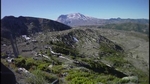
Mount Saint Helens was sitting right in front of us. We were facing the crater and a small amount of steam was persistent on the west side of the crater. The Johnson Observatory was also visible, sitting on top of a ridge, below and off to our right.
There were hundreds of bleached out logs lying in parallel, pointing away from the blast, on the ridge across the plateau from us.
Now some serious climbing, as if the other climbing we had done was not. The next mile has an average slope of 12%. Needless to say I did not do a lot of riding on the way up this ash and loose rock covered hillside.
The trail levels off and drops across a small valley just before the next summit.
Jim stood next to me and with a sweeping motion of his hand expressed how he loved the scene displayed to us; a ghost forest, the original timber still standing, hidden from the intense destructive power of the blast, these old gray dead trees towering like giants above the green carpet of new growth.
We made our way up the last part of the climb the terrain and the surrounding stark features present such an awe inspiring landscape.
A couple of hundred feet from the pass and we had to cross a snow field, the snow field was located on a northwest facing hillside so I should say we had to cross a block of ice. It was solid and steep. After the first twenty feet, I left my bike and decided to do the finish on foot. Jim's recollection was that the junction with Boundary Trail and St Helens Lake was just the other side of the pass.
Upon reaching the pass I could see Bob and Jim on the next pass, about a thousand feet away. Paul was coasting across a section of the path that was ride-able and I just needed to traverse the hillside and one cliff crossing to get there.

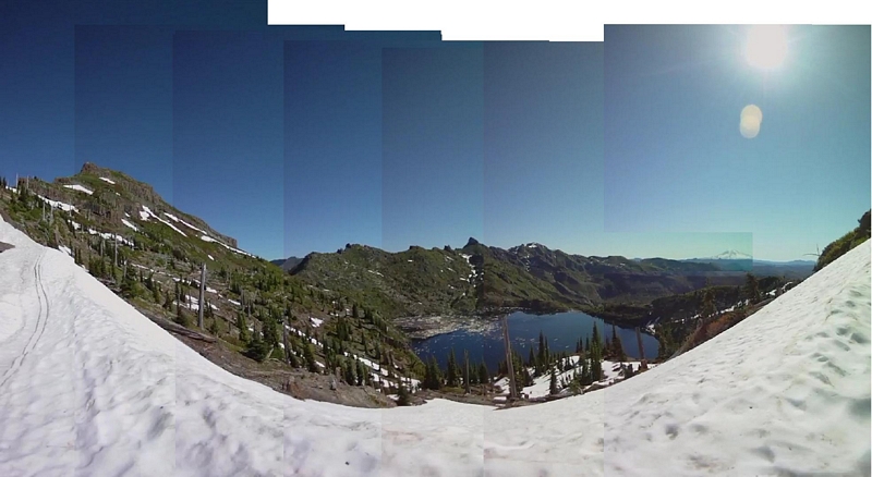
The view of St Helens Lake was obstructed by a large slow drift, which I climbed up on to observe a spectacular view of the lake laying below.
The lake was placid, a mirror on this windless day. Still a third covered with the floating timber blown into it on the day the mountain blew. The shore line reflecting the rugged terrain, the lake shore made up of cliffs along the east and north sides. The Dome, a rocky outcropping, was directly across from me and stretched down to the northeastern shore of the lake.
Mount Margaret sat back behind the Dome with the rugged denuded topography stretching across the horizon. Mount Adams a distant snow covered peak.

After a short respite, we made our way back across the hillside and through the pass to start the return run downhill.
The snow pack had softened up a little in the short while since we had crossed it and my anxiety about working my way down quickly vanished after a few steps.
With my saddle lowered and my weight back on the bike I gently applied the brakes, a few inches of tires crunching through the soft ash on a narrow line.
As I had climbed the trail, I could not envision me riding back down. The extreme sections of side hill had seemed ridiculously steep but as I started coasting down, my weight back over the wheel, I found that the narrow line was easier to ride than to walk.
There were points along the trail where the line was steep and narrow, causing me to slide a little and stick my foot out as I leaned in toward the mountain. Kicking my bike along like a scooter until the track firmed up and I could step back on the pedal and roll swiftly down the trail.
A mile later and I was back at the lower pass. I could see Bob and Jim way ahead of me crossing the hillside on the faint line that represented the trail.
I quickly scrambled down to cross the snow field and start my descent. Across the hillside I had to pick and choose where I could ride. This section was almost flat as it crossed the hillside but had very intense exposure.
I at last reached the rocky outcropping where the others were waiting.
We started down the trail, a steep descent but the track was firm by comparison. A feeling of relief came over me as I was finally able to throw my leg over the bike and feel comfortable and in control.
Down off the ridge we rode, breaks screaming as I balanced on both pedals with my weigh back, arms outstretched and two fingers pulling in firmly but gently on the break leavers.
The descent only interrupted by three log crossing and one ridge that carried a very high penalty for a mistake.
The trail runs out away from the ridge to cross over a wide expanse of the hillside. Running fast through low lying brush the trail turns through a switchback and drops down over the back of a wide shoulder. Finally throwing a few pedal strokes to cross back over the wide open plateau just before the line again drops and starts to traverse the next hillside.
Traveling through thick patches of salmon berry brush with red paint brush and lupine flowers growing wild in every break in the brush. The track disappearing in the brush as the trail passes by a rock slab, just a dark line through the field of broad green leaves.
Exiting the brush across the gritty coarse ash, the line turns to follow an old cat road. The trail crossing back and forth from track to track as logs and debris from the eruption creates flow. The trail climbs at a moderate 3-4% grade, with the trail visible across the small valley.
A half mile of climb puts us on the final descent, interrupted only by the need to stop and shake the numbness from my fingers.
The first mile drops just over four hundred feet. The track is firm coarse ash with the line running close to the outer edge of the old cat road, a consistent high speed run with a few little whoops and dips in the track.
At the equipment the trail descent turns into a blasting descent with almost a mile and three quarter dropping over a thousand feet. A true single track, that rushes down through brush on the north side of the ridge to cross over and blast across the wide open space on the south side of the ridge.
The line is smooth with very few features, a very fast run with broad corners.
The trail crosses back and forth across the ridge several times to finish by crossing the front of the ridge to hit a broad line of solid track that transitions from ash to dirt and descends down around the only real switchback then scream on a wide bench back to cross the bottom of the ridge to the parking lot.
Cold Water Lake
Video.


