Ride Report Archive August 2012
Coldwater Trail #21
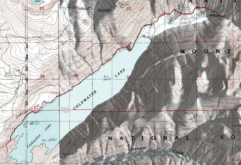
The Coldwater Trail #211 has just been opened up to mountain biking, as of Aug 18th 2012.
A group of volunteers calling themselves Friends of Coldwater spent a Sunday the following week clearing brush, benching
sections of the trail and repairing trail that had been lost to a rock slide.
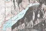
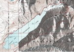
The trail starts is located at the boat ramp on the north side of the lake.
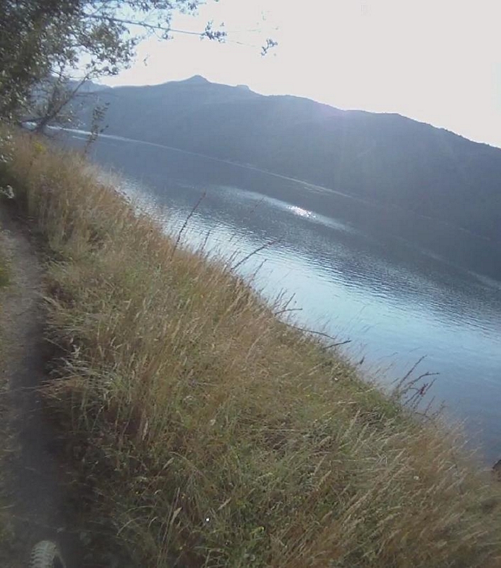
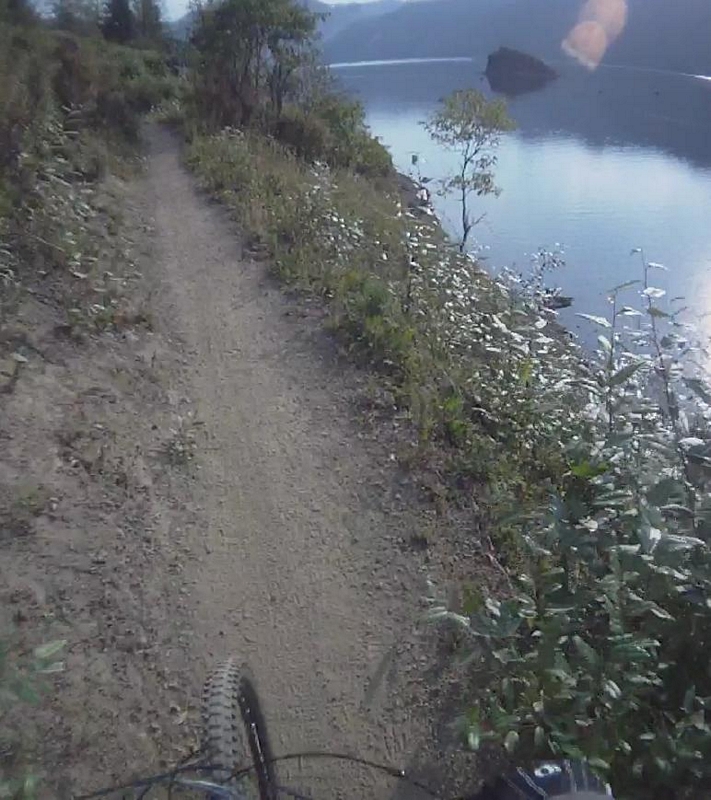
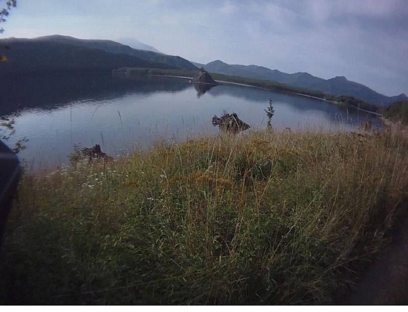
A quick climb puts you twenty feet above the water on the wide trail. The lake stretches away with a rock outcropping
forming an island partway out.
The jagged peaks at the end of the lake border the Mt Margret Backcountry.
This lake side trail offers some great scenery but the trail here is no ride in the park. Although the line is wide there
are many places, right from the beginning, that present a steep side hill with the shoreline some twenty to thirty feet
below.
The first part of the trail runs through a couple of small gullies that have a trickle of a creek and are lined with a
stand of alder.
Vegetation encroachs on the trail; tall grasses and flowering weeds of all kind, large ferns, succulent
thimble berries, tart red huckleberries, small red alder and vine maple along with small fir trees.
The trail follows the lakeside and turns toward the south, presenting a view toward the west and a wooden bench alongside the
trail for those who venture out on foot, for the views of the lake with its calming effects.
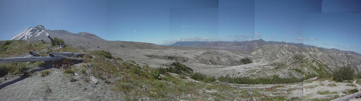
The view here looks back up the shore that is littered with the remnant bleached white logs which are the trees that blew
into this valley when the lake formed some thirty years ago.
There are three or four wooden benches in the first mile of the trail that afford beautiful views of the lake and surrounding
ridges and mountain features; the top of Mt St Helens just visible over the top of the ridge.
The trail makes a short but steep descent to run down through a grassy meadow area, next to the lake.
There is a solar powered rest room at about a mile and a quarter out.
Following the edge of the lake, the trail climbs back up through wild grass and flowers to regain a higher elevation above the lake.
As the trail approaches a line of trees the sound of a waterfall can be heard, a small waterfall that is just below the
trail as it crosses on a plank made from a chunk of bleached out timber, probably drug up here from the beach. It is an
easy cross, the creek only a few inches deep but a few feet wide. I could see the outline of a culvert under the water,
the culvert no doubt plugged with a large stone and debris buildup.
The trail flows up and down through more fields of grass and flowers, back away from the edge for a quarter mile or so and
crosses another small stream.
Around a small inlet and back out to the edge of the lake is the route the trail follows, until the line descends down through a grove of alder to cross
through some muck and mud and turn to present a creek running in a ditch about three feet deep.
The creek has another chunk of plank that is again the remnants of a bleached out piece of log. Plenty sturdy the plank
presents a challenge that no one took, the penalty for a mistake was big enough that even the more seasoned riders got off
and walked the ten feet across the plank.
The trail cruises along, back away from the lake a short distance, with a nice descent down to bounce through another
little mucky section.
Back down by the lake, the trail passes through some old logs that are three to four feet in diameter and crosses yet
another small stream.
So the first couple of miles are pleasant single track running along next to the lake, nothing too tough or scary.
Then the line starts to climb up and traverse a much steeper hillside. The climb in a couple of places a stiff
grind.
Around a bend, the trail crosses through a solid rock gully with a couple of the water carved depressions that are holding pounded
water. The crossing is a spot filled with loose rock and rubble. There looks like there could be a line across the bedrock
that would add some real challenge, I was not up for it but with a little work on the approach I think it has potential.
I walked my bike across the bedrock formation, looking for the best possible line, which unfortunately looked to be very
close to the edge of a drop off.
The trail skinnies up for a second as it leaves the gully then descends back down toward the lake.
The line is very narrow along here and there is a sharp drop off just a couple of feet away.
Just as fast as the line descended, it started to climb. The up was steep and loose, pulling me from my bike to hike up
and around the rocky ledge until I found a spot where it felt safe to remount.
Another quick down then the climb was on again as the trail entered another stand of alder, the understory very low
growing vegetation.
The trail wandered a bit as it maneuvered through the trees and over rock packs.
Rock had been put into a wire cage that looked like it was made out of fencing. The rock packs were near level with the
existing grade and the rocks did not move or shift as my wheels rolled across the packs.
Crossing an apex, the trail turned down and screamed for a few seconds before rumbling through another little gully and
creek crossing.
Pushing my way through the brush on the other side of the creek, I continued descending down around a ridge, high
above the water, through another stand of alder until the trail broke into the open and ran fast down to the water's edge.
A strong turn to the south again, the trail ran through a sandy, ashy area just a few feet from the water.
Another turn back toward the east and I only made it a few feet up the sharp sandy, gritty, incline before I was off and
pushing.
Head down, arms outstretched, I pushed the couple dozen steps up the incline to stop and gasp in a few breaths while I
scanned the panorama, looking from one end of the lake to the other.
I remounted my bike and started cranking up the trail through the brush.
As I rode up the trail I could see that the hill fell away very sharply through the brush and then the brush fell away,
leaving me exposed. A gnarly old bleached stump on one side of the trail and a fifty foot or more drop on the
other.
I rode on across the top of the rock outcropping, not taking the time to enjoy the view.
The little narrow strip of a trail traverses a steep hillside with more alder growing down below, the tops of the trees
off to my side as I approached another sketchy spot.
There is a rock face with the trail cutting across a ledge that is a couple feet wide but with a little ridge, maybe six
inches wide by about three feet long, in the middle of the ledge. It divides the trail into two lines. One line up against
the rock and the other a little closer to the edge; I have to take the outside line because of my wide handle
bars.
A couple of cranks and I rolled past the rock ledge and continue along the trail, high above the water, the exposure
masked here and there by thick brush.
It takes less than five minutes to cross this section but it is a very intense few minutes, culminating in a short section
that is just a ledge across a cliff face.
The line descends and runs back into the alder; the side hill is steep but not uncomfortable.
The trail descends to a rocky creek crossing, one that I had to dismount and pick my way across. The ridge formed by the
gully that the creek carved is a little sketchy and just a few feet of walking had me back on my bike.
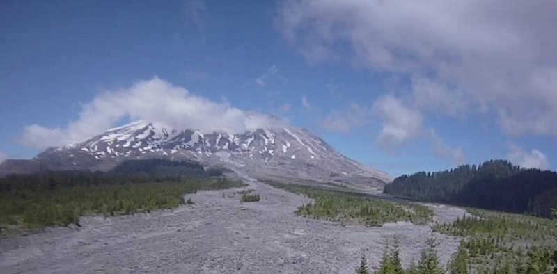
An easy descent brought me to the edge of the rock slide area, an area a good half mile wide that will present a
maintenance challenge every year, depending on the snow fall and spring melt.
I was on the work party, working the trail and the rock slide was my area.
The old trail was still in good shape across the first quarter mile and ride-able with the exception of a set of six
steps. The steps were just too close together for me to clear. A couple of the guys, removed every other step to improve
the climb and it had no effect on hiking.
The trail across the slide is a very winding twisting line that climbs up and over a rock and rubble ridge.
We had to put in a section of trail that had washed away last year, there was a huge jumble of very large stones about
fifty feet away and it would have been great fun to have dropped the line down through there but it would have been an all
day project and we needed to get as much trail work done as possible.
Looking the flow over there was a ridge of rock that ran higher than the surrounding rubble so we worked our way from
where the trail ended to the ridge and followed that down to a point where we crossed the creek.
The last section of trail, a little more than a mile, starts to climb and leaves the lake side.
It is good single track that makes its way through thick brush interspersed with small meadows and crossing several small
streams before hitting a sand wash.
I had heard about the sand wash from several people, the main issue being how hard it was to ride. The key is to keep your
weight back over the rear wheel and do minimal steering. Let the front wheel weave back and forth, just a little coaxing
here and there to keep you heading in the right direction because a strong grip on the handlebars will bring you
down.
The wash is a couple hundred feet long so it only takes a minute or so to cross.
After the wash the trail starts to climb in an interval fashion, requiring short bursts of power. And it has some fun
somewhat technical challenges, including a couple I did not clear.
The trail, having left the lake and making its way toward Coldwater Creek runs through a jumble of trees that were blown
down during the eruption some thirty odd years ago, winding around and under some large old logs.
The trail finally junctions with the 230 trail. A turn to the right and down through a switchback presents a bridge over a
narrow gorge. The rocks on either side, large rectangular shapes, look almost like they were set in place.
The 211 trail continues up the canyon but the section we are responsible for maintaining ends at the bridge.
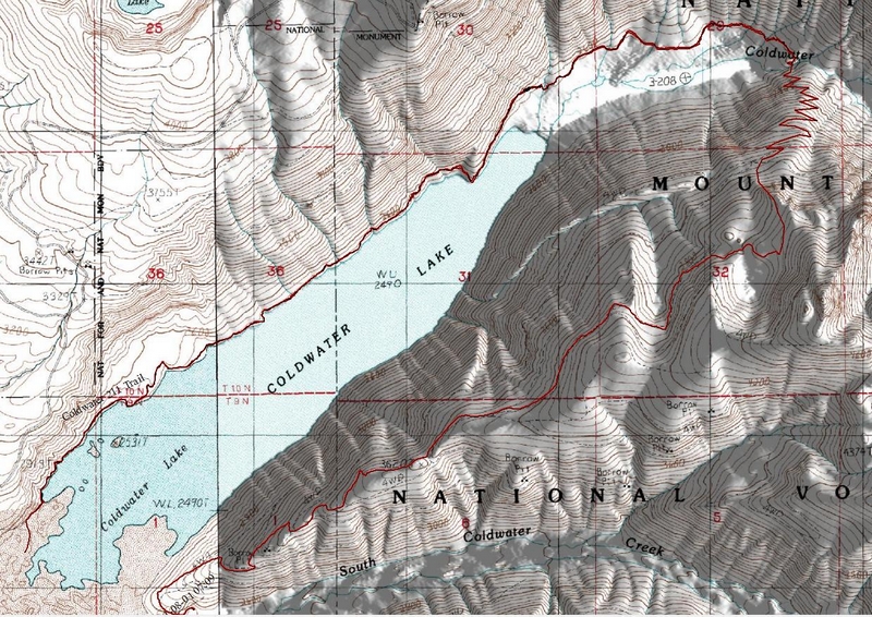
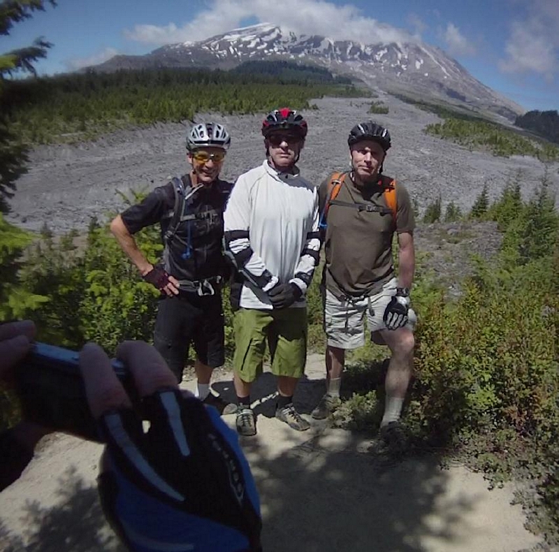
On a subsequent visit I rode a loop ride with Bob Horness, Paul Norris, and Jim LeMonds. We rode out the 211 and crossed
the bridge to climb two miles up the 230 trail. The 230 is so overgrown that there was just a narrow strip in the
foliage, the trail so steep that it was impossible to ride.
We pushed our bikes eighty percent of the time on that two mile climb, stopping in a few spots to take in the grandeur of
the surrounding panorama. At one point, looking up the Coldwater Creek canyon and spotting a monolithic rock with a steam
flowing over it.
After making the top, we picked up the 230A trail and rode a three and a half mile screamer downhill and back to the paved
road, where we turned and rode another half mile or so back to where we were parked at Coldwater Lake.
As an out and back ride, it is right at 10 miles of fantastic single track that I would rate as an intermediate
ride.
As a loop ride it is right around 12 miles with some great single track, some sweaty hike-a-bike, and some screaming
downhill and I would rate this as an intermediate ride also, just expect a hard thousand foot climb while pushing your
bike.
Mountain Biking in Bend
I Rode the Deschutes River trail on Monday. That has to be one of my favorites. The scenery is fabulous and the ride is nothing but fun. It is not a technical ride, and the Adventure Map has it listed as an easy (Green) trail, although it does have some technical challenges, but they are easy to walk around if you feel uncomfortable. I attempted all of them but was unable to clear two.
I rode trails in the Phil's system today, Tuesday. My plan was to make the ride that I had set out to make last fall but missed the trail and wandered through a different route.
The route was to be Swampy Lakes trail to the Swede Ridge Loop trail; I was planning on taking the first leg of the Swede Ridge Loop then proceed on to Sector 16. From there I would be in the Phil's system and would take Whoops down into Ben's trail and then finish at the Phil's trail head, with a ride to the Deschutes River Park to meet my wife.
The first two trails went just as planned, well almost, Swampy Lakes trail to the Swede Ridge Loop. I followed the Swede Ridge Loop until it looked like I had reached the junction of Sector 16.
Looking at the trail junction, the loop trail coming from north to south would never see the other trail and would continue on, back to the Swampy Lakes Trail.
I decided to ride up the Swede Loop for a quarter mile or so and see if there were any other junctions or if the shelter was up there, because according to the map, the shelter was near the junction of Swede Ridge and Sector 16.
After satisfying myself that the shelter was not up the trail, I returned to the junction and took that until it ran into a double track, now confused, I followed the dozen or so bike tracks on down the double track and onto a dirt road, following that until I hit the Swede Ridge Trail. What! How could this be?
I decided to follow the Swede Ridge Trail back until I found the official trail junction.
A fun trail, with both downhill and climbing, a couple of real grunt it out climbs in low gear and two miles later I was back at the Swampy Lakes Trail, not realizing that, the signage indicated that the Swampy Lakes Shelter was .2 miles. So off I went (my mind read Swede Ridge but the sign read Swampy Lakes).
A couple of log overs, a dozen twists and turns and I came to a rock garden - creek crossing that I recognized and realized that the Swampy Lakes Shelter was just up the hill.
Cranking it out, I made my way up to the shelter.
Sitting there I pondered whether I should take the same route I had stumbled upon last fall or return down the Swede Ridge Trail to see if I could find the Sector 16 trail and the Swede Ridge Shelter.
The whole ride was centered on following the course I had missed last fall so I returned to the Swede Ridge Trail.
There had been lots of climbs on the way up, and now I was getting some great action on the trail as I blasted down the fast descents, trying to ride high on the line to avoid all the breaking bumps.
One section was embedded with lunkers, rocks protruding up in the trail, which took some quick action to stay the line and bounce through the jumble of stones as the trail turned a corner and ran away down the hillside.
A quick two miles brought me back to the dirt road intersection.
I barely paused as I shot across the road and continued down the trail, expecting at any moment to see a shelter pop up alongside the trail.
The trail continued along the top of the ridge under the canopy of fir trees. With no real understory a brilliant blue sky was the backdrop and the landscape was littered with bleached white fallen trees and limbs.
After a few minutes of riding, the trail ran through a narrow gap between two large trees, their roots crossing the trail and formed a step down, as though riding through a doorway, the trail turned downhill.
The large timber disappeared as the line weaved in and out of the small trees, breaking through short stretches of meadow here and there to return to the thick foliage.
I had to watch the line closely, the tread dusty with lots of duff on the downhill side of the corners. I could see many places where riders have washed out by taking too wide a line as the trail swooped down and turned to cross into the next corner.
By now I figured I was on the Sector 16 trail. It is a narrow ribbon of a trail running through a thick forest of small fir trees.
This section of trail is about three and a half miles long and follows the boundary of a chunk of private land. On the map the trail runs north to south, makes a ninety degree turn to run west to east, then makes another turn to run south to north. But the trail twists and turns so much that I was never able to tell when I made those transitions.
The trail drops a few hundred feet over the first couple of miles of Section 16, then climbs in short phases to regain half of what it lost and brings you back up to the top of the ridge.
The ridge is not well defined and the trail wanders through the woods until it dumps you at a shelter. The shelter is a log cabin with a large opening on one side. There is a window in the opposing wall with a split log forming a bench that runs the length of the wall.
A wood stove made out of a barrel sits in the middle of the room, and there is a stack of split wood running the length of one wall, most likely the remnants of last winter's stockpile.
The trail heads off through the timber and starts to descend.
The trail continues to run at a mild descent, weaving back and forth through the woods. The under story thick brush that encroaches on the trail.
After crossing a couple of double tracks the trail has a marker, marker #30 which indicates the start of the Whoops trail.
This is the upper Whoops trail, a fast line that swoops back and forth as it descends through berm after berm. The trail wider and much better defined than before.
The air began to get dusty as I started closing in on another rider, so I pulled up to stop and let the air clear before attacking the line again.
A fast one and a half mile run, the trail has you blasting through the banked corners.
The upper Whoops breaks into a large open area where there is an interesting bench, one that looks like it is inviting you to ride it as a feature.
The next section of the Whoops trail has a warning; this trail has enhanced terrain, including jumps and berms. This trail has been designed to accommodate all levels of riders, the faster you ride the more difficult the trail becomes, proceed with caution.
The lower Whoops trail was a hoot! The trail starts off with a few gently banked corners and a couple of large rollers but within seconds the banked corners turn into big berms that flow from one to the other, with a transition that will launch you into the next berm.
A quick section of berms leads into some rollers and table tops; the choice is yours as to how you attack the line. I threw my weight back and pumped over the rollers and let the front wheel hop and skid on the table tops.
It is a very fast section of trail that had me stopping a couple of times to relax my grip and my legs before slamming into the next set of features.
The Whoops trail ends and the Ben's trail begins at a dirt road crossing.
The Ben's trail continues with some great berms and banks but not at the level of the Whoops trail.
There are a few optional challenges along the trail; one was a rocky lava descent down a steep section that also provided a ride around.
There is one section of the trail that weaves back and forth across the hillside through a section that contains some rocky lava features that can easily be walked if you find you're not up to the task.
For the most part the rest of the trail to the Phil's trail head is a swooping fast run through a forest with a sparse understory.
Once at the Phil's trail head, there is a connector trail that runs over to Skyliners Rd. The connector has a couple of features in the form of a very challenging skinny log ride, a few swooping berms, and down next to Skyliners Rd is a rock ride across a couple dozen large rocks, a six to eight inch left onto the first stone then a ride across the rest with one skinny spot in the middle, doable by most riders.
Ape Canyon Trail
It was an hour and a half drive to the Ape Canyon Trailhead from Woodland. We arrived at 11:30 and headed up the trail.
The trail presents its first challenge within a few feet of the parking lot, a quick root step on a short climb into a switchback corner.
The trail crosses through the woods and makes a turn towards the mountain. This section of the trail runs on a plateau next to the Muddy River. The evidence of the blast and subsequent snow melt still evident as you look across the vast expanse of the river bed.
A section of trail with a half dozen root steps spread over the first quarter mile as the trail meanders under the canopy of large conifers.
All too quickly the first ascent begins as the understory thickens and the view all but disappears.
A low gear grind up the twisting trail quickly brings you to a point of land with a great view of the Muddy River and the Mountain.
The trail makes a sharp turn at the view point and continues to climb at a moderately steep angle for a short ways before the ascent slackens a bit.
This next section provides for a quicker pace, leveling and even descending a bit as the line follows the terrain, running in and out of the narrow little valleys as it follows the base of secondary ridges, heading for the main ridgeline that runs northward toward the mountain.
The trail runs across the face of the hillside a couple hundred feet above the base of the ridge, glimpses of the mountain and riverbed are scattered through the brushy hillside, the stand of timber along here smaller with a thick understory.
It is a nice low to mid range pedal along this section of the trail as the timber transforms into larger old growth and the understory all but disappears as the line starts to climb the main ridge.
The steep hillside exposed as the brush disappears and the trail starts to climb in earnest.
The tread is nice firm loamy track that flows from tree to tree as the line climbs, breaking to a flat as it passes over the back side of the large timber.
It is a pretty steady climb for the next couple of miles, the trail staying to the west side of the ridge for the most part, climbing through five switchbacks.
The trail crosses from the west side of the ridge to the east side and the timber is replaced by brush. The brush is thick and tall, forming a green tunnel like effect as the climb continues.
The line moves back and forth across the top of the ridge, tracing a path through the thick brush then bouncing up over root steps, under some tall firs, then back to the exposed west side.
The trail starts a short descent as it crosses and turns to follow the top of the ridge. It provides a break from the grinding climb in the form of a fast smooth descent.
There are places along the trail where the track is covered in very small cones that make a crunching sound as I ride over them, the large lugs on the sides of my tires pick up and spit out the little cones, little cones flying in all directions as I blast down the trail.
The trail cuts a line down the west side of the ridge with a few exposed sections, one in particular feels a little sketchy but is always a place where riders seem to stop and take a picture of the mountain. It is a rocky open area where the trail turns and heads back onto the top of the ridge.
A fast run down the top of the ridge, dropping over large roots, then back onto the west side for a very fast ripping run, the trails tread turning to a more ash, gravely mix.
The trail makes one final ascent as the line moves back over the top of the ridge to cross between a couple of large fir trees that provide for one big root step up before crossing back to the east side and climbing to the top of Ape Canyon.
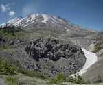
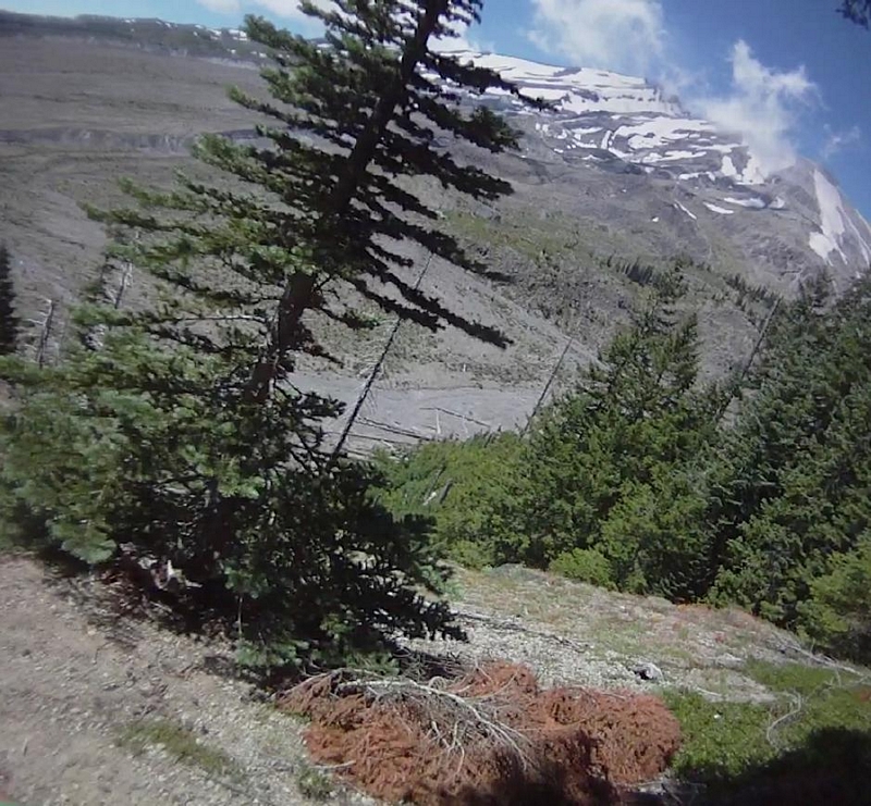
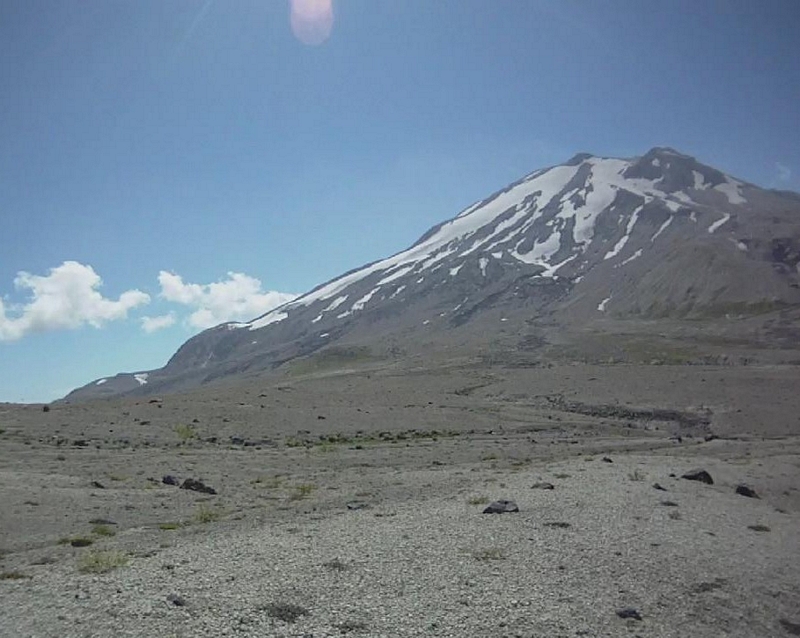
The approach to the rock formation that is a cliff that stands hundreds of feet above Ape Canyon provides an open line with a naked exposed hillside falling away into the valley below.
My first experience here was in the late fall, just a week before hunting season. The weather was overcast and cloudy, providing only a few glimpses of the mountain through the clouds. The final approach was snow covered and the area was so socked in that the visibility was no more than ten feet. When I reached the top of the cliff I could hear the echoes through the canyon of the river far below and decided to turn back.
The views from the rocky outcropping over Ape Canyon are spectacular, Mt Adams to the west with the snow covered Goat Rocks stretching north and Mt Hood to the southeast.
From the top of the rocky outcropping the trail winds across the treeless area to a rocky face directly across from you. There is a wide strip of white snow that flows around and drops below the huge rock face.
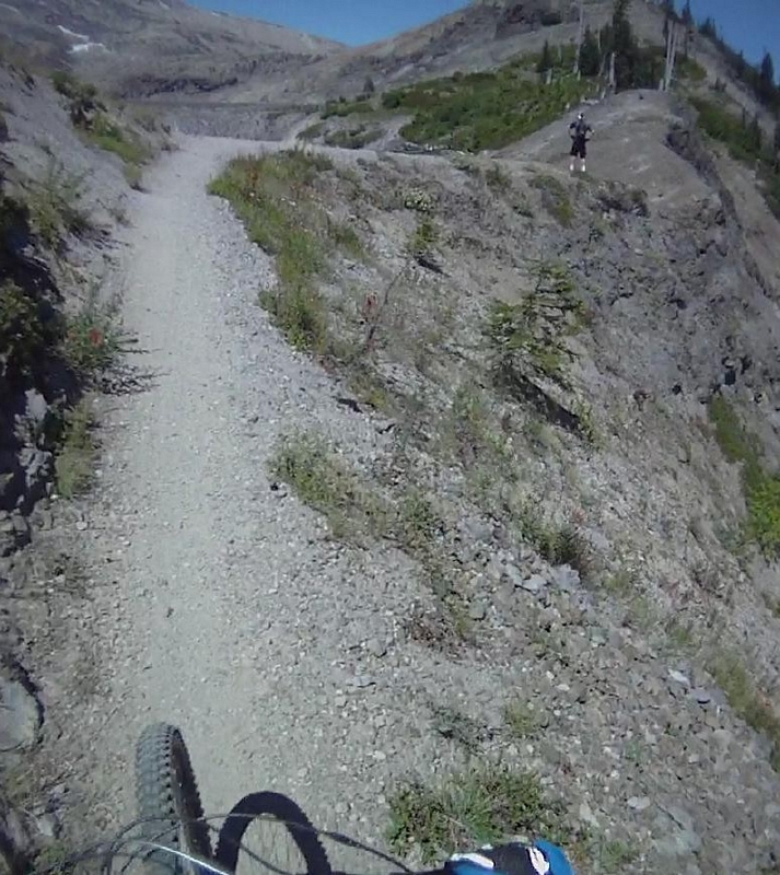
The trail is cut into the face of the rocky outcropping and has two spots that drop into the chasm below.
The tread is loose ash and rock which is very hard to get traction in and the trail ascends sharply.
I always walk my bike across this section, maybe fifty feet because the penalty for making a mistake while riding here is extreme.
I have seen many riders take this challenge on and succeed. And have never heard of anyone failing, but failure would most likely lead to death. As one of the guys I was with said as we pushed our bikes up the trail "man you wouldn't even get your feet unclipped before you hit the rocks on the bottom".
A little more climbing before the trail descends and crosses two small gullies, they are very challenging and I have never cleared both.
This is very rocky, chunky riding with a mix of gravel and ash as the base for the trail.
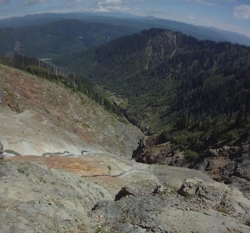
The trail climbs up and over a broad ridge and descends to another rocky outcropping that drops off into Ape Canyon, a second tributary to the creek far below tumbles off the cliff to the left and forms a white ribbon of froth as it bounces down the rock face.
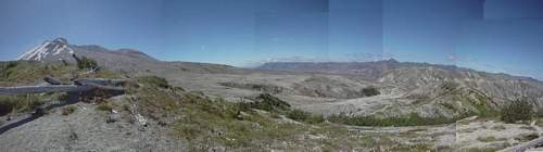
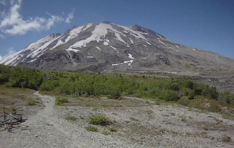
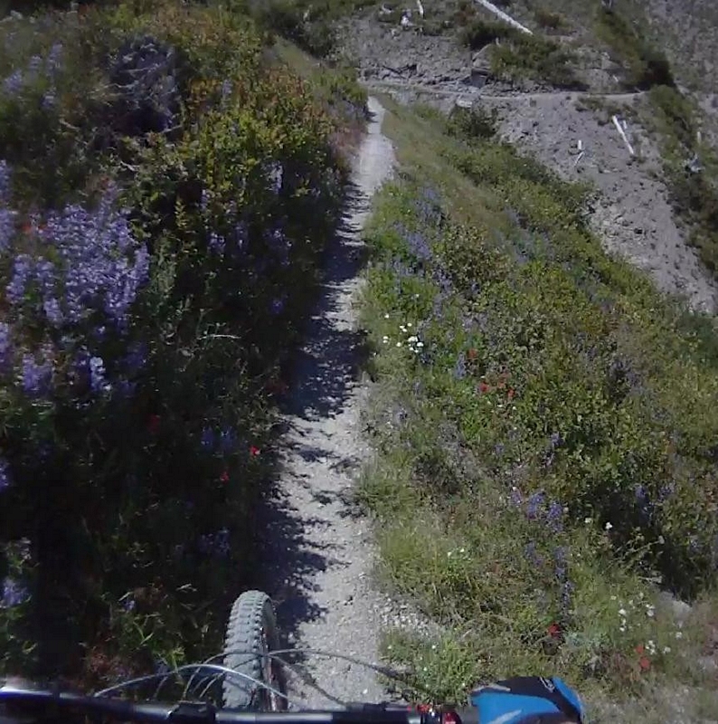
The Plains of Abraham stretch out between you and the mountain. The plain is covered with wild flowers, especially Lupine.
The trail crosses the bedrock flat where the stream flows and climbs up a couple of feet to turn and follow the banks of the creek for a short ways. The tread is a sandy gravely mix with large stones buried in the line along this section, technical but doable.
A little way down the trail and the large boulders and stones disappear, with the exception of whenever you cross a wash.
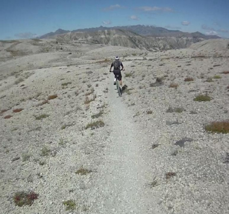
The crunch of the soft gravel giving way under your tires rings out as you crank your way across the plains; the line runs at a slight incline but is all but undetectable.
The primary force to contend with is the winds that seem to always seem to blow. Today we were riding into a headwind, but it felt good, cooling me as I powered my away across the next couple of miles from cairn to cairn.
The trail drops through a large dry wash on the other side of the Plains of Abraham. A hard switchback in loose ash and gravel to drop down and rumble through a couple of dry creek beds and climb back up through another switchback and gain the top of the ridge.
The line follows the ridge in a climb for a short ways then rolls over the top and continues to climb on the other side but at a lower angle of attack.
The hill is full of color, the beautiful blue Lupine, fiery red Indian Paint Brush and large white Daisies in patches along the patchy grass covered green and sandy colored hillside. Bone white logs still scattered in a pattern, the results of the blast some thirty odd years ago.
The trail crosses a series of ravines, each having its own challenge to present.
The first ravine, shallow compared to the next five, a sandy approach and exit with a narrow rock and rubble bottom to cross.
Then the trail traverses the side hill of the ravine, the slope gets much steeper as the side hill falls away.
As the trail climbs to cross over the ridge that defines the next ravine, the expanse of mountains and valleys stretch away, with Mt Rainier on the far horizon.
The ridgeline that stretches across the horizon contains an interesting rock stratum that runs the length of the ridge, a band clearly visible across the face of the mountains.
Crossing the ridge the trail descends into the next ravine through huckleberry brush and wild flowers to rumble across a narrow stretch of granite like formation and turns to pass over the next ridge.
Rounding the next corner exposes a ravine that cuts through rock, the trail just an etched line crossing the steep rocky slope. One section of the rock looks like large rectangular blocks that were cemented together, providing a platform for the trail to pass over before returning to the ash and gravel tread.
Another ravine to cross, a large rock drop at the bottom of the valley gives everyone a hard time since the drop leads into a sharp turn over a jumble of large stone to gain the trail again.
Still ascending the trail passes out of the ravine and across the top of a large ridge, crossing the hillside and into the last of the ravines.
The track is easy to ride and exits back onto the hillside, there are a few tight spots where the huckleberry brush encroaches on the trail and the stiff brush scrapes my arm as I ride by.
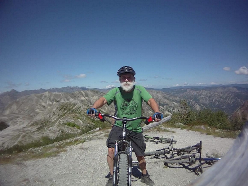
The trail weaves in and out of the rolling hillside as we finally reach our destination, the Lunch Log; a tree that was blown over by the eruption and is now a bleached white log that sticks out of the hillside to present a suitable seat for a spectacular view while you eat a snack and talk about the splendor.
Sitting on the shoulder of Mt Saint Helens, not quite able to see into the maw, this is a good place to turn around. This is where I always turn around; some people extend the ride to the end of the ridge.
There is also the option of riding down windy ridge road and picking up the Smith Creek Trail #225. I have never done it and probably never will.
I have ridden down to the Smith Creek Trail and taken it up to the north end of the trail where it leaves the valley and climbs to the top of the ridge.
I have it from good sources that there really isn't a trail, it is a line that flows down through ash and gravel, you can't really ride it, it is more of a downhill power slide where you spend all of your time trying to stay upright and fighting through thick brush.
I have also been told there is at least one spot where you have to use a rope to lower yourself down the steep hillside.
The bottom of Smith Creek has a nice single track for a couple of miles, then a couple of miles of double track, then a long, long climb up a decommissioned road.
The return trip takes you back through the ravines, but now the grade is mostly downhill. It is a fast and narrow line for the most part, with a little climbing as the trail leaves each ravine.
The approach to the planes is down a wide ridge, again to take the switchback and cross a couple of dry washes, nice rocky washes that are a great challenge with big rock drop steps and some large boulders to negotiate before making the climb back up and onto the planes.
Again the winds were blowing hard on my last ride here and with the wind at our backs we flew across the Planes of Abraham.
After crossing the creek and cranking up through the soft material to gain the top of the wide ridge, we sailed down through each of the two gullies, the first of which was an easy line to make, dropping down the rocky drops and cranking up over the next ridge.
The second gully has the trail making a serpentine switch through the bottom, impossible to ride on a bike; Bob cranked it up on the descent in an attempt to ride straight through a section of small boulders but just didn't have enough to clear it.
One more climb on the gritty trails that make this section then a downhill run across the face of the rock cliff. This is an easy place to forget and cruise right on around the corner and past the exposure, in fact I have done it. But my preferred method of crossing this is on foot with my bike at my side.
From the top of Ape Canyon to the trail head takes me about twenty to twenty five minutes.
The descent starts with a fast line down through the brush and back over the top of the ridge to a climb. This is a low to mid range climb that goes on for a ways, moving from the exposed side hill and up to the top of the timber covered ridge.
This is followed by another fast descent and grinding climb.
Then a blasting fast straight run down the east side of the ridge, a line that descends through tall brush that has an effect that makes it feel like you are riding in a green tunnel.
Over the next couple of miles the trail descends down the west side of the ridge, it is wide and very fast with the only thing slowing you down are the half dozen switchbacks (and possibly hikers or bikers on their way up the hill).
The trail moves off the main ridge line and onto secondary ridges where it narrows up a little and starts to serpentine through the smaller timber and brush.
With a couple of climbs toward the bottom, climbs that for the most part that you can stand up and crank out.
The trail finally makes a sharp turn as it approaches the Muddy River and quickly descends to the river bank. The trail providing a couple two or three nice water bar kickers along the way.
The final river bank ride is a bump and rumble section of roots with a few rocks and a twist and turn that dumps you back in the parking lot.
The ride is a 15 mile out and back that usually takes me between three and four hours.

