Ride Report Archive September 2011
George Barnett and I ride the Tarbell Trail to Hidden Falls
Thursday 9/29/11
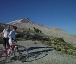
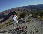
Rode out to hidden falls with George Barnett today, the ride was great, the tread tacky and Yelli handled everything so well that I almost feel like I'm cheating.
I met George Barnett at the Woodland park and ride.
We headed for Tarbell picnic area to ride the Tarbell trail out to Hidden Falls and back.
As we turned onto forest road 1100, we noticed there was a sign posted that indicated we needed to have a Discovery Pass, another thirty dollar a year expense to use our state resources, I just reached an age where I was able to get a lifetime pass for the national forest and now they hit me with a pass that costs more than the national forest pass costs when I was buying them on a yearly basis. The posting said we could get our pass where ever hunting and fishing licenses were sold.
We parked on the road instead of in the parking area, thinking that maybe we could avoid a ticket if anyone was checking, and I don't think anyone would be on a Thursday afternoon, but who knows. I wonder how this pass is going to affect hunters?
We rode to the trail head and climbed up through the picnic area to pick up the real trail about a quarter mile in.
There was a sign board at the junction that indicated Hidden Falls was 5.8 miles and that Rock Creek campground was 3 miles. I told George we could add another 6 miles to the ride by taking off from Rock Creek, a strong climb from there to here.
We headed up the trail. The rain from two days ago was still evident in the dark mud that made up portions of the trail, it was not dry but it was not wet either. Instead it was tacky, our track visible but it was not sticking to the tires.
The first mile is a good climb through lots of rock and root drops, tough riding that we cranked out in the second and third cassette gears. The line runs along the edge of a clear cut as it climbs toward the tree line a half mile away. The track requiring quick bursts to clear a cluster of roots steps, or bounce over some half buried boulders followed by a slow plodding balancing act to regain respiration before doing it again.
After hitting the tree line and traversing the hillside through a couple of switchbacks, the trail levels off for a ways. It was time to pick up the pace a little, the tires running fast over the firm fir needle covered trail.
Crossing a gravel road, the trail continues on level or slightly inclined. The line curving and swooping through the underbrush and across the firm mud patches that I know will be very sloppy after a few days of rain.
Then the trail begins to climb again through a series of root drops on a track that consists of a rocky scrabble that clearly shows a water track down the middle, the fir needles washed into rows from the last big rains, along the edges of the trail.
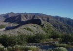
The line switches between rock and rooty climbs and short intervals of level to near level for the next mile and a half until we reach the top of the climb at Squaw Butte (renamed Kloachman Butte for political reasons) and the trail breaks to the right and follows a moderate slope around the end of the ridge.
It is a fast track between here and the switchbacks down to the north fork of Coyote Creek. The line is a wide track running across the hillside, swooping up and down through the woods and the new clear cut sections.
When we reach the switchbacks I am excited about my new dropper seat, hitting the lever I put it all the way down and comfortable make each of the tight switchbacks. A push of the button at the bottom and I'm back into trail mode. I feel like I'm cheating, it has become so much easier and my confidence has leaped to another level on the descents.
Check out my new
Kind Shock i900 adjustable seat post.
After crossing the bridge on the north fork of Coyote Creek, we follow the line out and around the end of the ridge, where the trail starts a comfortable descent. The trail is wide and smooth, rolling through some large dips where I can feel a light G force as I power into each dip to launch out the other side.
A fast run across the hillside leads to a wide switchback and the tread changes from the smooth fast fir needle carpet to a loose rocky and rubble surface. The line winds through another switchback and rockets down next to the creek and over a bridge to end for us at Hidden Falls
Hidden Falls is very spectacular, the amount of water coming over it formed a thin veil over the rocky surface. A much different picture from last spring when there was a torrent of water cascading over the rock ledge high above.
The return trip has a moderate climb from here back to the ridge then some fast paced track back to the north fork.
It is a short moderate climb from the north fork up to the big climb at the switchbacks. On the half dozen or so rides out to the falls, I have never been able to clear all the switchbacks on the way up. There are a couple that have either a large root or a cluster of large boulders to surmount after making the swooping turn.
I cleared all six switchbacks for the first time. As I approached each of the switchback turns, I lowered my seat just a couple of inches and with my bike in the second sprocket gear, cranked hard into and through the turn. I followed through by popping my saddle up and slowing to a snail's pace for the straight climb.
We flew through the rolling section that traverses the hillside below Kloachman Butte, stopping at an unmarked intersection which I have never explored. George suggested we take a look, so we rode up and over the ridge to find out that this is a short connector trail that led to a double track on the back of the ridge. I checked my USGS map when I got back home and it shows the double track as a 4wd road.
Back on the trail, it took the few short climbs to get us up to break around the ridge and start the big descent back to the picnic area.
After the trail crosses the ridge it makes a sharp left turn and drops down across some large roots, making a foot or so drop to a steep slope down about thirty feet of trail. I have always walked this, but this time, I dropped the seat and turned that big wheel down the hill. A big drop across one root and bounced off and across a couple of more to hit the steep and ease myself down around the corner to wait for George.
George didn't fare as well, as I sat there I could heard him mumble something as he dropped over the root and his front tire slammed to a stop in-between two roots. As George told it to me, he started to go over the front but was able to throw his weight back and regain his balance. He said that on the way up he had made a mental note about that drop but he has a hard time remembering trails. That way the trail is always new to him.
A couple of pedal strokes and I started blasting down the hill, railing from side to side, hitting the natural banked up edges on every turn. My bike rumbling across the rock and root drops; hearing a few of the rocks hit my frame and thinking how my new bike was probably going to have a few dings from this ride.
Discovery ride on the Wauna Trails
Tuesday 9/20/11
Wauna Trails off highway 30 near Clatskanie.
I met up with Paul Norris at the Home Depot in Longview and we headed to Clatskanie where Bob Horness was waiting.
Bob led us down highway 30 toward the coast and after a few miles took an exit.
It was a very short ways from the highway, where the power lines crossed the gravel road. We parked our cars and were soon pedaling up the road.
It was a sharp left onto a rocky ascent up a rough trail line. The trail has not seen much use for the past few years and was in pretty rough condition.
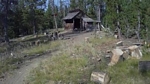
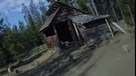
It seems that there were a couple of men that worked at a mill nearby, Vaughn and Ed. They had developed a network of trails some twenty years ago. They would come out here on their lunch break, riding ridged bikes, to ride and scratch out new trails.
As we turned off the road and started to head up into the woods, the overcast day did not let much light into the forest and the line was hard to see. A rocky track with lots of moss covered rocks to bounce off and over.
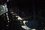
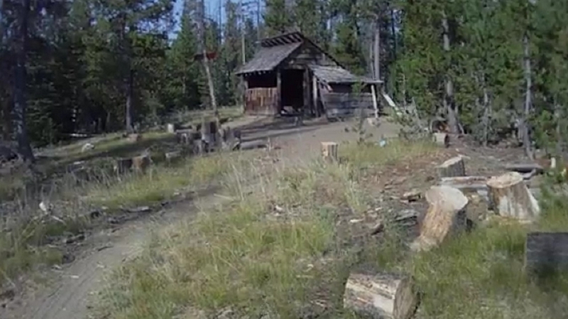
This trail led up over a rocky reach into the woods where there was an area the Bob told us was kind of a skills area that they called the playground. It had contained a teeter totter and other features to develop your skills and have fun on. A rotted plank of a bridge lay busted into the creek, like the other features that are now just remnants of years gone past.
Some more climbing and descending on narrow rocky track until we re-emerged on the gravel.
Bob told us we would be doing a bit of gravel climbing so I shifted into a comfortable gear and leaned into grinding it out.
We climbed for about thirty minutes. Pausing briefly at an intersection where we went to the left.
We finally turned into the woods, anticipating a downhill run, we instead climbed some more. At least it was in the trees. A moderate climb for the most part, with some quick intense sections and one section where Bob told us that he had only cleared it once but wasn't going to give up on trying.
As we rode the trail, Paul, who is always on the lookout for edible mushrooms, spotted a mushroom from the genus Amanita. He quickly stopped and plucking the mushroom from the ground, showed it to us and told us it was most likely poisonous. Pointing out that the bottom of the stalk had a bulbous shape and I noticed a definite line where the bulb and stalk met. He said it was most likely a Death Cap or a close cousin. That any mushroom that had that bulb at the base should be avoided.
A little more climbing and then...the downhill starts.
First off, Bob tells us we will start this section with a fast run downhill through the woods to be followed by a strong uphill grade. Bob tells us that the formula for clearing the steep is to hit it hard in a mid range, get almost to the top, where the pitch gets real steep and while dropping to the small ring gear, jump up and crank like hell (paraphrasing).
From there on, the pitch increased to a steep downhill for a ways, then slacked to a moderate pitch for a fast run through a very dark forest, almost felt like I needed a head lamp. This section was called Ed's loop.
We hit gravel and headed up hill for a few feet before turning back into the forest for some more of the moderate grade descent. There was one section where Bob pointed out that most of the year had this area soaked with water but that the base was solid enough to allow you to ride through with ease.
Next we turned into the woods to make our way through Dan's Delight, some technical and a section where the line was some soggy boards laying across a mud hole, got my attention because I stepped down to bury my foot in muck.
We hit the gravel again and Bob then tells us the next section has some very steep stuff with potential penalties in the form of a big drop off, just the kind of stuff I like to hear about.
After a quick screaming road ride, we turn into the woods and immediately hit a rock and rubble drop of about ten feet to make a sharp turn onto the track and start down through the woods on a moderate grade for a few hundred feet until it breaks into a steep downhill run.
Dropping my seat post, and pushing myself back off the saddle, I ease my brakes on to the point where they just start to lock up the wheel then back off. The sound is a familiar rumble of the brake modulation as my pace quickens and slows with the intensity of the downhill grade. It is a wide enough track with some loose stuff here and there and sharp drop offs on the left.
The trail dumps us out onto the gravel just a few hundred feet up the road from where we started the road climb.
Bob takes us down the gravel to make a turn uphill on a spur road, passing by a nettle patch which he points out as he tells us how they had a narrow trail through the nettles but it was very hard to maintain and unforgiving if you made a mistake.
We turn off and slam a quick downhill run on a track that has seen a lot of quads on it. The tread is loose and steep, with one short section of uncontrolled skidding.
We hit gravel and cross under some high voltage power lines to ride through a rock pit. The next trail is just beyond the rock pit, a very hidden trail, the line crossing a jumble of large rocks that Bob thinks might be ride-able but we walk it. The track is very rocky but the line is not too steep and it was very fast, a screaming fast track that dumps us on gravel just before a power station.
We grind out some gravel climbing and hit a trail that has us walking our bikes more than riding as we make our way up another very rocky section to cross over a low ridge and pick up an old double track. A quad is parked at the end of the trail, probably a hunter somewhere in the woods.
Back on the first climbing road just above the playground area, we ride back through the first section we rode to exit onto the gravel and bomb back to the cars.
Having ridden quite a few trails with one of the architects of this system (Vaughn Martin), it was just what I expected; lots of climbing and rugged trail.
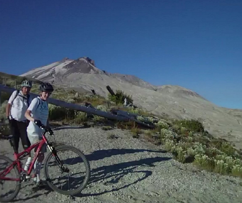
Yelli Srecamy at Post Canyon
Saturday 9/17/11
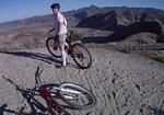
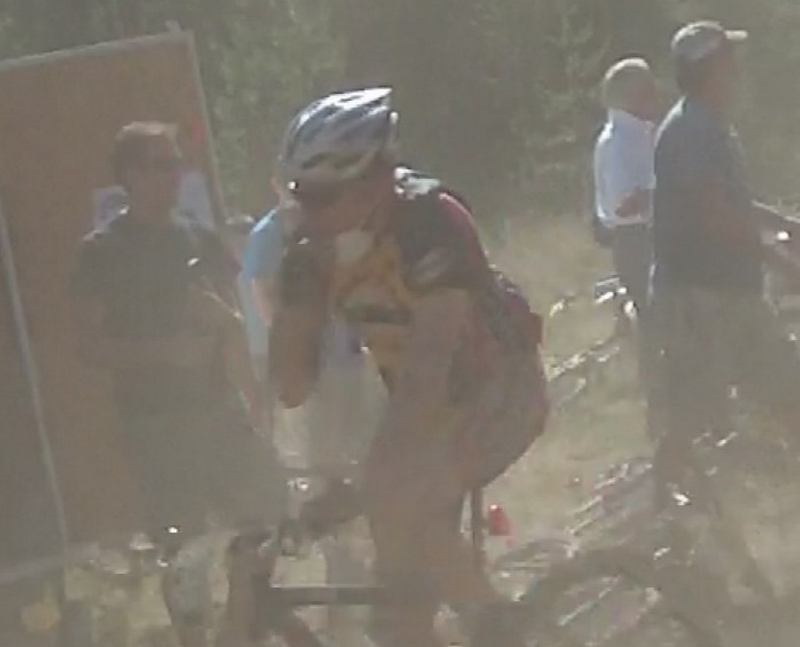
I took my new Yelli Screamy out for the maiden ride Saturday.
I picked up Barry at 7:00 and had e-mailed Tom that we would be in Post Canyon at 8:30. We arrived at 8:28. Tom was there and getting ready to ride.
Tom said he had been exploring the trails and had some new ones to show us. We headed up the road to pick up the first of the single track segments that follow the stream up to the Seven Streams trail #100.
We hit trail 100 and headed up the creek to the family man area, but didn't stop. Tom took us right through and continued to follow the 100 line until it turned off to go downhill. We continued straight ahead onto trail 105 until we reached the top of Grand Prix (which is trail 105) where there was a twenty foot spur trail up to gravel.
Up to this point this was the same route that Barry and I had taken last time we were here, except we headed down Grand Prix, which is probably one of the funniest runs in the Post Canyon trail system.
We turned away from the trail and hit a gravel road, Tom told us we would be cursing him in a minute and hating him in fifteen minutes.
We ground our way up the gravel, very steep gravel with wash boarding to add to the flavor. The Yelli handled the climb very well.
Once on the top, Tom took us down trail 150, a free ride trail. The track started with some simple manmade features right off the mark, just slightly higher than some of the ones in Family Man.
The 150 line runs around the top of a ridge to the edge of a clear cut with a view of the Hood River Valley. The track turns and starts a quick descent down through the timber. I slide my hand over a little and punched the button for my new dropper seat, and felt my bike transform from a mountain bike to BMX bike with the press of a button.
The track descends through a series of switchbacks with ride features built into the line. The second corner had a wide stick bridge structure with a very sharp down platform on the end, covered in chicken wire to keep the bike from sliding. It led right into a quick switchback.
The trail heads down around a couple of tight switchbacks with a couple to slatted kicker ramps on either side of the trail. Then there are a couple of downed trees that are crossed with skinny logs runs going over them and the last log is crossed with a stick bridge that arches up and back down, to drop into some powdery dust with a quick turn down the hill.
Trail 150 dumped us on an old skidder road that we glided down until we hit the Eight Track trail head.
Eight Track runs rambles through a clear cut, a well developed trail that is wide and easy to ride. I could not help thinking; this is what Legacy in Growlers Gulch will probably look like after a few more years.
As we rode down Eight Track, we came to a spur trail, 150L which was labeled The Boot.
Tom led us down a short run to a junction, where we went to the right, the left junction would be our return line and Tom said that this was the best way to ride the loop.
The Boot is a meandering trail with some gentle climbs and a couple of sharp switchbacks. Where the dust was so deep on one switchback that Tom just fell over as he leaned into the turn, stuck and unable to remove his foot from the clipless pedal, I reached down and pried his shoe from the clip.
About half way around the loop, the track runs through a small stand of trees on the top of a knoll, where hanging from a leaning tree is a boot. Hence the name of the trail?
The line continues down the back side of the hill, switching back and traversing around to a junction with a new trail loop called Twin Peaks. Tom told us the trail was very new and the dust was six inches thick so we passed on riding there.
We followed the Boot trail back through the clear cut to the end of the loop and back up the short spur to the main 150 trail, or Eight Track.
We followed 150 down the hill on a gentle winding track that finally hit a spur road and continued for a short ways to a junction with trail 106, which continues along the spur road and Eight Track splits off and heads back to Family Man.
We followed 106 back to trail 100L which we had ridden out on earlier this morning. Then we continued on to 105 to the top of Gran Prix, or trail 158.
Grand Prix is a hoot, this was my third time down it and the only thing I could find wrong with the trail was that it was too short.
The Yelli just flowed over the trail, rocking back and forth over the rollers and table tops, almost to a point where with just a little more speed it could launch from one to the next, then hitting the big rolling section down at the bottom where it felt like I was riding on waves.
We did not do the Spaghetti Factory trail; Tom took us up trail 140 which was a more direct route to Post Canyon Rd and Mitchell Ridge.
Trail 140 is designated a motor cycle trail and was a little rutted in spots but very ride-able.
When we hit gravel we turned to the left and rode up the road until we hit trail 130 crossing the road. The trail was posted with warning signs that there was a logging operation going on but Tom said they had completed the logging a couple of months ago.
We headed up the trail and crossed over a few hundred feet of chewed up forest with a couple of burn piles stacked up next to the trail.
We were on the Mitch Ridge in a couple of minutes and started the screaming downhill to the power line.
We took the same route we had last time, go right at the first split and left at the second, a couple of places where the choice was between sharp down slope and big drop.
At the power line, Tom told us that there was a second way to get up on top, which was to take an old jeep road on the north side of the ridge line, the climb was very steep, but I was able to grind it out at an incredibly slow cadence, damn I love that 36 tooth gear.
We reached the top and rocketed through the mix of oak and fir, over the ridge and down to the junction with the power line route.
The next section would take us through the narrow gorge where the trail dropped straight down the hillside to roll through a gap that was only a few feet wide and catapult you back up the other side. Barry takes off in front of me and shouts back over his shoulder, "I'm almost afraid to do it now that I know about it".
After we pulled a couple of G's through the drop, we headed on down the trail, a fun line when it is dry but it might be a little sketchy under wet conditions. There are some very steep sections along here.
Traversing the hillside we make a few more sharp descents and finally make a hard right to skid down the hill and back out onto gravel just a few feet away from where we are parked.
A little over three hours of riding with excellent guidance from Tom.
My new Yelli Screamy was a sweet ride. The handling was different for sure then my old 26er which has given me countless hours and miles of fun. The new 29er was covered in a coat of dirt; it was time to head home and clean her up before the next adventure.
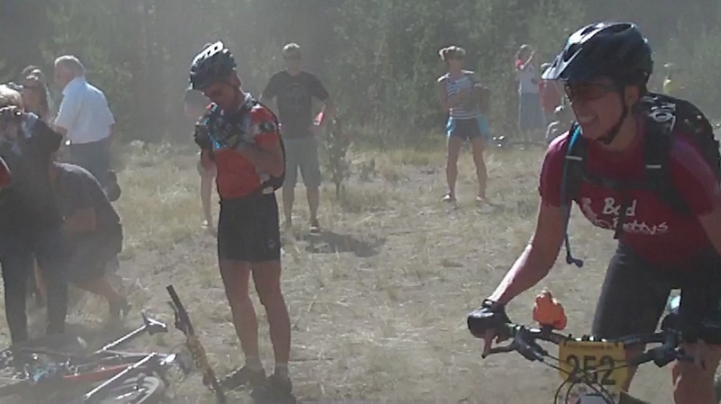
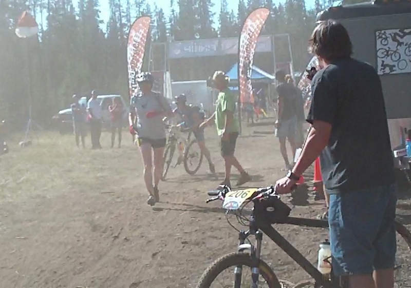
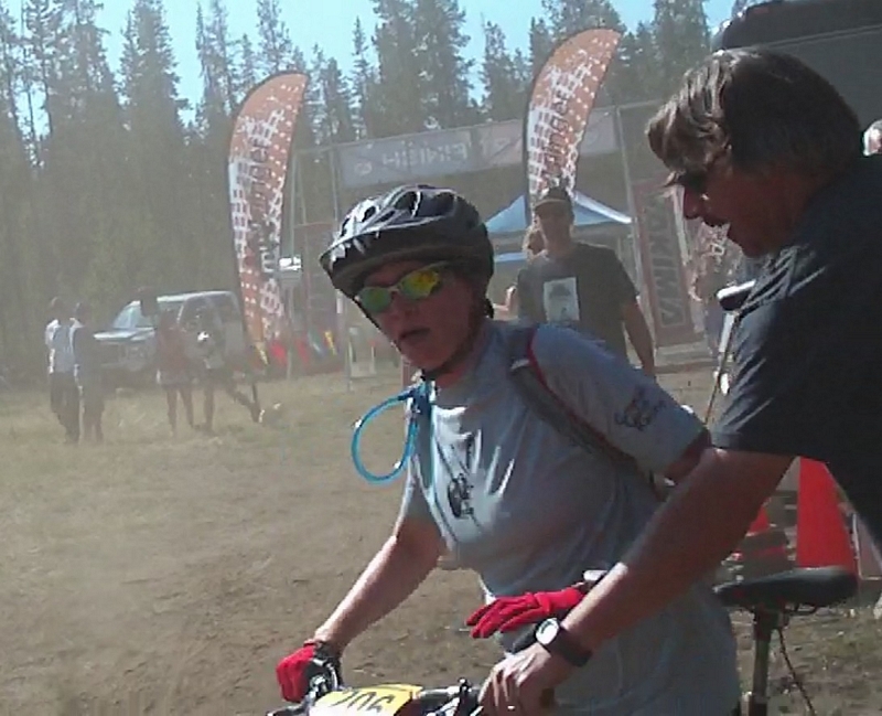
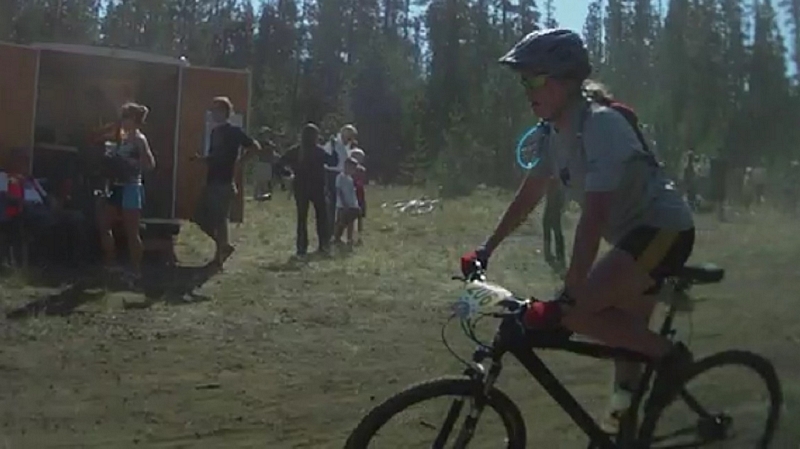
Bend 24hr Race
Saturday 9/10/11
Back in May, five of the women who ride at Growlers Gulch signed up for a 24 hour race in Bend. The race would be in September. To save a little money on their entrance fees, they offered to put my web site logo on their jerseys if I would volunteer to work the race support.
That was a long ways off and I had hoped to be living in Bend by then so the idea appealed to me.
I had never sponsored anyone, and could not afford to put up actual money so this seemed like it was workable.
As the race time approached I sent an e-mail to the promoter asking if I could get either a late or early shift, since I didn't relish the idea of working through the middle of the night. He responded with a 5 am to 11 am shift on Sunday morning, working the aid station.
Saturday and race day, my wife and I showed up at the event around 9:00 am. The race was to start at 11:00 am with a La Mans type starts, a start where all the riders would run to their bikes and take off riding.
I stopped by the Bad Betty's tent and saw all the girls, everyone excited and anticipating a real challenge. They were ready and I felt confident they would be a solid team.
I also went over to see Paul and Melanie Norris, since they too were racing, but as a duo team. We had just done a 40 mile ride the week before and a 20 mile technical ride around Waldo Lake the day before.
The bull horn squawked and a call for all the riders to gather at the starting line went out.
The promoter introduced himself and went over the rules of the competition; you could feel the excitement in the air.
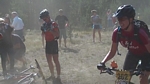
As I looked around I noticed a few riders with dust masks hanging around their necks and wondered how long that would last. The area was thick with dust, my shoes and legs were a reddish brown in just the short time I had been here. Every step puffed out a brown floury dust cloud.
A few minutes to the start of the race, the first lap participants are all over at the starting line. The promoter has told everyone that the race will start with a half mile lap on foot around the tent area to the bikes. The idea behind this, as I understood it, was to break up the group. That way everyone would arrive at the start line a few seconds apart.
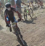
Someone started a ten second countdown, the promoter fired a starter pistol and the riders sprinted off in a cloud of dust.
I headed for the lap tent, along with the crowd, where the bikes were all strategically placed by the riders to gain the optimum advantage in the start.
A tall guy came loping through the lap tent, cheered on by the clapping onlookers, grabbed up his bike and hopped on it as he ran down the hill, leaving a streak of dust lingering in the air.
Within seconds four more racers ran into the area, one grabbing a bike near the tent, another hopping around the bikes strewn through the area, heading for his bike. While the others found and hurried to mount and charge out on to the trail.
In a rush there were dozens of racers running through the area, some scrambling to put on their packs, seeing an advantage of doing the foot race without it. One racer running up and quickly pulling off his running shoes, then putting on his biking shoes and pack before leaving after almost 30 seconds of change time. Others swooping in to snatch up their bike and take off at a run as they leaped onto the saddle. All, seeking to take the advantage.
The whole area was soon a cloud of dust as bike after bike went whizzing by.
Then as fast as it started, the number of riders dwindled, the core group had rushed the area and now the more conservative riders jogging in, no doubt having come to the conclusion long ago that a few minutes in a 24 hour race was probably not going to make or break their game.
As the dust settled and all the racers had left, we made our way back to our car and headed out.

3:45 am and the alarm on my cell phone went off. I rolled over and looked out at the star filled southern sky through the plate glass windows that stretched across the whole south end of the cabin. I crawled out of bed and made my way to the kitchen. I needed a hit off the coffee pot before I took off to pull my stretch at the aid station.
I pulled into the parking area at Wanoga Ski Park just before 5:00 am.
As I got out of my car I could hear the hum of generators going, providing power to light up the lap tent and power to run the battery charging station.
I headed up to where Justin and Mike, from the Friends of Capitol Forest, were manning the aid station.
Mike was busy making peanut butter and jelly sandwiches, which he was putting in a plastic bin.
It was a pretty boring job, just waiting around to point out the energy supplements and hand out sandwiches. A few riders would show up and gulp down some food or grab some energy gels then we would stand around and talk for the next ten minutes.
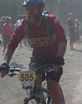
I did see each of the Bad Betty's at some point during the morning. Dara had almost run a deer down during the night run, saying she was shouting and honking her horn to scare it out of the trail. Wynn had a bat buzzing her on one lap. The Bad Betty's took second place for their category, with Dara and Denise both doing 4 laps while Juntu and Wynn each did 3 laps. An outstanding showing of 14 laps or 224 miles for the team.
Paul and Melanie also came by, Paul had returned in the middle of the night to find that Mel had overslept, but decided to cuddle up next to her and they both passed on a lap. It's ok though, they still placed first in the duo category and both did an incredible 5 laps of 16 miles each for a total of 80 miles each.
Mike was replaced around 9:00 by a young woman named Ann, who was pretty ho-hum about the whole thing, not much for conversation so I was pretty much just standing around.
About ten, Justin came over and told me that things were winding down and I could take off if I wanted.
It had warmed up nicely so I headed down to my rig where I threw on a jersey and riding shorts. I pulled my bike off the rack and rode up to the starting line, where I turned around and took off. My intention was to see what the course was like and get a very small feel for what the racers had gone through.
Starting off with a short downhill run, the trail marked with large pink arrows. The line moved up and down through the timber on a mostly straight path until it left the Wanoga Ski Park area.
Since the last lap of the race would be started by a lot of the riders in this hour, I tried to make sure and get off the track when I heard someone approaching. I don't think anyone overtook me and had to call for the trail.
I was overtaken by a rider before I even left the Wanoga Ski Park area. The dust from his passing hanging in the air and I immediately knew that 24 hours of this would have me coughing and red eyed from the dust.
The Tiddlywinks trail was the first single track, leaving the Wanoga Ski Park. It headed off through small pine trees for a short ways, then crossed a gravel road and into a grassy clear cut where the serpentine line made a moderate climb up to pass over some lava rock features, where I noticed a lot of foot prints.
I was passed by a couple of riders through this stretch.
It was about two and a half miles before the trail started to seriously climb, it had been climbing but not low chain ring climbing.
About a half a mile of climbing, now on the Kiwa Butte Trail and on what appeared to be more of a downhill run that the racers were riding up, to break over the top of a wide ridge and follow the back side of the ridge on a wide track. It was a fast track and if I were racing I would see this as a place to stand up and hit some high gears.
Finally dropping down to cross a dirt double track the route flows through small pine and grass until it reaches a gravel road. Crossing the gravel, the line continues for a short ways then starts into some interval climbing.
The trail starts a serious climb for close to a mile, ending where the route follows a skidder road up to cross over the top of a mountain. Crossing the top the track rumbles through some lava rock features before starting down a nice flowing single track. Where the only caution was to not ride too high on the berm because they were topped with thick duff and it was an easy place to lose the line.
The single track exited out onto a fast double track, another place to stand up and scream down through the woods.
The double track ended when the route took a turn onto the Dinah-Moe-Humm trail. This trail was made up of short up and down sections, not enough climbing to be considered interval but enough to keep me on and off my saddle as I negotiated the undulating line and several rocky features.
After two miles of Dinah-Moe-Humm the route dumps you back out onto gravel double track. There was an aid station here and I stopped for a shot of electrolyte, telling the people manning the station that I had worked the other station and was just poaching a ride on the track in an attempt to see what kind of misery these poor riders had set themselves up for.
From here on it is all double track, most of it on compacted gravel, the strategy then would be to cruise the single track and hammer the double track for time.
Really nothing to describe on the double track except that I am sure that after about the second or third lap the gravel had to feel like it went on forever.
The gravel double track at last gave way to some dirt double track and a formidable climb up and over the back of the small nameless butte that sits above Wanoga Ski Park.
I checked my time after the ride and came in at just over two hours. If I were riding this race I may have been able to shave about ten minutes but that would be about my best time and I couldn't do it every lap.
Another strategy that I noticed from one rider was to wear the same clothing for every lap. Because when he passed me, my nostrils were assaulted and my eyes started to water, I just had to drop back until the air cleared.
Bend - Swampy Lakes to Phils
Monday 9/12/11
While I was in Bend, volunteer support for the Bad Betty's in the 24hr race, Wynn told me about a ride that she had done a couple of days before.
She lined it out for me on her map:
Start at Swampy Lakes Snow Park and head into the shelter, then take the Swede Ridge trail over to Sector 16 trail, sector 16 to the Whoops trail and down to Storm King. Then pick up C.O.D. to the E.L.V. trail and take that line over to finish on Phil's trail.
Then she handed her map to me and told me to give it back to her the next time I saw her.
It sounded good and I had ridden the Storm King trail with most of the lower trails she outlined once before.
Monday I took off from the Swampy Lakes snow park and headed out to the shelter. It seemed simple enough.
First junction was right after leaving the parking area. This was the trail I should have taken, instead I rode on for a few hundred feet and took the double track to the left, misreading the signage, I was on a double track that led to Swede Ridge while I thought I was on the trail that led to the Swampy Lakes shelter.
After a mile the double track ended at a couple of gate posts and single track started. The tread was like most of the tread in the area, gritty, sandy, and dusty.
Most of the line along here was flat or slight descent with a couple of short climbs. According to the map, the double track had been at an elevation of 6000 feet and the shelter was at 5850 feet so there was 150 feet of drop over 2 miles, nice easy riding with no real technical tread.
There were two trail junctions along this line; the first had very poor markings with a sign fifteen feet in the air on a tree indicating a cross country ski trail and a plastic marker sign with a mountain bike symbol and arrow pointing in the direction I was headed.
The second trail junction had a trail marker post. The post indicated I had come 1.8 miles and that the swampy Lakes shelter was .2 miles further (a discrepancy between the map and sign post of almost half a mile, the map indicating .6 miles). The marker also indicated that the Swede Ridge shelter was 1.8 miles in an easterly direction, down the other trail.
The track to the shelter went down through a small valley and crossed a small creek, the crossing was on large smooth stones, it looks very ride-able, but being on my own I decided to walk my bike across the creek.
The trail I thought I was on when I looked at the map and the trail I was on were two different trails.
I rode in on the trail I was supposed to ride out on to access Swede Ridge.
The trail I did ride out on, which had a marker post but the labels had been removed, turned out to be South Fork Trail.
I headed down the hill, with the idea that I would run into Swede Ridge trail in six tenths of a mile
The South Fork Trail (as I found out later) started out with a gentle downhill flow, tracking across the top of a ridge, flowing through the woods bumping over simple root steeps through a tinderbox forest. Sections of the forest, bleached white, dry, with the smell of smoke in the air.
The flow turned steeper after the first three quarter mile, as I kept looking for the junction with Swede Ridge (which was not to be found on this trail). The trail wasn't ripping but was fast with a touch of root drops, the line switching back and forth, traversing the hillside with fast smooth flow.
About two miles and 650 feet of descent brought me to a creek crossing. There was a bridge made out of a single large log, the top smooth and wide, with good approach from this side. If I had been with other riders I would have ridden it but since it had a penalty for mistake I stopped and walked across.
The marker post on the other side of the creek indicated that Tumalo Falls was 1.7 miles away and I was 1.8 miles away from the shelter.
I knew I was off track now. I reviewed the map and saw that I could ride this trail down to Skyliners Trail. From there I could ride around the ridge and pick up my intended course just after the Whoops Trail.
The map also indicated this was a black diamond trail, since the part I had just ridden was defiantly not a black diamond trail, I was a bit anxious about what lay ahead of me.
Black diamond trail markings are mostly because of features or short exposed sections and my guess was that it would be an exposed section of trail.
The line became steeper and the flow straightened out a bit as the trail headed downhill following the creek. A good fast run with sections that really ripped and sections of rock and root drops features that were on a moderate scale.
About a mile down the run and the line moved higher on the hill above the creek, the side hill became much steeper and the track narrowed. The line was approaching the black diamond area.
Probably twenty to fifty feet or so of moderately steep side hill with exposure and some rocky sections to negotiate was what made up the black diamond area. On video it looks benign but in reality I was focused on each rock and root with open space in my peripheral.
After negotiating the short intense black diamond section I shot down through a brushy area to hit the trail junction with Tumalo Falls trail.
The trail had dropped me another 400 feet of descent over the last mile, bringing the total descent from the shelter to just over 1000 feet.
The marker post indicated Skyliners Trail was three miles to the east and the Falls was a half mile the other way. In hind sight I should have ridden out to the falls for a photo op.
The Tumalo Falls trail was fast, not steep but very fast and smooth. There were a few rocks but no roots. The track ran through thick deciduous brush and at times gave limited visibility.
There were a couple of short climbs toward the lower end of the trail, followed by some great serpentine trail running through small timber that had just been cleared of underbrush.
At the parking area, I knew where I was and where the Skyliners Trail was. It is not the easiest trail head to find.
Starting at the parking area, most people intuitively head up the Tumalo Trail, looking for the Skyliners Trail.
The issue here, as I see it, is there are two trails heading away toward the west that converge into a single trail about a quarter mile away.
The Skyliners trail head is on one of these trails. There is a 50/50 chance to miss the trail.
The Skyliners Trail cross an open space just above the parking area, which puts the trail directly up the hill from the parking area, so head straight up the hill from the parking area toward the no sledding sign and take the second trail to the left. The first trail to the left is a ski trail loop.
Skyliners Trail starts with some challenging interval climbing that is loaded with roots and rocks, mostly rocks. A hard section because it requires mid range gearing to clear the rock features but is hard to sustain the climbing in the mid range gears. I was stopped a couple of times waiting for a couple of recovery breaths (the point where the panting gives way to a couple of natural deep breaths) before resuming the challenge.
The Skyliners Trail is fast, mid range gear riding. It swoops up and down a lot along the side of the ridge, with a few quick switchbacks down the hill before resuming the rolling fast track until it reaches the end of the ridge at about a mile and a half.
The end of the ridge is where the line presents four nice banked switchbacks that can be ridden hard for a fast back off the seat blast before the line starts a serpentine crossing over the face of the wide ridge for another mile of easy climbing.
After three miles of Skyliners Trail the elevation gains about 150 feet, most of that in the last mile and a half.
Back on track, this is where I would have been had I not missed the Swede Ridge Trail.
This trail junction is Skyliners, Whoops, and Ben's Trails along with a well defined double track. The last time I was here, I rode around on the double track for a good thirty minutes before realizing I had missed the track I needed.
One hundred and fifty feet south on the well defined double track there is a track that heads off to the left, east. A short run down this old double track put me at the head of the Storm King Trail. The double track is easy to miss because it looks like single track until you have ridden it for a short ways. The map shows it as double track.
Storm King is a fast trail. It starts with some nice whoops or pumping rollers before heading down through the woods on a fast line that is loaded with lightly banked corners. A fast enough line that I activated my seat dropper, to make it easier to shuffle the bike back and forth under me as I blasted through the corners.
There are a couple of short climbs and a couple of rocky features on Storm King but I found myself in mid range to tall gears for almost the whole four miles of track.
Just before hitting the pavement of Century Drive the trail marker post #32 appears. This is the junction with the C.O.D trail.
C.O.D. used to be a black diamond trail, but I noticed on Wynn's map it was now considered a blue trail. Since I had never been on the trail I wondered what had changed.
Apparently just the map had changed, because after a couple of miles of fast single track through the timber, the trail crossed a double track and a sign in the tree displayed a black diamond.
I continued on and figured it was a rocky section that would be the challenge, and I was right.
There were three primary rocky features to cross on this line.
The first and last were the most challenging and I was unable to clear ether of those, though I did attempt to clear the first one. I rolled and bumped over a good sized lava boulder, to rumble across a short field of rough lava and get my front wheel trapped between a couple of rocks while my back wheel gave out a whirring sound as it spun across the face of another lava rock.
Most of the rocky features were ride-able, the key at most times was to maintain enough momentum, have the bike in a low mid range gear, and keep my weight back over the rear wheel.
The E.L.V. trail is a connector trail that runs from C.O.D through Grand Slam and on to Phil's trail. The track is well developed with a line that runs up and down over and along small ridges. The trail will set you up for a few fast banked corners followed by a quick short, stand and pump climb, up to the top of the next section. As the trail approached Grand Slam, there was a stump alongside the trail which serves as some sort of shrine. I do not know the reason but the stump was adorned with strings of beads, beer cans, bicycle tube patches, matchbox cars, and assorted other trinkets.
My final trail for the day would be on Phil's trail, from trail marker 7 and the swan sculpture back to the parking area.
The Phil's trail is a mostly moderate downhill slope, which can be ridden with your crank spinning the whole way.
Phil's trail would best be described by me as a crank and glide trail because that seems to be what I did for the next two miles. By the time I reached the parking lot I had the ring gear in the largest gear and the sprocket shifted into the higher range. That way I could stand up and do a lot of the cranking to maintain good speed and squeeze the most out of the shifting trail line.
The ride took me almost four hours, which is about what I was expecting, and ended with a map mileage of 24.2 miles. I started my ride at about 6000 feet and ended it somewhere around 3800 feet.
The only thing missing on this ride was friends. A solo experience is fine but a ride like this needs to be shared.
Melanie Turns 40
Saturday 9/3/11
Melanie Norris had turned 40 in February, to celebrate this occasion she wanted to do a 40 mile mountain bike ride. The middle of winter in the northwest doesn't present much opportunity for a 40 mile mountain bike ride so she set a goal. On the Saturday of the Labor Day weekend she would complete 40 miles of single track on the Ape Canyon trail, out to the lunch log and back for 15.5 miles. Then she would link three trails, the Toutle, the McBride Lake, and the Kalama Horse trail to add another 8.5 miles. Then to complete her goal, she would do the Falls Creek trail for an additional 17.5 miles.
In addition Mel had also set a goal to raise $1,500.00 through support donations for the Fred Hutchinson Cancer Center to honor the fathers of Susan Martin, Carla Mitchem, and Shaun Alexander.
She has been training over the winter and spring, losing 15 lbs in her effort, by riding close to 1000 miles on her road bike, which included the STP, Seattle to Portland road ride, done with her husband Paul in a single day. Hundreds of hours on her mountain bike, riding the trails at Growlers Gulch on a weekly basis and Yoga, Zumba, weight training, running, and swimming.
Her ride would be with just three people, herself, Paul her husband, and Jim LeMonds who was going to ride sweep.
Unfortunately Jim suffered an accident that broke multiple ribs and punctured a lung. So when I offered to work in whatever capacity I could to support her goal, Paul and Melanie asked me to ride as the sweep rider. I was honored.
---
The illuminated numbers on my alarm clock displayed 2:30 AM. I rolled back over and tried to go back to sleep. The alarm would be going off in a little over an hour.
Every conceivable thing that could go wrong on tomorrows ride popped into my mind. Was I fit enough to do this distance, what if I bonked half way through the Falls Creek leg, what if my hands start cramping while doing that wicked descent on Falls Creek, what about that...I pushed those thoughts from my mind and fell back to sleep.
I had just pulled into the Park and Ride in Woodland when I spotted Paul's familiar Subaru approaching the parking lot.
4:45 AM and we are heading for Ape Canyon. Our target start time was first light.
We pulled into the Ape Canyon parking lot at 5:45 and piled out of the car. The forest around us was becoming visible, the stars disappearing as the light from the sun turned the sky blue.
Jim and Dave LeMonds were there; waiting, standing behind Dave's truck, dressed for the cool morning air. They would be the support crew for Melanie's forty mile ride to celebrate her 40th birthday.
There was one other vehicle in the parking lot, with a tent pitched just the other side of it.
It was a few minutes after six and we started turning the cranks.
Paul led the crew of three riders. We headed up through the lower area, covered with root steps and similar features to negotiate.
Paul set a quick pace and I struggled from the start to keep up.
After the first mile, I pulled to the side of the trail and shouted that I would catch up. I had started the ride with a couple of layers and was already pulling off the extra layer. The cool air felt good as I gave a scooter kick and flipped my leg over the saddle to hunker down and crank out the next couple of miles of climbing.
I set a good solid pace and just kept cranking with just two stops to scan the horizon with my helmet cam.
Pulling up the final climb to the rock above Ape Canyon, I could hear Paul holler out and replied with a hoot.
I asked how long they had been waiting and Paul glanced down at his wrist and said I was six minutes behind them.
A quick high five and we headed toward the Plains of Abraham.
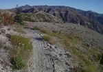
We made our way across the face of a cliff and then rode down through the desolate moonscape terrain. A sandy ash tread with a line running through the rocks that presented a little firmer track.
We rode across a couple of small ravines, large angular boulders and rocks strewn everywhere, a few small green tufts of plants speckled the expanse as we rode toward the low lying ridge that we would cross to the Plains of Abraham.
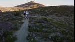
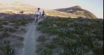
I was just a few feet behind Melanie as we crossed over the broad ridge and the scattering of plants became thicker and thicker. Soon we were following a track that cut a swath through a thicket of wild flowers. Lupine, Indian Paint Brush and what looked like Daisies were all in full bloom; bright vivid colors lined our path and stretched away in either direction.
We stopped for a quick photo op on top of the rock cliff overlooking Ape Canyon on the northern side.
We turned our attention to the line that ran away from here toward the north. Down to cross a small creek that flowed across a flat rock surface and up onto the trail. The next few hundred feet dotted with technical rock negotiations that were scarred with marks from pedal strikes.
The trail broke out to a straight run across a moderately firm surface.
The plants as we rode became sparser but still displayed gorgeous blue and white blooms that were primarily made up of Lupine.
We rode in the shadow thrown by the peaks bordering the Plains on the southeast, the sun still low in the sky, a stark outline of the mountains to the right, a stark shadow displaying their relief on the left.
Off in the distance a pyramid shaped cairn, which grew as we rode toward it, then another, then a tent with a couple of campers standing outside of it, dressed in heavy jackets and long pants. We waived as we passed by.
We followed the trail down through a wash and up on to a ridge; the line turning and climbing toward the mountain and crossing the ridge to enter the first of about a half dozen narrow ravines.
This section of the trail has steep side hill and plenty of exposure, with views that are spectacular, but a section of the trail where you have to pay close attention to the track.
We hit the lunch log in less than two hours of riding.

The lunch log is a location on the trail where there are a couple of logs; probably a foot in diameter, that were blown over in the blast and half buried. They are sticking out of the hill at an angle and height that is convenient. It is a place with a comfortable panoramic view and nearly the highest point on the trail at around 4,550 feet elevation.
We took a very short break and turned our attention to the return run.
We were heading back on a track that would be a fast descent. The narrow ravines would have me off my bike a couple of times to cross the bottom and push up over a solid rock strip that ran through the mountain or push up through a steep section of soft ash.
As we descended the final ridge leading onto the Plains of Abraham, a plume of dust like a vapor trail rose from the back tire of Paul and Melanie's bike and blew away across the ridge.
The wind blew at an angle to our progress, pushing the dust away from the trail.
We flew by the campers with another wave, still dressed in heavy clothing and standing outside their small dome tent.
As we approached the northern edge of Ape Canyon, we rattled through the rocky technical section, dabbing down on a big rock as I guided my front tire between a couple of large stones to twist around and through a small rocky gap.
We crossed back over the low ridge and out of the Plains of Abraham, the trail to circle a large basin and cross a couple of rugged ravines that feed into Ape Canyon.
Finally back at the overlook rock on top of Ape Canyon, Melanie tells Paul and me to go ahead I'm going to turn you guys loose. Nope, I say and Paul, leaning forward on his handle bars says "That is not why we are here". We are the support, this is Mel's 40 at 40.
We kicked off and started the big descent of almost 1300 feet over 4.5 miles back to the trail head.
The line follows the side of an exposed ridge for a couple of hundred feet then descends into a narrow corridor of brush. The brush breaking the breeze and the dust rolling up off of their tires limited my line of site. I paused for a few seconds and that was the last time I saw Paul and Mel until I rolled out into the parking lot after 35 minutes of some of the best and smoothest screaming downhill and just about two minutes behind them.
We packed up our bikes and socked down some supplements and headed for the Blue Lake trail head.
Our course would take us from the Blue Lake trail head down the Toutle Trail to Red Rock Pass. There we would cross the road and continue on the Toutle trail down past McBride Lake, down to where it hit a spur road that led back to the main forest road. At that point we would turn on to the Kalama horse trail and ride that for about three miles until we reached the Kalama horse camp for a total of 8.6 miles.
The Toutle trail starts a few hundred feet up a line that runs through a rocky wash. The area looks like a river ran through it and left scads of rocks, the path along here twisting its way through the wash.
The first half mile is a moderate uphill grade that on smooth single track would be cranked out in a few minutes. This on the other hand was full of rocky wash, the line options were endless but each was filled with roots and rocks to maneuver through. Standing in mid range gears to create enough torque to clear one obstacle after another until we reached the gorge.
There is a gorge that each year gets deeper. The trail has been rerouted a couple of times to find access where the sides are not extremely unstable.
After crossing the small gorge and making our way up through the small stunted densely packed trees, the trail enters a very mature forest.
A fast track that blasts down and around a few ridge lines, the trees here are very large and the setting is deep forest with minimal lower story. The tread is rich forest floor with lots of small fir cones.
The aggressive tread on my Nevagel tires would pick up the fir cones and launch them as they passed between the tire and the front fork, at times showering the air in front of me with cones shooting off in all directions.
The tread changed as we encountered more old lava flow. The track presented new challenges in the form of steps and rock drops formed by the lava which composed the underlying structure of the many small ridges that the serpentine trail worked its way around.
After a couple of miles the trail turns south and heads down through an open area, the tread sandy ash with a few rock drops.
The end of the trail crosses an old lava flow which is barren of vegetation and has lots of sharp jagged fissured rocks, close to an obsidian state the lava fractures to very sharp edges. Once when crossing this area on an out and back, a lava stone along here slit the side of my tire, destroying the tire and tube.
We crossed the road at Red Rock pass, the trail from here goes west to pass McBride Lake. None of us had ever ridden this section before. Our expectation was that it was a small climb followed by a long downhill run, based on information Jim had given us.
The tread was a very earthy. A trail that sees a lot of horse traffic, and at this time of year, the horses have beaten the soil flat and firm although a little rough, it is very ride-able.
The line was a nice downhill slope after the initial short climb. The trail follows the contours of the hillside with no real sharp descents or climbs. Crossing a number of small creeks to finally pass above McBride Lake and then make its way down to the edge of the Kalama River which appears to have its source in McBride Lake.
Paul stopped at one point to pick a very large mushroom, a King Bolete. Paul told me that they have picked these as large as your head. Breaking the fungus in half, Paul pointed out the tube structure that forms the underside and also pointed out that this one was a little on the mature side with some bugs living in it. Ok for some more protein after drying the mushroom.
The trail finished out on a spur rode that crossed the Kalama River.
The next section that we would ride was the horse trail that ran down the north side of the river.
We headed down the trail, with the sound of the fast moving river running off to our left.
The line ran at a good grade for the next two or three miles, the tread was poor. There were lots of root drops with a mixture of rock, rubble, and large stretches of sandy ash. There were many locations where the trail was at least six feet wide, some places where you could grab a short section of un-disturbed forest floor and ride for a few feet before being channeled back into the ash and rubble that made up the majority of the trail.
A hard trail to ride and I could not and would not ride it in the other direction.
We came across three parties of riders on horseback, where we stopped and got off our bikes. We talked so that the horses would know we were people and waited until they had passed to remount our own steeds and continue down the trail.
Just as we were approaching the Kalama Horse Camp, we side tracked onto the Fossil Trail #242 which took us up to cross the paved Forest Road 81. Paul checked our distance, at 8.64 miles so we decided to cruise down the road to the main entrance to the horse camp where we found Jim and Dave.
After eating a PB and banana sandwich, gulping down a recover drink and some more water, we took off for Old Man Pass and the Falls Creek Trail.
Paul and Mel had put out an invitation on Facebook to have friends join us in the last leg of the ride. Since we didn't know when we would reach the trail head, everyone was on their own for start times.
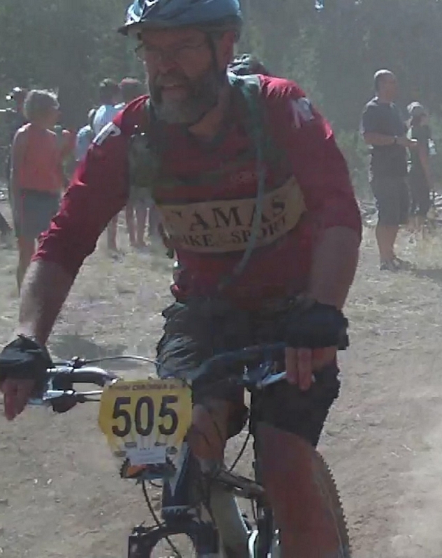
When we reached Old Man Pass, there were a couple of vehicles in the parking lot, one of which I recognized as Bob Horness's car. That meant that Bob, Vaughn, and George were probably making their way to the bottom of Falls Creek. Bob was my ride home so I was happy to see he was here and on the trail.
While prepping our gear, another group of friends showed up with encouragement.
Since we were already twenty three miles into the ride we asked everyone to go ahead and take off, our pace would probably be a little slower.
The trail head for Falls Creek trail was still about five miles away. There are three trail options to get there, really just two. Trail 150 which is the longer route but very smooth swoopy track. Trail 151 a shorter route but has a somewhat fast, somewhat more primitive line that goes down across the headwaters of the Wind River to finish with a very steep climb out. We opted for the 150 trail because it will give us the required mileage we need to finish the ride.
When we hit the trail we expected a smooth fast line but were surprised by a half dozen or more spots that were plowed up. The trail follows an old road bed from Old Man Pass to just behind McClellan Meadows Snow Park; it is a wide swath that has the single track running down the middle. For some reason which we could not figure out, it looks like the forest service has plowed parts of this old road bed. The dirt is churned up for stretches that run a couple of hundred feet, and then stop.
Since our friends had taken off before us, there was a fair track running through the plowed up area and on the downhill portions we were able to ride, although very slowly over the very bumpy surface.
When we hit gravel we turned toward the east and the McClellan Meadows Trail 157 tail head.
The 157 trail starts with a moderate climb that can be done in low range gears, I took it on in my small ring and large sprocket, the lowest gears I could get. Spinning my way up the hill, the trail is firm packed dirt with good grip and has a few large root drops, although I was able to clear all of them.
The line of this trail repeats at least three times, a climb that is followed by a stretch of flat or a descent, and then repeats, where the last section of trail is mostly flat but with some technical features to spice up the ride. Toward the end of the trail a couple of more technical climbs and out onto gravel.
At Forest Road 65 we made a turn to our right and rode down the gravel a few hundred feet to the campgrounds.
The Falls Creek Trail 152 starts at the entrance to the campgrounds.
Starting off in big timber, the trail runs fast for a minute then crosses a stream. The stream is normally a muck mess but has all but dried up today.
It is a short uphill climb from the creek to the edge of the tall timber where the line wanders in and out of a maturing clear cut. The track still fast but with a few root drops along the path.
Another creek crossing that most of the year is wet, dried out today and though a little technical, I was able to spot a line and followed through with a short stiff climb on the other side.
This section of the trail for the next few miles is loaded with technical features, a section that you either love or hate. The dust along here was getting thick enough that I had to fall back a bit to let it settle enough so that I could see the line.
After about five minutes the trail takes on some of the technical features with a couple of sections that are steep with lots of rock and root drops. With my seat dropper down near the bottom, I was able to set my weight well low and back to drop over a series of large steps.
Crossing through the mature clear cut the line drops through a series of technical sections, crossing a spur rode and continuing to challenge with a twisting meandering course over roots and rocks.
All the way down the trail I was thinking about, what I considered the gnarliest section on the whole trail. On my last trip down through here when I came to that spot, the pitch of the descent and size of the rock drops brought me to a brake clamping stop. After looking it over and walking down it, I thought that if I had taken the left line I would be able to clear it.
Waiting at that gnarl spot were the riders who had left Old Man Pass before us, cheering me on. Damn! There was nowhere to go but forward down through the rough rumble preamble of half buried lunkers to drop off the left side. I slid my butt as far back as I could and lined my front wheel up on what looked like the best line. Steering around a broken stump and rock to slip past a large stump that forced me into the line, dropping the front wheel over a pair of rocks, to be followed by an even larger step and the bike lurching forward and backward under me to finally roll out and shoot down the trail.
I had lost sight of Mel and tried to let go as much as possible, railing the edges of the trail at every opportunity as the line wandered through the woods and past the trees until it finally exited onto a double track.
I had half expected to see Paul and Mel here. This is the place we regrouped last time we did the trail, so I let the bike roll. The double track was as smooth as it gets out here, so I pulled my fingers back off the brake levers and wrapped my hands full around the grips to scream as fast as the line would let me run.
I never touched my brakes until I saw the primitive camp site coming up, where I pulled up to slow down and spotted Paul, Mel, and Ryan McMaster straddling their bikes over by the lava caves.
As I pulled up, they pulled away and we were off to hammer down the next section.
The trail crosses a road as it leaves the double track and turns into another single track, a fast track which still contains some rock and root features but is just not on a scale with the last section, a place to be cautious of not getting too confident.
This short little section is a good fast run that ends with a great little set of banked corners just before exiting across a gravel road.
After picking up McMaster, the pace seems to quicken. Or maybe it's just that we are getting closer and pushing it a little harder. But I think its Ryan.
The double track leading down the hill feels like a cobble road with gravel scattered across it; rough and unsecure.
The double track turns into a short piece of single track and when we hit a junction with some more double track, we notice a rough single track straight across the gravel.
The track has the flavor of a Growlers trail, meandering slightly with a log over where there are a couple of more friends standing and waiting as we pass by.
Back on gravel for a short climb, then a long run down the packed smooth gravel to make a turn into the woods.
I can hear someone on my back wheel, just as we make the sharp turn from the gravel and into the woods. Cranking it out, I shot back to see if they want the line and hear them say they have to stop and wait for someone.
We crank our way through the timber to a rock slide where the trail skirts around the bottom, wide enough but rough and rocky.
With Paul in the lead, the three of us are again together in a close pace line formation, spinning the pedals as we bounce over the roots and negotiate a few rock features until I can hear Falls Creek off to my left.
I know the descent to creek level is steep with multiple rock steps to negotiate. I lower my seat as we approach so I can get back, then follow the line that Mel takes. Smooth action on the left side, channeled into a line by a large tree that has fallen and lays on the hillside. A few rocky bumps followed by one big drop. I find myself releasing the brakes as the front wheel drops, then snapping the back brake on just as the rear wheel makes contact.
The creek side area is filled with mountain bikers, mostly Growlers and Stella area riders but some of the DOD (Disciples of Dirt) group from the Eugene area of Oregon are there.
We hesitate for only a few minutes to say a few hello's but not wanting to stand around for any length of time, we need to keep moving to finish the last section of the trail.
Paul takes off up the short climb, and then Mel and I ride up and over the rocky section at the top of the climb to hit the trail.
Mentally preparing myself for this very steep descent, I look down at my brake adjustment and see I have lots of clearance.
Right on Mel's back wheel we start the descent, steep is the only word that comes to mind to describe it. Very steep descent where the last time I came down I could smell my brakes heating up as the rotor rumbled between the brake pads.
The steepness is only topped by a short section of root and rock drops, where staying on the line is a matter of having your weight back and guiding the front wheel toward the next drop as the back wheel skids across the short space between drops. The bike is not out of control but it feels like it is right on the edge.
The line flattens out as it passes by a tree where Mel stops and I can hear an audible sigh of relief, as she walks a few feet then kicks her leg back up over the saddle and rolls on down the trail.
Hopping back on my bike I kick the pedals around and start cranking to catch her.
The angle of descent is still steep but not like the first part. We sling shot through a small swale and continue to blast down the trail. This section is fast with good flowing lines.
About half way down we are overtaken by Davy Sprocket and Ken Pearson. Davy lets me know they are there and Mel see an opportunity to pull off the trail so they can pass.
Through a rock garden and down the trail to another larger swale where Mel picks up the pace and starts to drop me as she fires down the line.
Thirty seconds later and I am just catching glimpses of her as she hits the end of each straight section and rails into the next corner.
Another minute and she is gone, out of site when I hear Miles Olin come up behind me and I pull over so he can have the line.
Flying down the trail, I make the bridge in a couple of minutes to find Paul and Melanie waiting. We cross the creek and ride a few more feet down the trail to the parking lot where Dave and Jim are waiting with a shot of ice cold Patron and a couple of good IPA's.


