Ride Report Archive December 2011
The Eightish days of Christmas.
video
On the second day in Phoenix,
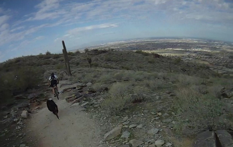
our wives had joined us so Melanie, Paul and I hooked up with a couple of the Tucson crew, Brian Vance and Vernie Aikins, and Greg Schuster with his dog Niles from Tempe. We were going to do a ride on South Mountain.
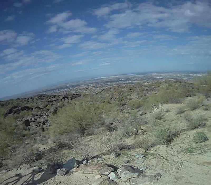
South Mountain is a park in the Phoenix area that is a string of mountain peaks, actually called a dome structure that juts up out of the flat surrounding the Phoenix area. It seems that all the mountains around here are very similar in one respect; they seem to rise out of the desert floor like islands in the ocean. Phoenix and the surrounding communities are sitting on thousands of feet of sand and gravel.
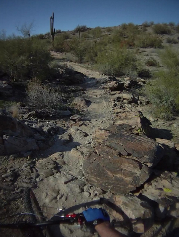
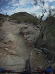
So rising up from the floor of the desert is South Mountain, a very stark metamorphic core complex. A Sonoran habitat; cactus and prickly things that wanted to stick me and the mountain structure a Granodiorite material that has been decaying through the millennium. The trail made up of slab formations of granite like rock and rubble; very exciting trails to ride.
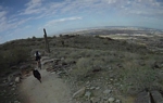
We took off up a fire road that was in itself a fun ride, wide with firm packed gravel and lots of rocky formations to rumble over on a fast paced ascent for the first mile or so. There were lots of hikers along this part of the trail, in fact lots of hikers throughout the ride but this section was by far the most populated.
We turned off the fire road to ride a few feet on an undeveloped broad section of track to take a turn onto some real single track. The trail dropped down through a small swale, bumping over some large flat stones to present a quick climb up a rumpled up looking rock structure, my first taste of this type of rocky trail riding. Sorry to say I faltered out of the gate from intimidation but would soon learn it was ride able; it took the right gearing and a little confidence.
We were now on the National Trail in a section that was a sand wash, running between some ledges, winding up through the valley to take a turn onto a rocky outcropping. We climbed up across some solid stretches of rock formations with a few sections of rubble to turn on to the Mormon Loop Trail.
The Mormon loop starts with a short but challenging rock step climb to settle into a firm gravel line that climbs at a moderate angle as it crosses the face of the hill. There are a few rocky assaults along the line but only one pulls me off my bike and a couple have me dabbing.
As we huff and puff our way up the trail, the line starts to steepen and I find myself setting into a grinding it out mode as we lean into the climb until we hit a very sharp ascent.
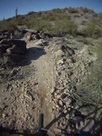
The trail crosses what looks to me like a dry creek wash, to turn up a very steep rocky faced hillside. The base of the incline covered in loose stones that have rolled down the hill which is primarily large imbedded rocks. The line required me to power through, negotiating the lose stuff and turning across and over the solid rocks, handling my bike with a lot of twisting and jostling motion to keep my balance and keep moving forward on the assault.
The trail turned straight up a rock face, the rocks forming small steps with loose rubble filling in all the cracks and crevices. Paul was the first to attack the line and set a mark that no one else was able to hit. I, as my fellow riders did, cranked it out until we hit what felt like it was vertical then got off and pushed the bike up the incline to the top of the ridge.
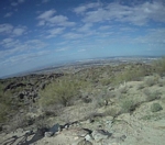
The view of Phoenix was fantastic; a sweeping panorama from the top of the ridge that took in a wide view of the city. Turning around and looking back down the hill revealed a view of the valley we had just climbed up with another panoramic display across the valley to the hills on the far side.
The trail followed just below the ridge line, climbing up a stiff climb with lots of rock steps over the granite like surface, the sound coming from the trail was a rough crunching sound as my front tire twisted and wiggled as I tried to keep my balance, catch my breath, and climb.
The trail finally gained the top of the ridge again and maintained less of a climb over the rocky steps and presented more views of the city below us.
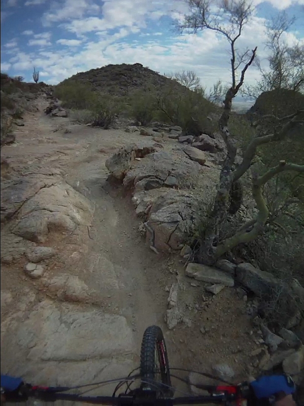
The ridge line presenting a firm gravel tread with sections granite rock steps, slabs of rock lying along the track with the trail weaving in and out, offering the challenge or not.
We stopped at a point where there were some Cholla(choya) cactus. Paul pointed out that if I were to fall into a cactus, that this was probably not the best one to fall on. The Teddy Bear Cholla is cute but not friendly. Everybody in Arizona has a cactus tale, in fact now I have one. I hope to keep those stories at a minimum.
The trail made a sharp turn and headed downhill, for the first time, a short but exciting little descent. My first experience of dropping down some moderate rocky steps and bumping across the weathered face of a granite outcropping to drop into a rocky gravely ditch that flowed out to a wide stretch of compacted trail, to all too soon, lean back into the climb.
As we rode, I found myself taking on more and more challenging step-ups; stuff that looked like I could never make that, I found myself at least trying and sometimes succeeding. I found that if I could get my front wheel up on the step, I could probably lean up and crank the back wheel over. It really helped to have someone in front of you that was making the climb, then just follow their line and try to copy what they did.
The trail merged back into the National Trail and the line climbed a bit but it was not sustained. There were lots of large rocky steps and chances to start getting a feel for this type of riding.
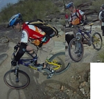
As we climbed we reached an area called the waterfall. There isn't any water here, it is called the waterfall because a skilled rider can flow down over the rocks and make this very treacherous looking area look easy, as Brian Vance showed us.
While we were all standing on the rocks, waiting to watch Brian ride down one of the three possible lines, this guy showed up on an old Diamond Back Racing DBR circa 1990's and he starts telling us how he saw a guy ride up the water fall, he said that the guy did a lot of track stand and hopping to get up and over.
We took off from the waterfall and continued to climb, we have picked up another rider as we climbed, Mr. DBR follows us for a while, and then passes everyone. A few minutes later, we pass him as he stands by the trail. We hit a short extended area of large rock steps that puts all of us off our bikes, the first few steps had maybe six to eight inch lifts but the last two had a good eighteen to twenty inch lifts, one after the other.
As I pushed over the last lift, I looked back to see the DBR, head down, cranking up the steps. Picking a very precise line; he rode up and over the lower steps on the downhill side, to turn and place his front wheel at the junction of the large rock step and a rock that was uphill of the trail. In a motion that was like he was turning a corner, he lurched up out of the saddle as he pulled the front end of his bike up onto the rock. Then as he cranked the rear wheel up the face of the step, he twisted the front wheel back around and aimed it toward the low point on the next step. Shifting his weight forward again and leaning up over the front of the bike his front tire made the lift. Then with one turn of the crank, his back wheel pulled up onto the rock. At the same moment, his tongue pierced his lips as he stuck it out and rode by us.
We rode on, the line flattening out with lots of rock steps and slabs for the next few minutes, until we hit a trail junction with Corona De Loma Trail.
Stopping to regroup, the next short section would be very exposed with lots of rock drops and technical riding.
A short section but the exposure was big. There were places that all I could see was large rocks next to the trail, where a mistake could have a big penalty. I rode most of it but when we started to climb again, the big steps and equally big exposure had me off my bike and hiking.
We reached a parking lot on N. Buena Vista Rd and took a break. A place where I put on my armor for the return trip, it was borrowed from Paul and Mel, it was the first time I had worn anything like it. I had just a set of shin and knee guards and could see that I was going to need to get my own set.
The ride across the exposed section was just about the same as the ride over, rode when I could but there was a good bit of hike a bike.
Once again we were back at the trail junction with Corona De Loma and the return trip down the National Trail. I was a bit apprehensive since we had pushed and rode up a lot of gnarly stuff.
It didn't take long to realize that every bit of this trail seemed to have options as to how much gnarr you wanted. There were the big drops that could be launched then there was the option of rolling from one rock to the next down a small waterfall of rocks to a table or back onto gravel and sight the next line.

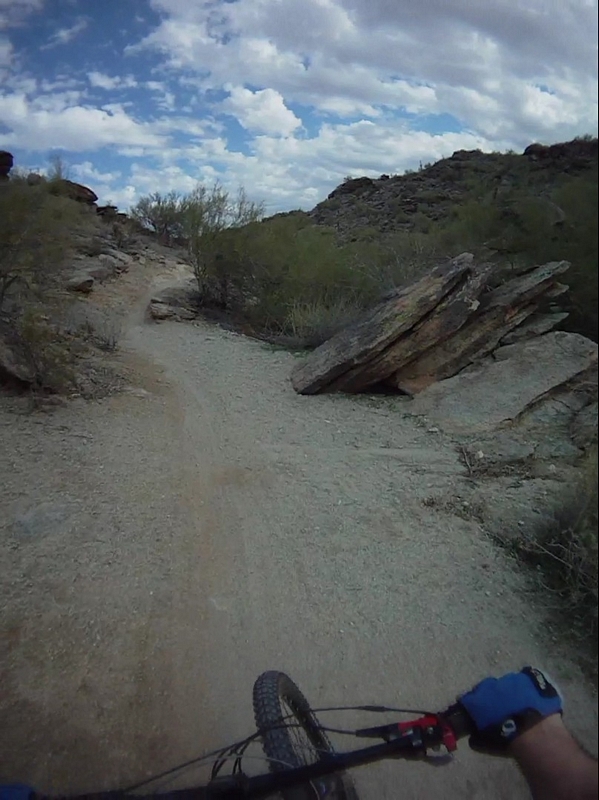
The first part of the descent was mellow by comparison. It was a firm gravel run, broken up by little rocky features, most of the time some rumbling over rocks or a large flat rock with a small drop off or a few rocky steps on a wide track.
Then the approach to the waterfall, the wide track disappears and is replaced by rocks. The trail morphing from smooth pack to a jumble of rocks leading from stone to stone; large flat stones that are ten to fifteen feet in length. The flats connected through a series of rock jumbles and drops, in one place there is a narrow ridge of rocks that guides you onto the next flat. The trail runs under and next to giant piles of slab rocks, rocks as long as cars and stacked three and four high, angling upward.
This is followed by that incredible jumble of rocks that we stopped at on the way up to watch Brian Vance ride one of the three lines down.
After I picked my way down the waterfall, carrying my bike with one hand and bracing myself with the other, I turned around and watched Brian take a different line then he had ridden before, down the rock jumble. He made it look like anyone could do it but I knew that was a ridiculous idea.
The trail followed the top of the hill, crossing and flowing down the small valleys. The scenery was fantastic if you could take your eyes off the trail long enough to look. The trail wound in and around huge boulders ranging from a few feet across to the size of a house, with a variety of cactus and desert vegetation lining the trail.
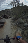
As the trail ran along the top of the ridge, it presented some solid challenges in the form of short climbs and stepping descents down narrow little gorges.
The final section being a lot of steep descents over rumbling rocky formations that took on a crumpled rough surface. The challenges presented by these features were offered from every conceivable angle. The track would run down the groves or across the rumpled face of the rock, and at angles that a couple of times forced me from my bike.
On the return trip we did not take in the Mormon loop but instead rode the National trail to the bottom and finally took the fire road back to the trail head. The fire road being a very fast and wide run, especially after all the technical riding we had been doing through the last hour of descent.
The South Mountain trails are very challenging. I would not suggest riding these trails until you have some experience with riding on rocks, which I had very limited experience.
By the end of the ride, I had a real respect for the riders that ride these trails. I had learned a lot on this ride but knew I was a real novice at chunky trails.

The Eightish Days of Christmas.
The first trail we would ride in the Phoenix area would be The Estrella competitive trail. Friday 12/16/2011
The Estrella trail system is located just up behind the Phoenix International Raceway.
The trail system was not easy to find, we drove up and down Indian Springs Rd looking for Coyote Lane and finally headed over to a nearby park as an alternate ride. The guy in the booth told us how to find Coyote Lane and we purchased the $6.00 parking permit (hang tag) and headed back to find the competitive trail.
The entrance was located between the parking area and the concession area down at the track just west of the raceway.
We parked and picked up the trail, which is a one way trail, Paul told me the trail was rated a green trail.
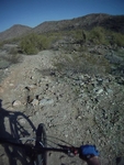
The course was very rocky, a double track that ran in and out of washes.
Paul kept a high pace on the first half of the 10 mile track. We kept pressed hard at it. Hitting lots of short climb sections that were all mid range gear ascent, right up to the final climb. The trail turned to single track which was a low gear grind to a low pass on a ridge line.
Once we reached to top of the pass, the trail took a sharp descent and headed down through three big rock drops.
The track firmly packed and fast through some weaving turns to rumble across an area of tightly packed fist size rocks. I held the handlebar firm and guided my bike across the rocky field and over the top of a couple of large boulders to drop down onto some more firm pack.
Then another chunky drop across some more large boulders in single and double combinations, like steps as the line descended. Most of the time the trail was simple single track with a few rumbling rock gardens and then smooth fast hard pack.
The big challenge came in the form of sections where the line would drop ten or fifteen feet through large boulders. Trying to spot a line and committing was tough. My experience in this type of riding was now on its second day, second ride.
The first rock drop was a challenge but ride-able for me, the second much the same, but the third presented some big rock drops, causing me to falter and miss the line. I ended up dumping it and I smacked my knee hard. I picked my bike up and using it as a crutch I hobbled down the trail; testing my weight on it until after a couple of minutes I could walk again.
Mounting up I took off at a roll, dropping down over some rock steps, then another drop, then the line flattened out and the pain subsided as I rode on, wondering if I was going to end up with some swelling.
It didn't feel like there was any real damage, it felt almost like a crazy bone kind of a thing and left a red mark on the top of my knee but that was it.
The trail had me bouncing and rattling my way down through lots more washes and gullies before circling around and catching up to where Paul was sitting and waiting for me.
The track was loose scrabble everywhere; there is no dirt, just hard packed coarse sand and gravel. This created some fast riding through the dry washes.
The area loaded with what looks to me to be quartz, rose quartz, and field spar; a neat combination of gravel and rock.
It took us about an hour to do the complete loop, right at ten miles. I iced my knee while Paul drove us back to the motel. Then I iced it again that night with no ill effects although I did notice some bruising behind my knee cap about a week later.
The Eightish Days of Christmas.
Boot leg canyon Thursday 12/15/11
We left Bakersfield after getting the
van repaired and headed to Boulder City in Nevada.
Arriving just after dark we grabbed a
bite to eat then headed to the Boulder Beach camp ground. Pulled in
and set up camp in the dark.
Next morning we broke camp and headed
out to find Bootleg Canyon. It was a little tricky because the
cartoon map that Paul had purchased the night before at the local
bike shop, showed it up the hill behind town. The trail head clearly
marked on Yucca street but there was a sign on the street name post
that said “No Access to Bootleg Canyon”
Confused we drove around until we were
back at Yucca street and drove up there anyway. There was a parking
area and a good map (the map Paul had paid 5 bucks for was like those
cartoon maps that have everything out of proportion, a real piece of
crap for finding and navigating trails). We spotted how to get to the
upper parking area.
Just as we pulled in to park a guy
pulled up next to us. We asked if he was familiar with the trails and
found out that he was from Missouri, he had just moved to the area a
few months ago and had just found the trails here a few weeks ago. He
was helpful, telling us about different trails, also telling us that
a couple of pros had ridden the black diamond runs last week and said
they scared the hell out of them.
We all took off about the same time,
with Paul and I heading for the single track, we just can't help
ourselves. If there is a choice between riding up gravel or single
track, no mater if I have to push my bike half way up, I will almost
always choose single track. The young Missourian started to follow us
but when I looked back after a few hundred feet I saw him pushing his
bike out to the gravel.
We headed up Girl Scout. It was very
rocky, lots of rocky outcroppings that had me off my bike more than
once, I attempted most of them but a couple of them just looked too
wicked and appeared to carry a big penalty for a mistake.
After making the climb, we stopped to
check the map and headed out on West Leg Trail. A blue trail, it was
a level harder and presented some big rock features to negotiate. I
was able to clear most of the features, with a few exception where I
got caught with out enough momentum to break over a big jutting rock
or blast up a vertical face.
We hit a trail junction at a low pass
in the rocky terrain. A location where there was a connector trail
that crossed the pass and hooked into Mother Trail.
A few nice smooth rolling turns in and
out of the ravines that made up a large portion of the the topography
of the area. We broke over the edge of a big craggy outcropping were
the trail changed from gravel crunch under out tires to a smooth
rock. The line dropping a foot and a half through a small opening in
the solid rock to plateau just long enough to level for a split
second and present a four foot drop down a craggy rock face. The
exposure on one side vertical just a foot away. This followed by a
couple of more drops to a fast run-out and back to the crunching
sound of the trail.
My ears ringing with the hoots and
hollers as Paul cleared the whole thing, while I balked and ended up
walking one of the drops and dabbing my way through the next ones.
We finished out the Mother Trail with a
few short climbs and some rolling terrain following the line, which
was a big lolly pop loop on the end of it that circled around and
broght us back to an intersection with the P.O.W. Trail.
P.O.W. headed down hill through some
mellower and faster terrain with lots of big whoops and smooth
rolling corners. The only drawback was the tread was heavy gravel and
rock, making for a somewhat loose track, but still we only hit one
corner that washed out and had a great descent through lots of sling
shot ravine crossings.
We followed the line to the end, which
was a trail head for another parking area.
The cartoon map had indicated a loop on
the end of the trail but what we found was a paved loop, what's the
point!
We climbed back up at a moderate pace,
to pick up the Par None Trail.
The Par None Trail for us was a
climbing trail. Not a difficult climb but one with short moderate
steeps and lots of low grade climbing on the gravel crunch that made
up most of the trail.
We hit a junction with a connector that
would take us bake to the parking area but opted to continue on up
on the I.M.B.A Trail and hook back into Mother and ride it back to
the parking lot. We packed our bikes up and over the rock face which
gave both of us a real feel for how gnarly the trails out here can
be.
The trails we rode are all rated in a 1
to 10 scale.
Girl Scout and Par None were a 3. We
rode up Girl Scout and most people ride the gravel and ride down the
trail.
West Leg, P.O.W. and I.M.B.A were a 4.
With Mother being the only 5.
The Eightish Days of Christmas.
Tuesday 12/13/11 - Stuck in Bakersfield
We headed out of Big
Basin with an early start, thinking we could grab a breakfast burrito
at a taqueria. Twenty six miles down the twisting winding road to get
to Santa Cruz.
We hit Santa Cruz
and missed our chance for breakfast, heading on through to pick up I-5
and head south, target destination Boulder Beach Campground in
Nevada.
We stopped to fuel
up and as soon as we were back on I-5, the van started having power
problems. Paul got on the phone and checked with Mercedes Benz
customer service line and they gave us the number of the dealer in
Bakersfield. A couple of phone calls later and we headed to
Bakersfield to get a diagnostic.
We grabbed some
taco's at a taqueria a few blocks away and came back to lounge around
and wait for the results.
The Van had the
turbo go out and they could not get the part until Wednesday morning,
but promised to have the repair complete by noon.
Stuck in
Bakersfield! Paul had found a video of a trail that was supposed to
be on the outskirts of Bakersfield, the trail was called Mr. Toads
Wild Ride.
A little more
research on the net, and a stop at the local bike shop (Snider’s)
had us heading out to find the trail.
The kid at the shop
had given us directions to the area where the trail was located.
Drive out Panorama to Fairfax, get on the Alfred Harrell Hwy and head
out until you see the target range, there is a large dirt area to
park next to the target range.
As we left town, the
hills became very sharp, well defined ridges, deep crag like valleys
and very steep slopes with no trees of any kind. Brown grass,
vegetation, and sage brush. With the height of the hills ranging
about four or five hundred feet. It did not look promising.
When we arrived at
the parking area there were three trails visible. One that ran low, a
mild climb across the face of a very steep hillside. A second one
climbing quickly up and over a low ridge, and the third going
straight up the front of the hill, not climbable and not ride-able at
my skill level.
We did a warm up
ride around a lake that was just north from where we had parked then
took the the trail that headed east, across the face of the mountain.
A nice piece of single track that looked like it was going to take us
up but just after we crossed a ridge, the line headed down and back
toward the base of the mountain.
We continued to
follow the trail, climbing again up and over another ridge, noticing
that almost all of the ridge lines have a track running down them.
That track double exposed and at many points very steep, too steep to
climb on foot or by bike, a trail for descent only.
We dropped down some
steep , but short descents to pick up a double track that ran down
next to the road.
The double track
headed for an opening in the mountains, a single track headed up into
a valley. The track split into two lines, one of which faded
quickly and the lack of definition on the other had us turning around
and leaving this box canyon.
We retraced our
route back to the car.
There was a trail
right in front of the car that made a sharp ascent before
disappearing over the ridge. A few quick pedal strokes and we broke
over the ridge into another small valley. The trail was paralleling a
dirt road just below us and merged with it a couple of hundred feet
away. Nether Paul nor I had even considered riding the road. At times
we may be single track stupid.
As we rode up the
single track, Paul pointed out a crude skills area. The area
contained a pump track, some skinny’s, a bunch of banked
corners flowing into each other and some small gap jumps.
After a bit of
testing our skills we headed for a single track that climbed steeply
up to a narrow gorge.
There was a track
coming out of the gorge but the line was too steep and rugged to
climb but looked good for riding down .
Another line
intersected this one at the mouth of the gorge, it climbed at a
challenging pitch, up and around the hillside. The exposure was
enough to force my focus on the dirt in front of me as we ground out
the next few minutes to climb up and break across the top, onto a
double track.
When we emerged
above the ridge we spotted a single rider who had climbed up on the
double track.
The lone rider was
an older woman, who told us she was in training and had just
completed a half marathon in LA. We asked if she knew of the Mr. Toad
Trail.
She knew the trail
we wanted and led us up the hill on dirt double track, pointing out
some brightly painted rocks and said they were the results of a 20k
race that had been run which included the Mr. Toad Magic Ride Trail.
We parted ways with
the other rider, she had explained that if we followed the painted
stones we would find the trail head for Mr. Toad.
Following a single
track line that traced the edge of the hill top, we rode until we
reached the trail head at a junction with dirt double track.
The woman had told
us that the dirt double track would take us out to the crest of the
hill and we would have a great view. We rode out to the front edge of
the hills above where we had parked.
The crest above the
hillside had a single track running along the edge and the larger
ridges that extended out away from the top, each with a single track
running down the spine. I walked down one of the spines for a few
feet, until my legs felt like they would turn to rubber. I am amazed
that there are riders who descend these trails.
We returned to the
Mr Toad trail head on a single track that ran along the crest, a
sharp break off to the side with steep canyon walls.
We dropped into Mr
Toad and started bombing down the hill, supper fast and smooth
descent, mostly straight until Paul noticed a line off to our right
that was weaving up and down through a small gully. We turned around
and headed back up the hill until we found the spot where it
diverged, then we headed down through some great whoops, dropping
across a small gully and launching up over the edge on the other
side. A couple of those led us into one that dropped in and hit a
sharp banked corner. It was not really a banked corner but we were in
the bottom of a tight twisting ravine, big side walls that were
almost vertical so that every corner had us running up the side wall.
The track turned
fast, I leaned my bike and pushed the outside pedal all the way down
at each turn through the serpentine valley. Rocketing down the gorge,
turn after turn, all of them railing you up two, three, four feet on
the sidewalls.
We ran the canyon
four times, each time trying a different approach into the canyon.
We had a super time,
I never would have guessed that Bakersfield would turn into one of
the best rides of the trip to this point. It is going to be hard to
find anything that is that fun.
The Eightish Days of Christmas.
Trails in the Demo Forest, steep ridge line riding.
The great mountain biking folks of Santa Cruz invited us on a ride in the Demo Forest.
We got up early and after a quick bite, headed out to find the trail head. We were headed into Soquel and would be hooking up with the group on the
Highland Way Rd.
We drove up the Soquel San Jose Rd until we found Highland Way. From here we were pretty lost. Cell phone reception was blank and after wandering a bit,
we came back onto Highland just in time to see a pickup shoot by with a mountain bike hanging out the back.
We tailed the pick up onto a narrow road that weaved in and out of the crevices that made up the very steep hillside along here. The road had a number of
sections where it had slid away and many sections without guard rails. We were driving by brail around the blind corners, hoping that another vehicle
wasn't coming from the other direction. It was a very memorable road.
When we reached the staging area there were a couple of dozen cars with people and bikes milling around in preparation for the ride.
When I got out of the rig I was surprised at how cold it was. Quickly getting ready for the ride I threw my wool Pendleton on over my jersey to display
true northwest colors.
The milling group soon turned into a pack of mountain bikers all racing up the pavement. We rode for a mile and a half until we reached a dirt road that took off toward the west. Turning onto the gravel we climbed for
another mile to gain about 400 feet of elevation.
We hit a little section of single track as we wound our way up into the woods, picking up some more of California's famous fire road double track.
That brought us to almost five miles of double track to end up at the top of a run that would drop us from an elevation of 2500 feet to 600 feet over
about five miles on sweet single track.
The Ridgeline trail led off with a line that ran quickly down through a hardwood forest of Tanoak and Madrone. The ground on either side of the single
track was a carpet of dry broad leafs from the Tanoak. As the trail shoots down through the woods there are diverging lines that present options for an
increased thrill factor.
The tread was made up of hard pack that would change to loose rubble and back to hard pack with lots of breaking bumps in the corners and steep sections.
I hit one corner a bit too hard and had my bike wash out from under me, throwing me off to roll over once and scramble to get my bike and back on the
line.
The descent was fast for the most part, with one push and hike a bike before a quick swift line that dropped into a rocky section of tread that had me
weighting my back tire and guiding the front of the bike over the small drops to negotiate the rumbling rocky descent.
We hit some more swift track before exiting the forest into an open area that looked like a helicopter extraction point.
As I understand it, after riding a trail to the lower road, or the bottom, riders can circle back around to this place by a gravel/dirt road to throw in an
extra loop if one time down the ridge line is not enough.
After we re-grouped we continued through the next section of the Ridgeline trail. The trail followed the ridge, just below on the north and east
side; with a few views if you could take your eyes off the line long enough to look.
The line was very fast with some steep sections, lots of small features erected along the trail for those willing to hit a kicker and launch. It seems
that all the corners have a section of breaking bumps that had me trying to ride high on the berm and minimize the chatter.
A downed tree slowed us to a stop. A walk around the tree revealed a very steep section that if we had stayed on our bikes we could have skidded through
the loose material that will soon to become part of the trail. This next section was the steepest along the trail; it was approaching an average twenty
percent grade.
The trail along here was running just under the ridge line, very steep with lots of chattering and skidding down over root sections until we hit a
section of exposed rocks. The rocky section had a couple of line choices, of which I chose to ride the line closer to the ridge. A sharp rumbling line
that had me pushing my weight as far back as I could get it but maintaining enough momentum that the angular rock outcropping would not twist my tire and
dump me over the front.
The track was now running almost on top of the ridge and the Madrona and underbrush over took the landscape. The trail weaving around through the brush,
exposing short sections of trail as it wound down the hill.
The line quickly leveled off and started a short sustained climb. The brush thinning out and the larger trees started to be more prevalent as I cranked
my way uphill at a steady pace.
We regrouped at the top of the climb and turned downhill again, I think we were now on the Sawpit Trail. The Sawpit trail was another steep section that
would run an average fifteen percent grade on the descent.
The trail headed down a wide ridge, the line running through a mixed timber forest which included lots of Doug fir. A steep but not real technical line,
a few places where the breaking bumps would create chatter but for the most part a quick fast line running through easy twists and turns.
The track turned to flow into a small valley that came off the main ridge, a course that traversed the hillside in many places as we descended.
The trail narrowed up a bit and one of the riders just ahead of me, got off the line and washed out on the soft edge of the trail. He went down pretty
hard; we were all traveling pretty fast. The sudden crash shocked him and he laid there for a minute, still astride his bike. Another rider pulled the
bike off him as he rolled out and assessed himself, to find all bones intact. After a short recover to get his legs under him, he was soon back on track
and heading down hill.
A weaving swooping and steep finish that dumped us onto a gravel road that climbed at a six percent grade for three and a half of the four and a half
mile ride back to the parking area.
Another great ride with the Santa Cruz riders, lots of good folks and lots of fun on a great downhill run. Fast downhill with a sprinkling of technical
on the trails we did. I understand that the Brail Trail has more features and may be more technical and that Tractor Trail is very fast.
The only problem was the payment for this great single track was about three and a half miles of climb on a six percent grade up more fire road.
The Eightish Days of Christmas Road Trip.
Santa Cruz and The Wilder Ranch.
Paul and Melanie Norris were going to Tucson for a ride event with the TucsonMTB mountain bikers. This is a yearly event where different riders in the club schedule and take the lead on a trail they are familiar with, so that there is a mountain bike ride each day. The event starts just before Christmas and goes through New Years day.
Melanie would be flying down to meet Paul in Phoenix, so Paul asked if my wife and I would like to join them. I would drive down with Paul; the plan was to camp until we got to Phoenix, sharing the costs and driving. We decided to take in different trail systems along the way. The main goal was to drive south until we hit sun shine, then start finding places to ride.
Paul contacted the Santa Cruz mountain biking club through the mtbr forum and we hooked up with them on our second day (we drove for 12.5 hours the first day).
We reached our camp site just after dark. While we were registering, I asked the state park ranger how long it would take to ride the trail to the beach. He told us that there was only one mountain biking trail in the park and that you had to portage your bike a mile and a half to the trail! We later found out that poaching a trail could cost you a $250.00 ticket.
Early the next day, Saturday, we headed out to meet up with the Santa Cruz crew down at Wilder Ranch state park. This was a regularly scheduled ride that the group did.
It took a bit to figure out just where everyone was meeting, but with a few inquires and some stumbling around we found the meet up location.
We took off on a mild uphill grade, a gravel multi use trail. After about 15 minutes of climbing, where the track turned from a wide graveled double track to a gravel trail and finally to a dirt track, we turned to cross a couple of small valleys.
The track can best be described as a wide single track, probably would be considered a fire road but it was firm and fast. A blasting shot down into a small valley with a couple of good berm shots to rail, followed by a sharp climb that included a couple of sections of roots that presented a reasonable challenge.
From there it was just more dirt double track to an overlook that had a picnic table and a view of the ocean.
Another stretch of double track called the Chinquapin Trail took us out of Wilder.
We stopped at the edge of Wilder Ranch; one of the riders stepped up and said this was the official end of the club ride. We were on the edge of a non-sanctioned for mountain biking area. But in the few minutes we stood there I counted no less the twelve riders pass by us and head off into the woods on different trails.
We headed off across a field and into a forest of mixed timber, conifer like redwood fir and a few pine and deciduous, willow and oak trees. The first real single track we have seen on this ride.
The group took off on a moderate downhill line that swoops through the timber, leaning my bike into the turns and taking advantage of the small berms that have developed along the track. A few small kickers and a couple of swales lead to a junction where the line drops through a deep ravine or splits off to wind around to the other side. I kicked my bike into a mid - low range gear and dropped into the ravine to be launched up the other side, hammering the pedals as soon as my speed started to slack off to crank a few strokes and gain the top.
We regrouped over the next few minutes while another small group of riders passed us and headed on down the trail. The lead rider took off down the trail that continued on a moderate grade, following the other small group of riders.
The line wandered through the stand of tall conifers and took advantage of the smooth hard pack, allowing us to develop speed as the group of riders formed a serpentine line flowing through the woods.
Another stop for just a quick re-group before we launched down the trail. A fast track with a few root drop features was the only break in the flow until we hit a small ravine. The rider behind me, Becky, tells me there is a root cluster on the other side of the small ravine, a tip that I should keep my speed up and be ready to dig when I hit it. A quick swoop through the ravine to rumble up over the roots and jump up out of the saddle to crank it up over the break and back into the line.
We stop so that the lead rider can tell everyone that we will be hitting some steep stuff and it is a good place to drop your seat before the descent. A fast line that rails around the trees with some big log and root drops to keep the action exciting.
The line dropping even more vertical, the hillside steep enough that fallen trees have enough dirt built up on the uphill side so that they become drops. The trail weaves through the trees and underbrush. At times the trail runs through brush patches that are thick enough that you can't read the line ahead and just react to each feature as it is presented.
Again I was fortunate in a couple of places to have a rider on my rear tire who was familiar with the line and was able to coach me on a couple of features that were hard to read, features that I probably would have invoked the ten foot rule on or gotten myself in trouble. One spot where the clear line looked to be the lower line but Becky told me to take the high line which rolled up on the back side of a large tree and lined me up with a rocky steep instead of a big drop that was on other side of the tree.
Finally at the bottom of the run, the line turns to climb and now it is time for some payment, some sweat payment.
We took all the moderate options on the way up. The trail had a dozen places to make a choice so that you can make the climb as easy or as hard as you want. The forest here was just riddled with trails and it is a good idea to keep an eye open for a rider descending.
We ground out the climb to gain the top of the ridge again, probably a climb you would not want to do more than a couple two or three times in a day, but a worthwhile climb, since it would set you up for another descent down through the timber on another line. The trails crisscrossed all over the hillside and I am sure that after riding here for a while you would find your favorite routes for both descents and ascents.
We rode across the top of the ridge, running through lots of dips and swales. The line weaving, rising and falling as we made our way through a conifer forest that was made up of trees that were three and four feet or more in width.
Following the top of a ridge the trail run was a smooth dirt line that was interrupted by roots and small log over features; features that interrupted the flow but added character to the trail.
After a good twenty minutes of riding the top of the ridge the line started to descend at a moderate pace, lots of trail intersections where riders were coming and going in every direction.
I felt that the edge of the ridge was always off to my left. The trail seemed to follow along the southern edge of the ridge, rolling up and behind huge fir trees to swoop from the base of one tree to the next until we turned more westerly and headed away from the edge at a fast pace.
We hit a large intersection where the trail crossed a double track line, a fire road. The area was full of riders and one young guy that was going way too fast for the conditions almost slammed one of our group as he skidded sideways for a few feet then busted past us without a pause.
The trail continued after crossing the fire road. The line was a more direct downhill line, a winding path that wound through a timber stand where the trees were noticeably smaller than what we had seen on the top and far side of the ridge.
A few quick path changes dropped us onto a rutted wide section of trail. The trail hammering down the hill with good railing options, lots of root and down tree drops with short sections of sand. It looked like it could have been or may even be an old fire road, considering the width of the line.
That section of trail dumped us onto a clear fire road where we continued to descend at a very fast pace, the line being wide, smooth and featureless, until we picked up another trail.
The trail was wide and the undergrowth along this side of the hill sparse, which added to the width allusion. Still a fast line with slight turns and good speed until we crossed under a highway, the trail turned a little more technical with some rutted track under the bridge. The trail clearly defined along here with lots of root drops and rutted sections as it appeared at one point to follow the creek bed down the hill. The trail finally dumping us on a paved road.
We rode the pavement for a short ways then cut across the university property to pick up Farm Rd. A shot down the bike lane until we hit University Terrace Park where we picked up a paved to gravel then dirt trail to take us within blocks of Cabrillo Hwy. A few more blocks and we turned into the parking area for the Santa Crews Mountain Brewing to have a beer before we take a paved pathway back to our rig parked back at Wilder Ranch.
It was a great ride with some very fine and generous folks, sharing their trails and tales.
On a down note, we found out the next day that some riders that were in the same area we were riding in, were stopped by State Park Rangers and ticketed for riding single track. A $250.00 ticket for the first offence of riding your mountain bike in a state park, a $450 ticket for the second offence of riding your bike in a state park, and a third offence would net you a misdemeanor and a criminal record.
We never saw a horse rider on any of the trails we were on. I did see a couple three runners. I would say we saw at least 50 mountain bikers that day. California has a problem.
I loved the trails that we rode and the people that we met were great. But to persecute mountain bikers for riding on single track is an issue, one that will influence my desire to ride my bike in California.
Mountain bikers support the communities they live and ride in. They are always happy to help maintain and build new trails.
They support commerce by stopping at local eating and drinking establishments and all the mountain bikers that I have ever ridden with are very happy to share trails with horse riders and hikers always yielding as needed.