Ride Report Archive July 2011
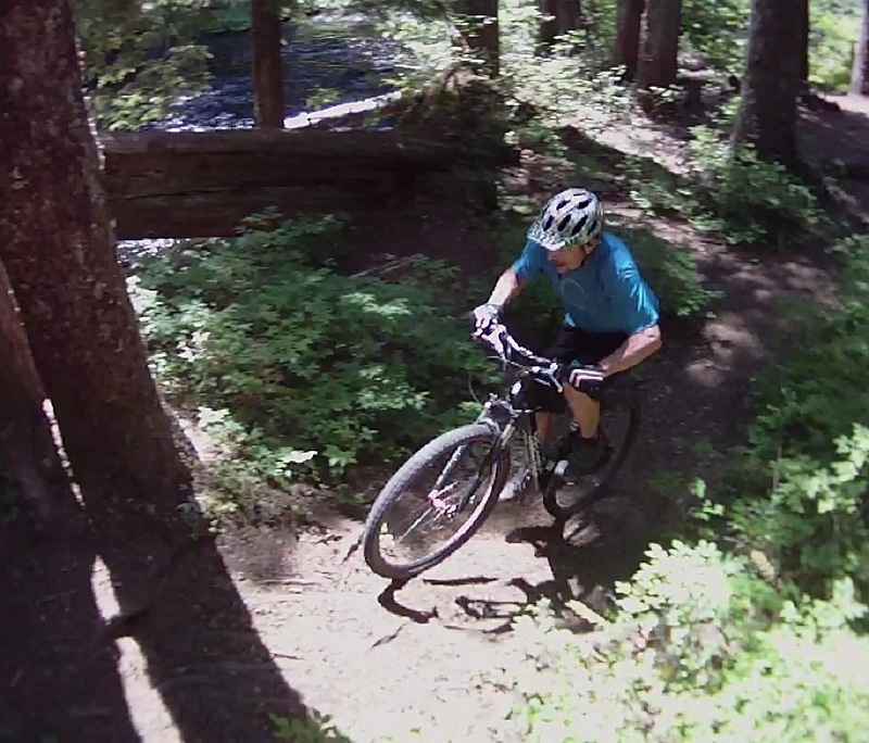
Falls Creek Trail #152
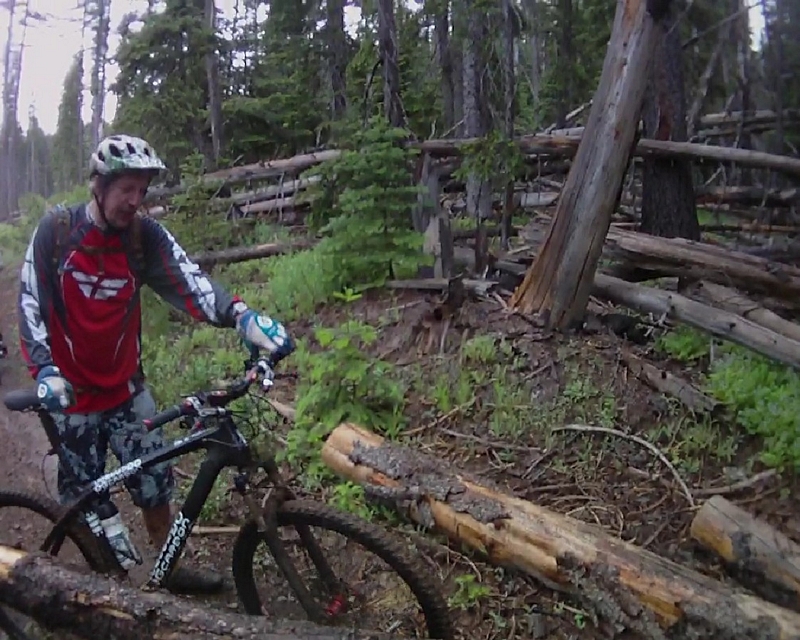
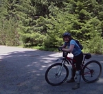
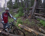
Sunday 7/24/11
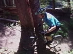
Ride report for Falls Creek.
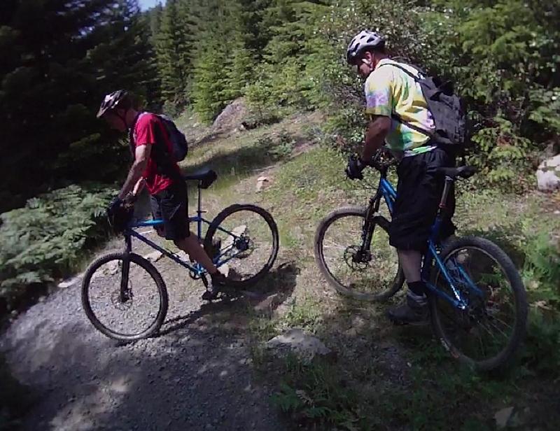
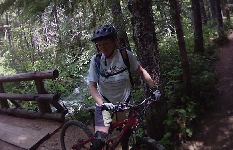
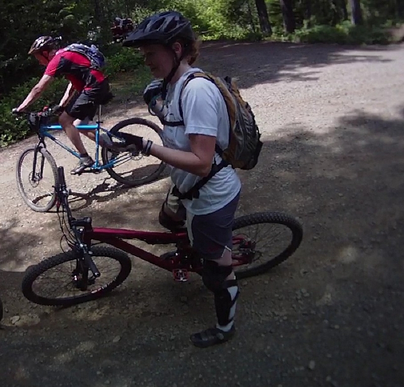
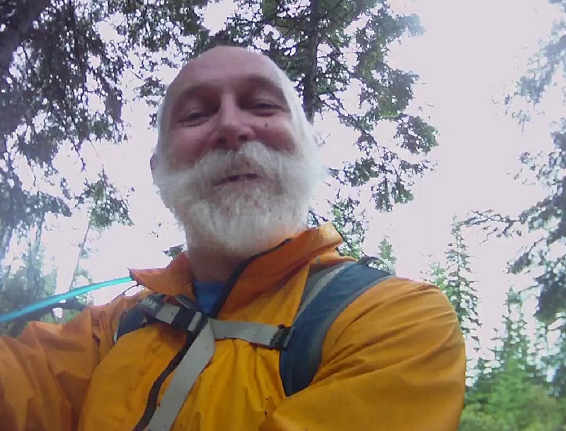
When I got back to the park and ride with Paul Norris after Friday's Smith Creek ride, he asked if I wanted to join him and Melanie on a ride at Falls Creek. The Falls Creek trail will finish off Melanie's 40 at 40 ride.
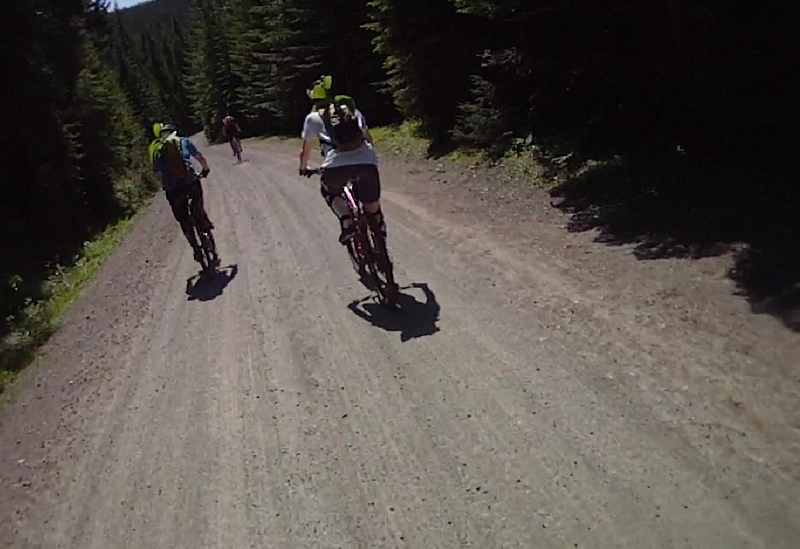
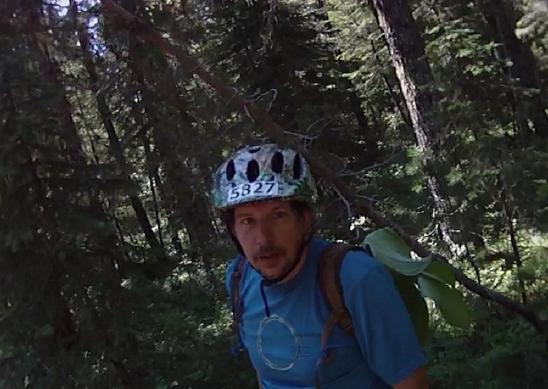
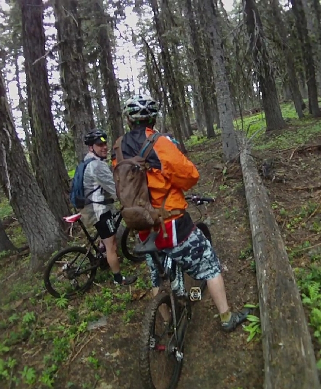
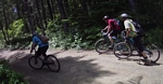
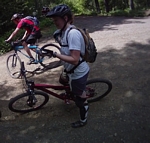
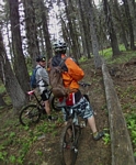
I met up with Paul and Melanie and we were joined by Joel, Ken, and his wife Nancy. We split up into three vehicles and headed for Falls Creek.
Leaving one rig at the bottom of the trail, we all piled into the other two rigs and drove up to Old Man Pass.
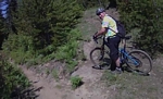
When I first started riding, I would come over to the Old Man Pass and McClellan Meadows area. I have ridden almost all the trails in this area so I knew that most riders did not know about trail 151 which goes from Old Man Pass to cross the head waters of the Wind River and deposits you on the gravel just a short distance from the McClellan Meadows Trail #157
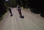
Ken was riding for the first time in a month, since he injured his ankle. Still in a walking cast, he and his wife Nancy took the Snofoot trail #150 over to forest road 3053 and followed that to trail #157. This is the route most riders take.
The Valley Ski trail #151 descends down into the headwaters of the Wind River, a quick pace that has a few simple root drops but mostly just a good simple descent into a lush valley.
The trail curves around through the top of the valley to turn toward the south, climbing at a moderate pace, rolling up and down on a wide track until it turns east. Then a serious climb begins.
A very steep ascent that causes me to stop a couple of times to let my respiration and heart rate drop to a reasonable level before pressing back into the climb.
At the top of the hill the trail junctions with the gravel forest road 3053 and we turn to the east to head for the McClellan Meadows trail head and wait there for Ken and Nancy.
Every time we stop there are biting flies that appear out of nowhere, or so it seems. I broke off a limb on a small fir tree and swish it around, passing the branch up and down my arms and swirling it around my head to keep them from landing on me.
Ken and Nancy arrive in a few minutes and we start up the first of a couple of short climbs. This one has some good root drops to negotiate.
The trail climbs about five hundred feet over the next three miles, a couple of short presses that have a slope approaching six percent but most of it around a two percent grade. Easy climbing with some fun features to negotiate toward the end of the trail.
Again when we hit the end of the trail the flies started attacking. The second strategy to keep the flies off was to keep riding, so we started riding up and down the gravel while waiting for everyone to regroup. As I was riding up the road, I rode past a broad leafed plant that I could smell as I passed, and I noticed that the flies disappeared!
I hopped off my bike and walked over and stood between a couple of the plants and no flies.
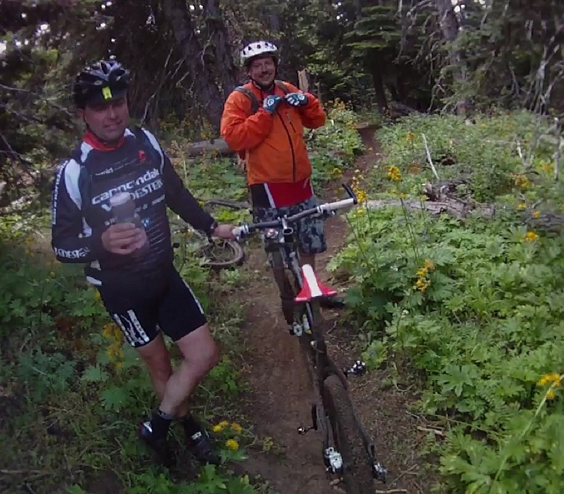
Paul rode up and I told him what I was experiencing and soon Paul, Mel, and I were standing in the plants, breaking a few stalks off and stuffing them in my pack when the rest of the group emerged from the trail.
Joel rode by and said that he thought that plant was
False Hellebore , which it turns out later when I looked it up, is
extremely toxic if consumed. But it works really well for keeping the flies away. Paul, Mel, and I became the flower children with broad leafed flora sticking out of our packs.
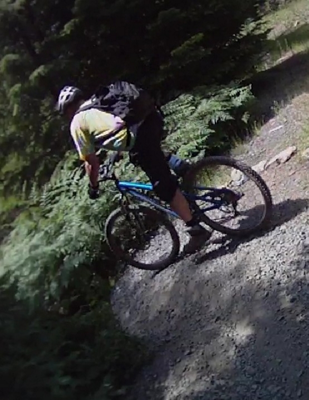
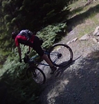
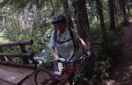
We headed down the gravel to the Falls Creek Horse Camp on Forest Road 65 where we picked up the Falls Creek Trail #152. Now my maps of the area show this trail as trail 171, which is the Indian Race Track trail.
The track starts out as a smooth forest trail with a sprinkling of rocks to run down and through a creek and then pops out into a maturing clear-cut with small fir trees for a short run, then back into the timber.
The trail is one of nice smooth fast running track that is interrupted again and again with short very technical sections of root drops and rocky features that take spotting the line and committing to it. I came to one section where I baulked and stopped because it was a very steep rock garden, seeing a simple line through it after I stopped.
The trail seems to present most of the technical stuff after the line leaves the timber and runs through another older clear-cut that has heavy undergrowth. A couple of places the thick bear grass hanging into the line and all but obscuring the track.
Two miles of sweet but challenging single track ends and the trail turns into a dirt double track.

The double track runs through a nice forest setting. It is in tall timber with one large primitive camping area alongside the track. I can only imagine how many mountain bikers you would have running through your camp on a nice weekend.
After a half mile of dusty double track the line crosses forest road 6701 and returns to single track.
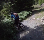
The line starts with some great railing sections, lightly banked corners that make for a swift start. The track continues to run through a nice timber stand and blasts downhill over lots of root drop sections.
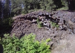
At about the half mile mark there is a very large lava formation, a large hole about seventy five feet across. The hole filled with large lava boulders, which makes me think it was probably a lava tube that collapsed. I mentioned the lava formation at the next regroup and I think that Joel told me that there was a similar formation back by the primitive camp site along the double track.
The trail finishes with a line that has a short section of serpentine track, perfect for leaning the bike under you and swooping around the corner after corner to finally exit onto the gravel.

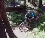
The trail continues on a rough stony double track that starts straight across the road. The line follows the road for about three quarters of a mile through the forest. Just as the forest gives way to an older clear-cut the line turns to single track.
The line is fairly smooth with no roots to speak of and a few loose rocks along the trail which flows through small fir trees and ferns. The single track runs for just over a third of a mile and turns onto a gravel forest road.
The gravel committed to trail use, a single lane predominate, with underbrush hanging in over the second track. The line takes to a steep climb after a few hundred feet with a couple of large water-bars that put me in low gear as I grind out the next couple of minutes.
Then more of the gravel, to a point where our group has spread so far out that I begin to think I may have missed a turn.
A sharp left off the gravel and down through a large fern patch to return to a forest trail; the track heavy with root drops and rocky sections.


The trail winds through the forest to pass through a lush meadow and turn onto an old skidder road that runs straight through the forest.
That smooth track ends with a short run of feature filled track that passes around a big rock slide which is made up of large angular boulders and demands your attention. Attention to the detail of the track leaves very little room for error or time to observe the expanse of marshy area that spreads out at the base of the rock flow.
The trail wanders through the timber, bouncing over roots and maintaining a line that requires pedaling but runs at a low grade descent with a few quick climbs over and through some rock features until the sound of Falls Creek is audible.
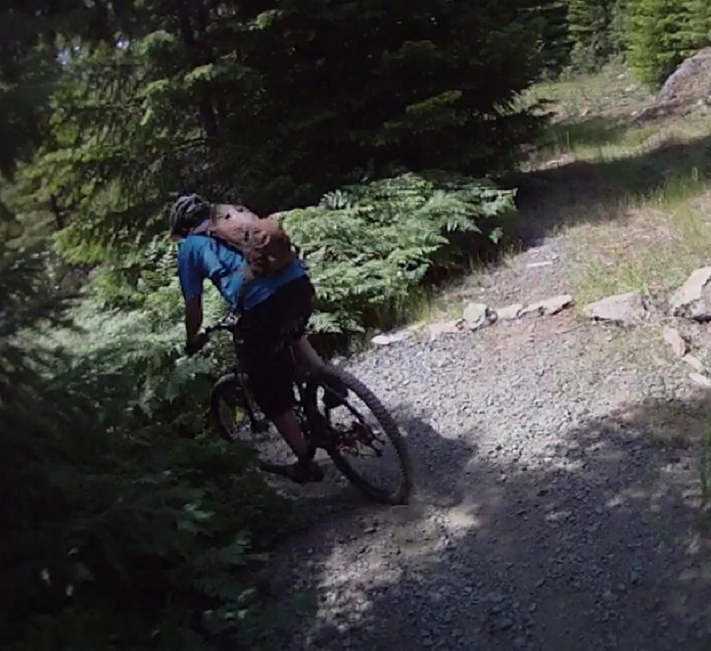
A quick drop down a steep line, bordered on the creek side by a large downed tree and technical enough to put you back off the saddle while negotiating the descent.
Falls Creek; a nice place to take a break before the pucker section. Relax and enjoy the melodious sounds of the creek and the view of the falls just upstream.
The line from here starts with a test of your ability to handle a root and rock feature at the top of the short low gear climb, then runs away toward the edge of a huge descent.
Gliding through the forest on the nice wide easily negotiated trail, the bike begins to pick up speed. A gentle increase as the angle of descent increases and just a touch of break is required to maintain a moderate speed.
The timber starts to thin out and the trail is contained in a brushy passageway and the pace begins to quicken.
Soon the brush is reduced to scrub along side of a very steep and narrow trail. A very steep side hill leaving the trail exposed. The track studded with rock and root drops at intervals along the descent.
I have shifted my weight back as far as I can, my breaks pulled in hard to keep the descent at a pace where I can feel as comfortable as the situation allows.
The trail, a mixture of gravely rocky dirt with places that appear to be no more than a foot or so in width, the edge of the trail from time to time, soft and looks as though it has given way under the pressure of the wheels on some mountain biker.
The smell of my breaks triggers a fear that they could fade at any moment. Every time I hit a short section of track that seems to decrease in the angle of descent, my speed increases because I start gently tapping my breaks trying to cool them down before the next radical section.
The line runs down the south face of a very steep hillside, almost all the turns are to the right and most are blind. I am hoping as I descend that I don't come around a blind corner to find someone pushing a bike up the hill or a hiker walking down the hill.
After about five minutes of steep downhill where I pass one group of hikers who have stepped up on the hillside to lean against it and let me pass, the track rolls through a dry stream bed and I can stop safely to let my breaks cool off for a second and to get some blood flow back into my now numb hands.
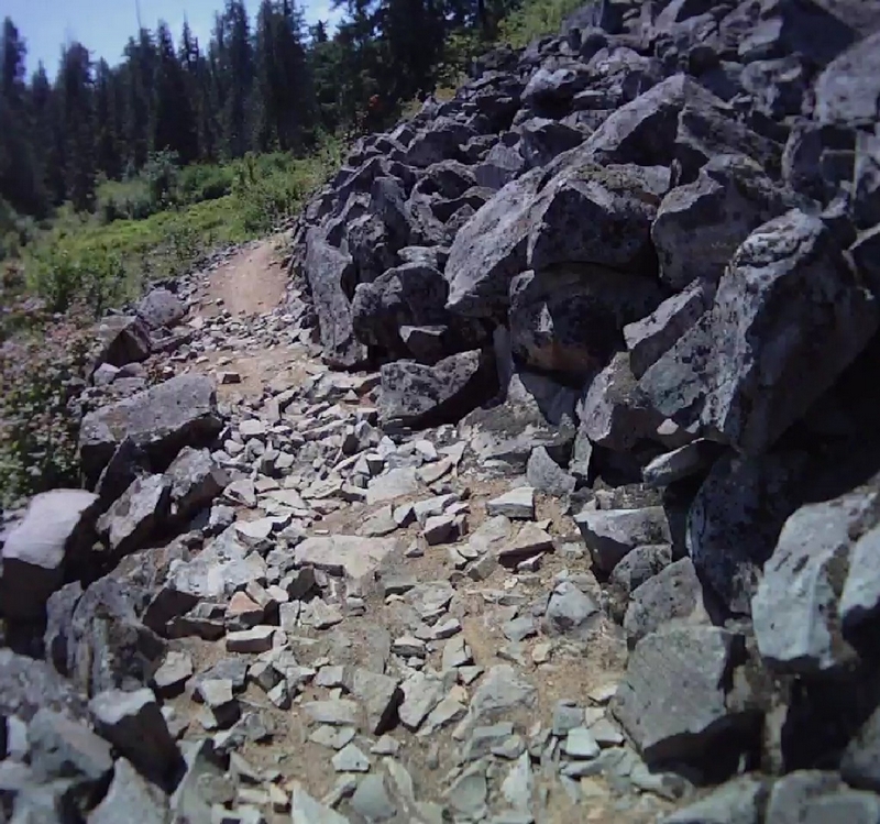
The line starts to ease up and the trail widens and narrows a couple of times before presenting a challenge. A short section where after a couple of quick turns the trail bounces you over a rock garden and across the back side of a tree to drop you down a sharp skid to cross a dry creek bed and climb with a couple of quick hard pedal stokes up through a bed of large boulders. The crossing requires a mid range gearing to give you enough torque to make the quick little ascent and still be able to handle the boulders.
The trail again increases in grade on the descent although not as radically as above. The line maintains a course with a side hill and width that match the previous section of trail.
Another dry stream crossing presents itself and this one is all dirt, the angle into and out of are too much for me to make the exit.
The trail returns to a moderate grade descent with steep side hill and narrow track for a short ways to start giving away to a less radical side hill and a trail width that becomes more reasonable. A section of track that can be ridden quite fast to the next dry creek crossing, a creek crossing that has a sharp angle of entry, but picks up the line on the exit quickly.
The track has turned from a pucker run to a fun run where the line is smooth and flows well, very few drops of any kind, allowing you to blast through the forest. Although I did have to stop one more time to let the blood flow back into my hands and shake off the numbness.
The ride ends when the trail crosses the Falls Creek and turns to run a few hundred feet through the woods to the parking area.
We parked our rigs down next to the road so we still had a couple of more miles on gravel.
Smith Creek Trail #225 on Mt Saint Helens
Friday 7/22/11
Smith Creek Map
A mountain bike ride for the under employed.
Melanie Norris is going to be doing a 40 mile mountain bike ride in the coming months to celebrate her 40th birthday. Her husband Paul, in an effort to support this goal, wanted to scout the Ape Canyon and Smith Creek trails for the upcoming ride.
When I pulled into the park and ride in Woodland, Jim LeMonds, Jack Berry, Bob Horness, and Rob Larsen were waiting.
Paul Norris pulled in within a couple of minutes and we were loaded and on the road by seven.
The parking area was empty except for one car. There was an older man who was getting ready to hike the Ape Canyon Trail.
After getting changed and everyone taking care of business, we hit the trail.
The trail down into the Smith Creek area is an abandoned gravel road that is just a short ride from the parking area.
The first third of a mile was level to mildly downhill through a lot of overhanging brush. The brush created a narrow course down the middle of the old gravel road. The track was littered with cut brush. It looked as though someone had cut back the low hanging branches and left the cuttings on the trail.
Not far into the ride the brush gave way to a timber cover as the old road started to descend.
The old road heavily littered with blown down limbs and smaller trees that had fallen across the road. The debris strewn about in every direction although it felt like most of it was lying across the path.
I was never able to get any real speed up, constantly breaking and bouncing over sticks and small logs, an occasional large tree that forced me to dismount and crawl under.
The blow down wasn't bad on the downhill run but was a pain in the saddle on the way up. I felt like I was constantly hopping the front wheel up and over to then kicking a half crank to position myself to drive the back wheel up and over.
The morning chill biting at my exposed finger tips had me wishing I had brought some long fingered gloves for the first three and a half miles of the ride. My hands were numb by the time we hit the bottom of the hill.
Once at the bottom the trail turns toward the mountain on a double track for a short ways then weaves into the woods to follow an old road bed.
There are many areas where the old road bed has been washed away and the track takes an alternate route around the washout but always returning to the consistent grade of the road bed.
I must have had to stop a dozen times to pull a piece of stick from my back wheel or a twig from my derailleur, causing my bike to ghost shift.
After a couple of miles of this we finally hit some single track that wound down to the creek across the face of the hillside, some nice track except it too was so littered with sticks that it was a very cautious descent.
There were a couple of options for crossing the creek. A very large log extended right up to about ten feet from another log laying at a right angle to that. Someone had built an access out of some smaller logs that from where I stood looked like they were roped together. It looked a little sketchy to me since the penalty for a mistake was about a ten foot fall into the creek, but Rob and Jim took that route. Bob and Jack crossed by stepping from stone to stone using their bike as a crutch I followed their lead and Bob was there coaching me and extending a hand to help me jump the last bit. Paul tried a different crossing and dabbed a foot in the water.
Finally on single track, the line left the creek and crossed an area where there was a dozen old logs deposited, not ride-able even though Bob gave it a try.
The trail along here runs up on a ridge with a creek visible in areas where the line becomes exposed.
Most of the trail runs through a forest of broad leaf trees, probably alder, when down close to the creek and small fir trees sparsely populating the areas in the more open terrain away from the creeks.
This whole area is filled with the remnants of the Mt St Helens blast of almost thirty years ago. Bleached white logs, whole trees, strewn up and down the creek and scattered throughout the forest along this portion of the ride.
The track was made up of a thick coarse ash lying over a fine ash to give a feel like riding in gravel on sand, though the line was stable enough most of the time.
Just as we approached our second creek crossing we ran through some very thick alder where the ground was soft and a small spring fed creek ran along the trail, a place that you had to keep the bike in a mid range gear and pump through to keep from stepping down.
Jack burped his tubeless tire along here on a half buried log and ended up having to put a tube in.
We took a little break while looking over the possible creek crossings.
Rob made his way across and scouted the trail on the other side, which made the choice for the crossing simple.
The crossing was exciting, a large log about ten feet above the water that had good access on either end. Bob hopped up on the log and told me to hand my bike up, and then he turned and walked across holding a bike on either side of him. Nice break for me, he said it was easier for him since it gave him balance, thanks Bob.
The trail headed up the bank and ran along on a ridge that ran between two large creeks.
We climbed at a moderate grade, weaving from one side of the ridge to the other, many times riding right along the edge of the precipice.
The ridge of land running between the creeks became so narrow at one point that it was unride-able and we had to carry our bikes as we cautiously crossed the narrow section. It was a very uncomfortable balancing act on a narrow ridge of loose ash with a creek some thirty or more feet below on one side and about the same distance to the ground on the other.
There was a large rock sitting on the top of the ridge, it was about a foot across, there was no footing on either side and when I came to it I stopped. I stood there, thinking to myself, don't stand here and freeze up, keep moving, step across, it's just a few feet to the other side. It was all I could do to take that step, then almost sprinting the next couple of steps to the other side. I was not looking forward to the return trip.
The trail continued to run back and forth across the chunk of land that extended between the two creeks until it finally turned toward the North and crossed the creek; another of those crossings using my bike as a crutch and stepping from stone to stone.
The trail headed up and into some thick brush and we decided that we would turn around here, just a little over eight miles in.
Jim has ridden the trail before and said that we were just about as far as we could go, the next bit was very brushy and the trail would soon be in the scree slope, deep loose ash and rock that was a hike a bike up very steep terrain for miles. Jim said that the stuff was very hard to ride down.
From Jim's description of the downhill track across the scree, it was more of a controlled slide than riding.
The return ride was fast and the ridge crossing was upon me before I knew it. The others were well out of site. Maybe because it was on a downward slope or maybe because we had all flattened it out a little with the crossing up and back, but I didn't hesitate I just quick stepped my way across and jumped back on my bike when I was on solid ground.
It was a nice swift track from here on down to the creek. I stopped above the creek on the bank because I remembered how soft the material had been on the climb up and did not want to dump myself over the handle bars.
Bob was waiting there and helped me across the log crossing to gain the trail on the other side.
Back into the debris covered trail, not as good a line as above, where there was very little material on the track.
The run was better on the return trip though because the speed reduced the effect of the limbs and branches scattered everywhere.
We crossed the creek again and started the climb back to the road bed up above us.
Bob took off across a small creek that was covered with branches and soon the grade was too much for the gear range he was in. His bike tipped toward the downhill side and his clipless shoe held for just a fraction of a second before it released. Just enough delay to put Bob into a sprint as he tried to catch his balance on the steep hillside, bouncing off the trees like a pinball (to quote Bob).
We pushed the bikes up a little further to another vantage point and Bob took another try at the climb, this time he made it a little further and was thrown by a large pile of broken branches lying across the trail. I had been looking down at my gears and trying to spin the pedal and shift to the low range when I heard a crash, I looked up just in time to see Bob falling down the hill side, his bike falling away as he rolled backward to do backward somersault down the hillside.
Once he was back on the trail, determined to get moving up the hill, he remounted his bike and took about two pedal strokes before his chain broke.
We walked the bikes to the top of the hill and spent about thirty minutes repairing his chain, I had some links with me and he had a tool for removing the broken link.
We headed downhill in the overgrown road bed, zipping around a few washouts and running a few short sections of single track until we reached a giant arrow made out of sticks, laid out on the ground and pointing toward the woods, the turn to head back up the hill.
I put my bike in the small ring gear and the second sprocket, and then to the tune of "Another one bites the dust" running in my head, I cranked my way up the 3.4 miles of mostly 6% grade.
Smith Creek
video.
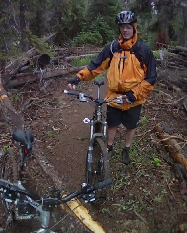
The Eight Mile, Bottle Prairie, and Knebal Springs ride
Saturday 7/16/11
Eight Mile Kenbal Springs Map
The alarm went off at 4:15AM, I had been laying there waiting for the alarm looking at the clock and doing a mentally inventory of the stuff I had packed up the night before. My feet hit the floor and I headed for the kitchen. I could hear the rain pounding down hard on the skylight above me as I made a bowl of oatmeal and sipped on some hot coffee.
Just before five, I pulled into the park and ride and backed my car in next to Guy Smith.
We loaded into the Paul Norris's rig and hit the road to pick up Barry DeSemple before heading for Eight Mile.
The rain was persistent all the way through the Gorge, letting up just before we stopped at Starvation Creek for a bathroom break. There was one other car there. A guy sitting with his lights on, Barry pointed that out to him as we were leaving; Paul and Guy said he was probably looking for a bear. I was clueless.
More rain as we headed up highway 35 to take the forest road 44 over to Eight Mile Crossing campgrounds.
For most mountain bikers, this ride starts at the Eight Mile Crossing campgrounds. The trail head is located in the day use area and this is where we started our ride. The trail is also accessible from a location approximately three miles west on forest road #44.
Parking here requires a forest pass.
The trail starts by dropping a few feet to cross Eight Mile creek then starts a climb that will go on for the next three miles.
Just as the trail leaves the camp ground it crosses a paved forest road, a place to be cautious since the road does get limited traffic.
Shortly after the road crossing there is a trail junction. Eight Mile trail #459 is a loop trail and the junction is the start and finish of the loop.
The track to the right or north is most commonly the return route. The line switchbacks down a broad ridge.
The track that leads straight ahead follows the creek and is the route most riders use to gain elevation. I have ridden it both ways and my preference is to ride up the creek line.
The climb is a moderate grade do-able in a mid to low range sprocket gears and in some places even in the middle chain ring. Just before the trail junction there is a parking location that has an information board, which when we were there had very little information.
After 700 feet of elevation gain over three miles, the Eight Mile loop trail #459 junctions with the Knebal Springs trail #474.
The Knebal Springs trail starts off at about the same grade through a large clear cut area, the line very straight along here.
Crossing over a gravel road (FR230) the ascent increase to a low range gear combination with one section that will test your climbing abilities, just for the sheer angle of attack, a short climb that requires perfect balance for traction, power and stamina.
The climb is just over three quarters of a mile and gains another 350 feet.
The track levels off with virtually no elevation gain for the next two thirds of a mile. The track crosses a maturing clear cut, that on a clear day has great views of Mt Hood, and then flows into a nice forest ride on almost perfect single track.
Now the screaming begins. A descent that follows a well established trail. The line plummeting almost 500 feet over the next mile, with lots of fast steep descent.
Starting with a quick serpentine line gliding down through the trees until it hits some gravel for a short sprint. Then a strong turn downhill through a clear cut and back in to the forest. Flashing past timber and large downed trees the line mostly straight with a sprinkling of root drops.
The trail crosses gravel and returns to the downhill run just a few feet to the west.
The well established track continues through large timber and skirts a clear cut along a portion of the descent. This is classic cross country downhill on old trail, the kind of descent that forces you back over the rear wheel, breaking lightly, and has you switching the forward pedal to reduce the fatigue.
The trail hits a third gravel road with what looks like the trail continuing right across the road, but it does not. That line is the old trail, a good short run that will dump you on a well traveled gravel road, FR 1720. The old trail used about three miles of gravel to navigate between Knebal Springs campground and this trail. This is a very short trail so if you do hit the well established gravel road, it is just a short push back up the hill to get back on track.
There has been a new section of trail put in, a few hundred feet to the east. The new section, as I understand it, is called the Dakine trail. I was told by a reliable source that the sporting wear company in Hood River provided support for the development of this trail, hence the name. The trail, again through hearsay, was scouted and the management of the development was done by a forest ranger who was an avid mountain biker. This section of trail really reflects that fact.
This is a trail section, which in my opinion is best ridden in this direction. To use a term that is so over used, flow! This line has outstanding flow and will defiantly put a smile on the face of an experienced mountain biker.
The trail is a 600 foot descent over two miles with a slope of 4.5 to 5%. It is a crappy climb and a fantastic descent.
The track starts down through a nice section of large timber, plenty of well laid out curves and corners with slight banking.
The line breaks out of the timber and into an older clear cut, the Lupine along here was thick the day we rode. The track never returning to the timber, the trail crosses meadows and runs through thick brush.
The Dakine section of trail is a fast paced cruise that had my hands going numb and me switching my lead foot over and over on the fifteen minute fun ride.
The trail turns at the Knebal Springs camp grounds to head toward the south. The campground is not visible from the trail but is just a few hundred feet north.
Continuing on the track to the south the trail a much straighter line, the track a more familiar forest type trail, continuing into a steeper descent of 200 feet in a little less than half a mile to cross a creek and start the return climb.
The Knebal Springs trail climbs back up a steep grade for a 250 foot elevation gain over a half mile. This is a good place to regroup and take a short break on the edge of the forest along an old double track.
Another half mile of single track through the timber on a mild downward grade to a point where Knebal Springs Trail ends and the Bottle Prairie trail #455 begins.
The climb back up to the top begins here. The 850 foot climb over about two and a half miles commences. The line is a simple one with a moderate number of root drops to ascend but only one short section where the climb becomes very steep, steep enough that I could not sustain it and had to hike a bike for a couple of minutes.
Other than a couple of old clear cuts that have transformed into meadows, with wild grasses and flowers growing across their expanse. The trail runs though forest for almost its entire length, large timber with a well developed understory.
At the top of the climb, the trail runs along the edge of a meadow and starts a fast descent that is interrupted by a short side trip to Perry Point.

The Perry Point trail is a walking departure that is well worth the few minutes it takes. A trip out to a rock outcropping that has an expansive view to the east, Wasco County.
The sound of disk brakes could be heard far below us as we sat on the rocks looking over the view towards Dufur Oregon.
Back on the trail, it is just a few hundred feet down to the junction with Eight Mile Loop trail.
We turned onto the track and started off at a gentle pace, each of us just a few feet apart for about the first sixty seconds. The trail slopes downward and the pace quickens as the distance between us expands, then just as quickly the distance compresses as we start a short climb, to finally break around to the front of the ridge line where we bust into a full on descent.
We ripped down the trail, hitting small root drops with a light touch on the breaks coming into the corners looking for the best line around the chattering track which is made up of the lumps and bumps created by out of control breaking.
The trail leveling off just a little as it passes by some log rides. Three logs all linked together in such a fashion as to let you ride on one end and move from one to the next, then off the end and back onto the trail.
Hammering on down the line through the woods until it drops across a gravel road.
The trail crosses an alpine meadow like area. Studded here and there with rocks as yet another ascent starts.
The climb returns to the trees, an easy three percent grade has us back into the line and pacing the lead rider.
The steepness of the side hill exposed as we leave the confines of the timbered hill side and cross an open face to negotiate some small rock gardens of sharp angular lava rocks. Then pass by a rock outcropping that extends its reach across the trail to present more technical features.
The view off the exposed hillside pulling my eyes away from the line for short glimpses of the cloudy horizon that hangs over the timber covered mountains and valleys for as far as I can see.
The trail reaches the fire watch tower junction. A short side trip through the low brush and wild flowers to the fire watch, it is no longer in use but can be rented at $50.00 per night from the
US Forest Service.
Just a note: The Forest Service books through a 6 month window and the place is booked up for the full 6 months except for a few week days in late November and December.
Once around the fire watch, which has someone staying in it, then we blast back down the trail to hit the main line. My riding companions rocketing down the track in anticipation of the extended downhill run back to the trail head, like a couple of mules within sight of the barn. The track will descend 730 feet over the next 1.5 miles.
The trail continues across the top of the rocky ridge, complimented with numerous small rock gardens passing over a sharp and narrow ridge line of rock then crossing a wide meadow filled with tall grass and blooming flowers.
A tall timber stand rises from the hillside straight ahead. The line breaks over the edge and turns into the timber and starts to descend.
It is a fast paced descent across a steep hillside, hitting banked corners that have good approach and exit with a minimal dampening effect on the speed of the descent. The track today is exceptional because of the wet weather we had earlier. The corners hold up well and there is no wash out.
Winding down the hill as the switchbacks get closer and closer together until the trail turns into a weaving track that ends on a small rock garden, turning to run a few feet and end where we started. Approximately 17 miles and 3000 feet of climbing.
4 hrs of riding cramed into 9 min
video.
Barry and I ride the Golden Spike
Saturday 7/9/11
Golden Spike trail from Stella to Growlers.
Barry and I met at the Growlers parking area, Barry showed up right at 8:30. We transferred my stuff to his car and headed for Stella.
We were cranking on the gravel by 9:25.
Both Barry and I had ridden it last fall on a group ride and were both beat at the end of the ride, we wanted to mitigate that a little by skipping the Stella ridge section.
When the trail comes off the Stella ridge and onto gravel, it is not obvious where the track heads back into the woods.
We rode up the gravel until we hit a spur road heading off toward the Northeast. After close inspection of the area we thought we might have missed the trail and went back down the gravel searching past the Stella line. Then back up the road and past the spur road until we finally spotted a narrow track heading up through some fir branches into the woods.
This would be our quandary all day, to ride on the road until we thought we had gone too far then turn around and ride back past the trail exit and back again to where we had turned around to find the trail just a few more feet up or down the road.
The first section was nice single track, much like the track at Growlers or Stella, one big log over and lots of rolling swooping stuff.
The next section was a little easier to find, both of us remembered it from the ride last fall. The trail exits the woods onto gravel. There is a spur road coming off the main line with the trail head for the next section just across the spur road.
This next section is easy to remember but hard to describe. Imagine a road that has been cut through a hillside, the opening made by the road bed leaves steep hillside or a berm on either side. The next section of trail runs down through this opening. Although the area has this form it is not a road it is in the woods. If I were to guess, I would guess it was an old rail road bed but I don't know. Still wet and swampy in a few spots, I can see this area wet and sloppy almost all the time.
The track moves from the bottom of the road bed to climb up onto the top of the narrow berm, maybe ten to fifteen feet above the bed.
The top of this berm is very narrow and the line moves from side to side creating little skinny spots on roughly cut benches as it passes around the trees.
The trail moved from the berm, across the flat and up on to the other hillside, the pitch on the climb too much for me. The track crossing back over to the berm and then back and a steep climb up the short hillside to hit what looked like an abandoned spur road.
This was another spot where we spent at least twenty minutes riding up and down the gravel looking for the trail entrance. Stopping just ten feet from the trail and questioning our choice and then riding back down and past the exit again. The trail entrance was up the hill on the left and not easy to spot.
The trail was a pretty good line through here, climbing and making a few switchbacks until we again exited the forest onto the gravel.
The next sections would start at the end of this spur road. The trail was again not easy to spot, a small opening in the trees at the very end of the spur road.
This section of track started out running pretty straight through the small conifers, an easy ride for about two minutes. The track showed signs that a quad had been on it recently.
The trail runs into a small meadow, and makes a very sharp right turn, an easy place to miss. The line has been marked with a line of limbs across the path to act like a diverter.
The track through the short path of grass is not easy to see.
Moving from a nice wide passive, easy climb, the line becomes very brushy. A few spots making me question if this is the trail but then the line becomes easy to see just before getting slapped in the face from a low hanging branch.
Very limited visibility, the trail wanders along for a short while with easy pedaling through the brush and small trees. A medium sized log with chain ring scaring lay across the trail just as it exits the dense brush into a root infested track that runs under the canopy of the larger conifers.
The understory is almost barren below the trees here, the line easy to follow but made a little more difficult with small technical features like log overs and roots.
Another road but this one is very primitive, it is not a forest road but just a cut through the area where there are ruts from big four wheelers. Our trail follows this road to the right for a few seconds then the track can be seen diverging to the left.
We take a left into more brush, the line along here is much sketcher, very over grown and the track is not visible at times (brings to mind Vaughn's hidden trail).
Another chunk of skidder road with lots of brush hanging across it, with the line making a right turn back into the woods, not easy to spot but also hard to miss.
The trail for the last thirty minutes has become much more primitive. It is understandable since we are probably approaching the middle of the ride, the most remote portion, likely the section of the trail that gets the least maintenance and the last part to have been developed.
Just to make things a little more exciting, a thinning crew has been through the last part of this section. To their credit or maybe it is Joel and Ken, the trail is clear. There is lots of down material next to the trail and some of the cutting left very sharp pointed punji sticks as a penalty for a mistake.
Out of the thinned area and onto the gravel, we again search for the trail entrance along the road. We rode up the gravel to the right until we saw a mile marker that had a six on it, we turned around and rode back down past the trail and came to a large area of small trees, back up the road to find the trail head right behind the mile marker.
A bit of trail that parallels the road for about a half mile, with not much to say about it, it is rough, underdeveloped, and I'm tired.
We hit the gravel at a major intersection of roads. Straight across the intersection the trail heads back into the woods.
A little over a half mile into the woods and the trail hits another bit of gravel, a much underused section of road where the trail was quickly found just down the road to the right.
The big clear cut is only about two miles away, how hard can it be? Probably the roughest section on the trail, a section that was rough enough to almost tear a knob off of Barry's back tire about half way across the section.
Sealant spraying out as Barry stopped and spun the tire around to position the puncture so the sealant would plug the hole.
After three tries at sealing the puncture, Barry gave up and put a tube in.
We finally hit the clear cut. The view from the edge was spectacular. We could see three major peaks laid out in front of us. A few wisps of clouds strung across the sky.
The south side of the clear cut was thick with lupine.
The downhill was outstanding.
The first section of the descent was a very smooth line in comparison to what we have been riding for the last hour and a half. Smooth by most any standard. The track crosses the hillside at a very comfortable slope, with enough pitch and speed to put a big grin on my face.
My weight back, my thighs pressed against the saddle. A light touch on the breaks as the line descended to a single switchback to run back and down to a gravel road.
The trail dumped me out on the road at an intersection with a spur road that headed downhill. We followed the double track for a little over a tenth of a mile until the track entered an opening in the trees.
The line starts with a moderate pitch running under the large conifers, the ground covered with fir cones.
After a turn the slope decreases enough that I can release the breaks and feel the full flow of the trail, rolling at a fast pace over humps and through a lush undergrowth of ferns.
Cranking the pedal around a half stroke to shift my weight to the other foot as the line breaks from the moderate descent to start picking up speed.
The smooth purring created by my breaks and the rush of the wind filling my ears as I slow for a switchback, then another short burst as I shift my weight over the bike and extend my outside pedal down for the next switchback.
Blasting down the trail now, flashing past a large hulk of a stump, rotted out and nothing left standing but the outer shell. The line hits a swale and my momentum carries up and over the back side of a large tree to see the line start leveling off as I release the breaks and glide through the forest.
A series of switchbacks down a moderately steep slope keeps me shifting my bike back and forth as I quickly descend around each of the three corners and swiftly bypass a cutoff trail to catch the last switchback that drops the line onto what looks like a very old skidder road.
The track turns to run out along the top of a large rounded ridge line and drops off the end as it turns back into the hill to a steep descent. Switching back and forth across the face of the ridge, the line drops fast at times, through six to eight switchbacks and empties out onto a gravel road.
I had to stop and adjust my front break here, the cable had run out of throw and the break lever was bottoming out in the last part of that descent.
The next sections trail head was right in front of us so Barry dropped over the side and into the woods to start ripping the descent through another switchback and follow the line down through the woods on a steep descent that weaved back and forth across a ridge line to quickly deposit us on another gravel road.
We turned left and rode down the gravel, looking for the next entrance; I could see a trail running across a flat just below the road.
A right off the gravel and across a section that has me pedaling for the first time in a while, a descent that is more gradual as it crosses back over a large ridgeline. Then into a large switchback that propels me down the track. The pitch increased for a short bit, then flattening out and switching back again.
Another sharp switchback and the descent picks up speed. The line weaving back and forth through a few more turns until it starts to level off as we hit a dirt double track.
Turning left on the double track I followed Barry down the road through some almost dried up muddy spots where there were layers of bike tracks.
The double track made a junction with another track where the prints in the dried mud turned to the right and the trail entrance was a short distance down the road on the left.
I remembered this next section as having a little more action. The trail starts with a little climb then a quick descent straight down through the woods to a creek crossing on a slatted bridge that is wide enough and has good approach.
Follow that with another short climb and quick descent down the back side of the next ridge, the line a little more technical and straighter, ending at another slatted bridge.
Two bridges in series, crossing the creek to a small island, the bridge exits under a tree overhang. The narrow spot has no room for error as the trail hugs the tree as it turns around it and presents another bridge.
Up across the bank and just a few pedal strokes to a skinny across a muddy ditch, I chose the ditch although the skinny looks very do-able and is only about eight foot or so in length.
A short ways through the woods and we hit another dirt double track, the trail crosses straight across.
A quick up and around some old stumps to cross a broad section to drop down and around a side hill, a little bench work in a few spots along a swift descent to yet another slatted bridge crossing a creek.
The track flattens as it crosses to the next descent. Down and around a switch back to the Monahan creek.
Almost the end of the trail.
The crossing is on a large log that has a strip of grip material nailed to the surface. Not a ride-able log, a strong nylon rope is tied across above the log and feels very secure. The skeletal remains of an elk lay in the bottom of the creek, reminding me why you should not drink directly from any of the mountain creeks.
A four point elk skull sits atop a large cross structure that holds one end of the guide rope.
The final ascent is a double switchback line that takes you up to an old double track for the final leg out to the gravel. The double track has lots of wet and muddy spots, a section that has sunk and is overgrown in many places.
We finished our ride by hitting Double Down and then upper and middle KMA. Rode the gravel to Predator and caught the road section to descend down the grassy power line hill and back onto the gravel to the gate.
This is the second time I have descended this trail but I think it is already becoming a favorite. The payment to get here is a little steep. I will defiantly be looking into the half spike alternative, an out and back from the Growlers side.
Monday Ride Report from Barry.
Monday 7/4/11
When I got home on Monday I found that Barry DeSemple had called. He called to see if I wanted to join him on a ride at growlers.
Here is his ride report:
Arrived at the parking area around 11:00 and there were two vehicles there.
I left Lucy at home; worried she might hear fireworks or gunfire and bolt.
Rode up the gravel and cut to the left before the power lines to take the new trail up the hill and avoid more gravel. There was a youngish doe looking at me from the meadow above that bounded off as I kept spinning up the hill.
Rode Predator to warm up then hit No Problem to session some features. Many of the log overs were in poor repair, so I did some log stacking, but there could be more done.
I have put on a new set of wheels and keep having to tune the brakes, so spent a little time on bike maintenance before continuing on the road trails.
I met a tired dog, followed shortly by a couple of tired riders that were just finishing up. They loaded up their truck and I continued down the road trails and followed gravel to climb Hyde.
I was pausing at the entry to Vortex for a short break when a Coyote came loping up the hill. When he spotted me he ducked back into the brush and continued up the hill.
I finished my climb up through the woods on vortex and on up to Legacy.
I met a few hikers while rounding Legacy loop, but had the top and its view all to myself.
Winding back down, I flowed right through into WTF.
Screaming down WTF I overcooked one of the corners. My front tire dug in and the bike bucked me off. I landed on a stump with my left thigh and now there is a baseball-sized bruise blossoming up from the depths of that Quad.
To top off the event I also rolled my front tire off the bead and spent almost an hour getting that fixed. A Schrader valve pump on a Presta-valve tube is not a good fit. I partially inflated it, tucked the valve inside and then it took all my muscle and some leverage to get it back on the rim. Once it was on though, I was able to fully inflate the tire using the Presta valve, since the tube held the tire in shape and let it seal.
I cruised down the trails to finish my ride on Upper/Middle KMA, but when I got back to the road the front was losing pressure again. I rolled down on the road to the car.